Skip to content

The Next Storm/Next Snow Forecast Discussion from the Cherrywood Observatory – May 25, 2018

This content was originally published by the Longmont Observer and is licensed under a Creative Commons license.

Forecast Discussion:

We're still in a very quiet, very warm pattern.  It is 87F in Longmont as I type (with beautiful blue skies.)

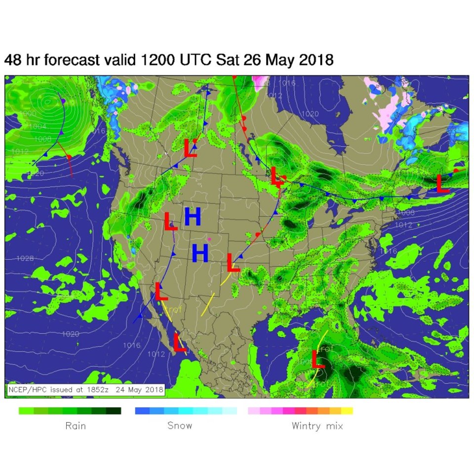
Figure 1 is the upper air pattern with a southern branch ridge (blue line) under a northern branch ridge (up in to central Canada, covering the central U.S. , but not marked). The atmosphere is sinking gently, compressing, and warming.  Warm air aloft is flowing in from the southwest making it harder for storms to form.  Figure 2 is the surface map for today - there is just a nice big high pressure system, at the surface, over Colorado.

Tomorrow, a hint of change is showing up out in California and Nevada, but we are still under a big high pressure center and headed above 90F.

Figure 1: The 500mb upper air analysis forecast from the GFS for Friday midday.

Figure 2: The forecast surface analysis map for Friday midday from NCEP.

Figure 3: The forecast surface analysis map for Saturday midday from NCEP.

The longer range forecast:

Figure 4 shows another cut-off low rolling in from the west by the end of the weekend.  This might pull moisture in again and slide cold air, aloft, into place to give us rain and thunderstorms.  We 'might' have a stormy Memorial Day.

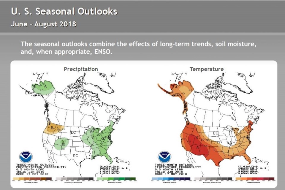
As is the pattern, when the weather gets quiet, we take a look into the distant future.  El Nino models were compared, and that comparison was released a few days ago (May 18th). The oceans are near neutral conditions for the summer with a good chance of El Nino conditions later this year (Figure 5). The seasonal outlook for the summer is out from NOAA (Figure 6).  Western Colorado is in the above normal chances for precipitation, eastern Colorado is in equal chances of normal precipitation.  Southwest Colorado is strongly expected to be warmer than average for the summer while northeast Colorado is expected to be warmer than average.

Figure 4: The 500mb upper air analysis forecast from the GFS for Monday midday.

Figure 5: The IRI/CPC Pacific Nino 3.4 Model Outlook. Multiple models are compared.

Figure 6: The June - August seasonal outlook from NOAA.

Current Weather

Mostly cloudy

Mostly cloudy

52°F

UV Index
0 Low
Pressure
29.91 Rising
Visibility
7 miles
Dewpoint
40 °F
Humidity
64%
Wind
NNW 3.7 mph
Gust
7.2 mph
Wind Chill
52 °F

Hourly Forecast

Today
9 PM
51°F
Showers
Today
10 PM
48°F
Intermittent clouds
Today
11 PM
45°F
Intermittent clouds
Tomorrow
12 AM
44°F
Partly cloudy
Tomorrow
1 AM
42°F
Partly cloudy
Tomorrow
2 AM
41°F
Partly cloudy
Tomorrow
3 AM
40°F
Partly cloudy
Tomorrow
4 AM
39°F
Partly cloudy
Tomorrow
5 AM
38°F
Partly cloudy
Tomorrow
6 AM
37°F
Partly cloudy
Tomorrow
7 AM
39°F
Partly sunny
Tomorrow
8 AM
44°F
Mostly sunny

7 Day Forecast

Intermittent clouds

Sunday

64 °F

Warmer with times of clouds and sun


Intermittent clouds

Sunday Night

37 °F

An evening shower in spots; otherwise, partly cloudy


Partly sunny

Monday

70 °F

Partly sunny and pleasant


Intermittent clouds

Monday Night

43 °F

Partly cloudy


Mostly sunny

Tuesday

73 °F

Mostly sunny and pleasant


Intermittent clouds

Tuesday Night

41 °F

Clearing


Intermittent clouds

Wednesday

65 °F

Times of sun and clouds


Intermittent clouds

Wednesday Night

39 °F

A thundershower in spots in the evening; otherwise, partly cloudy


Rain

Thursday

53 °F

Cooler with occasional rain and drizzle; breezy in the morning


Partly cloudy

Thursday Night

32 °F

Partly cloudy


Sunrise and Sunset

Sunrise
6:03 AM
Sunset
7:53 PM

Based on AccuWeather data