This content was originally published by the Longmont Observer and is licensed under a Creative Commons license.
Forecast Discussion:
Let's not bury the lead:
...WINTER WEATHER ADVISORY REMAINS IN EFFECT FROM 6 PM SATURDAYTO NOON MDT SUNDAY...
* WHAT...Snow expected. Total snow accumulations of 2 to 5
inches expected.
* WHERE...Fort Collins, Boulder and the western suburbs of
Denver, Denver, Castle Rock and Greeley.
* WHEN...From 6 PM Saturday to noon MDT Sunday.
* ADDITIONAL DETAILS...Plan on icy and slippery road conditions.
PRECAUTIONARY/PREPAREDNESS ACTIONS...
A Winter Weather Advisory for snow means periods of snow will
cause primarily travel difficulties. Expect snow covered roads
and limited visibilities, and use caution while driving.
The latest road conditions for the state you are calling from can
be obtained by calling 5 1 1.
I expect this might be upgraded to a winter storm watch tomorrow. I'll update as needed.
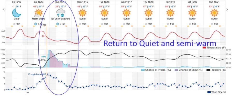
We'll still have nice 'warm-ish' temperatures today. The front wind shift line will pass around noon, but the cold air won't really arrive until later in the afternoon. We drop below freezing around 11 p.m. Precipitation chances begin around 7 p.m. when the temperatures are around 38°F - even if some models start the system with rain, I'm guessing it will be snow from the start. Figure one is a special graphic showing the surface front blasting through the state and a thick band of precipitation with moist up slope over much of the state.
Figure 2 shows how isolated, but stout, this storm is with precipitation tapering off later in the day Sunday. The heaviest snowfall will be between midnight and noon. We will stay below freezing, in the upper 20'sF Sunday. It will be really cold - a hard freeze.
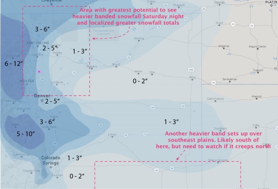
So how much snow will we get?
My forecast for a sampling of cities is:
Ft. Collins 3-5", Berthoud 2-4", Estes park 5-10", Longmont 2-4", Boulder 3-6", eastern Denver 2-4", western Denver 3-5", the Palmer Divide communities 2-5".
Figure 3 is the hand-made forecast from the weather5280.com forecasters. They give Longmont 2-5".
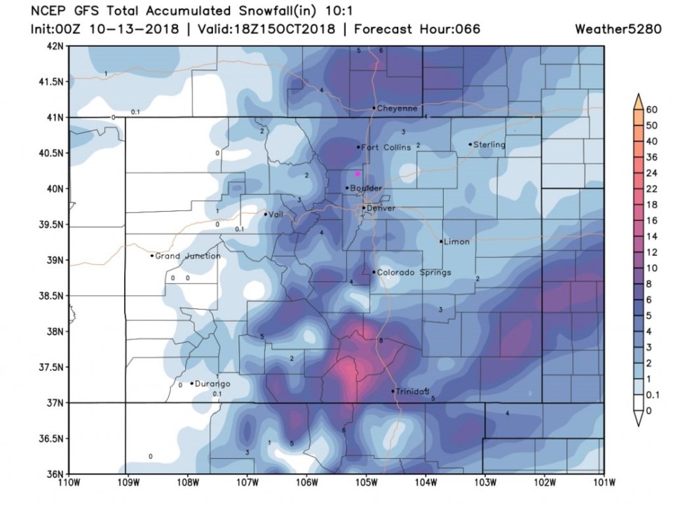
Figure 4 is the GFS which has 2-3".
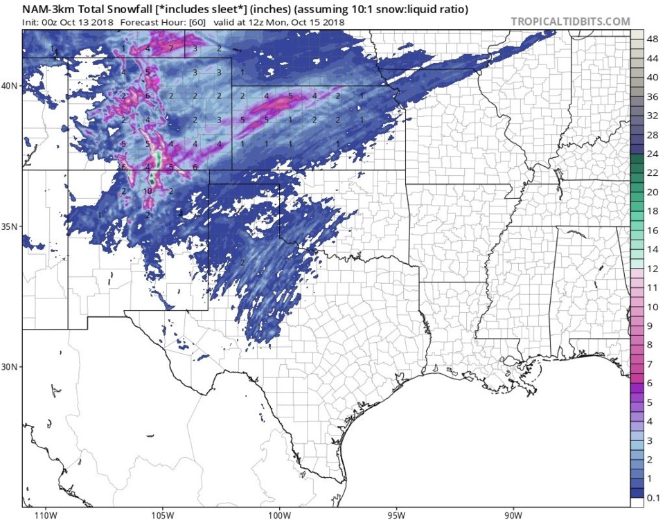
Figure 5 is the NAM 3Km resolution model which has 3-4".

The longer range forecast:
It's so quiet, it doesn't get a graphic... Figure 2 shows it drying out and slowly warming for the rest of the next 10 days, but still remaining below normal for daily high temperatures.


