Skip to content

The Next Storm/Next Snow Forecast Discussion from the Cherrywood Observatory – October 16th, 2018

This content was originally published by the Longmont Observer and is licensed under a Creative Commons license.

Forecast Discussion:

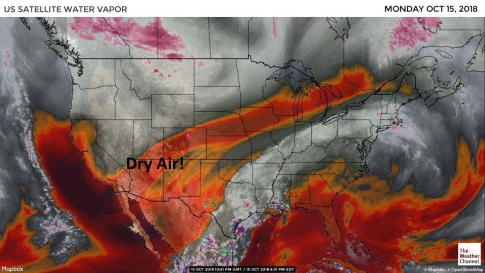
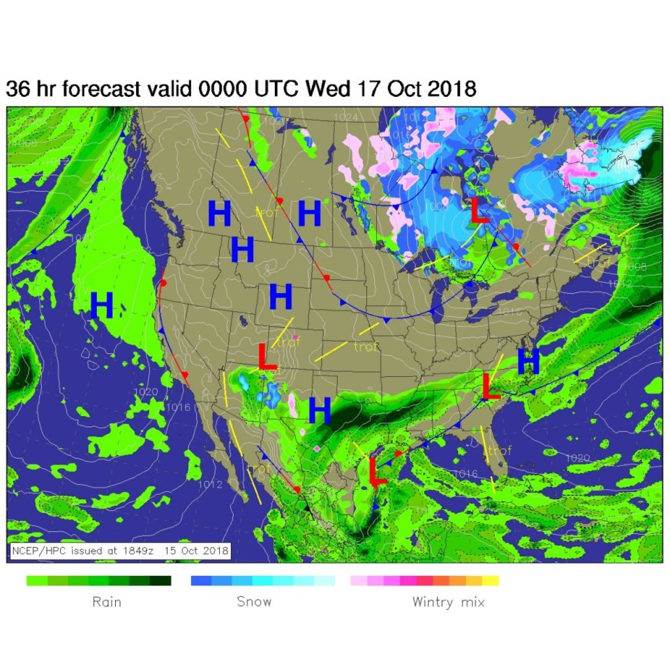
Our storm (with some ex-Sergio moisture incorporated in it) is off to the east and very dry/sinking air is in place over Colorado (red colors in Figure 1).  The surface map for today (Figure 2) has a low to our southwest that is kicking off storms in Arizona and southern New Mexico.  That instability and moisture is forecasted to stay far south of us.

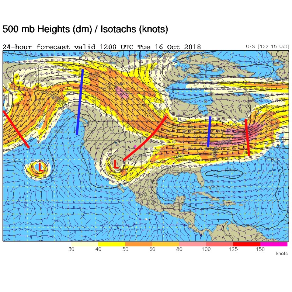
Figure 3 is the upper air map and the trough that has lower heights over the state, which makes our weather cooler than normal. That cut-off low over Arizona is the feature generating those storms. Interesting set up!

Figure 1: The visible satellite image from Monday PM from NOAA

Figure 2: The forecast surface map for Tuesday PM. From NCEP.

Figure 3: The 500mb forecast upper air analysis for Tuesday AM. Pink dot is Longmont. Red lines are troughs, blue lines are ridges.

The longer range forecast:

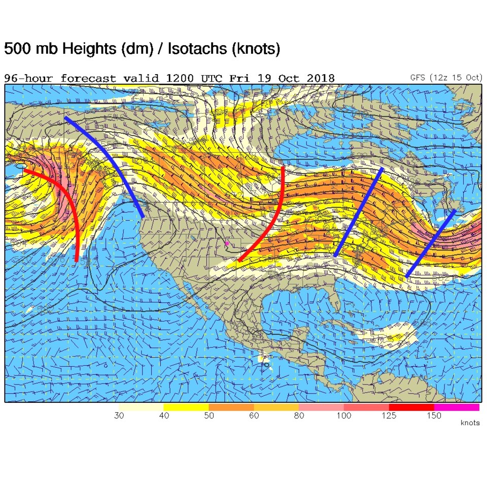
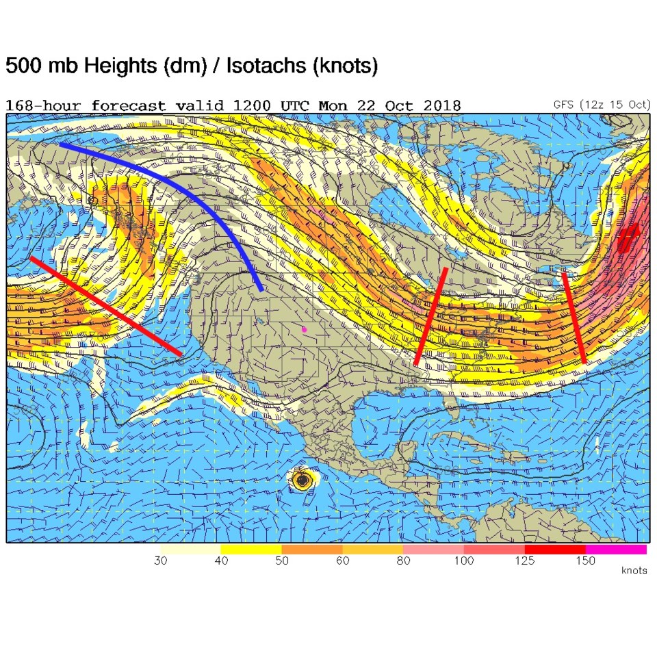
We stay cool and dry for a long time.  Figure 4 shows the ridge to our west and lower heights still over Colorado Friday AM.  Figure 5 shows the ridge next Monday still dominate over the West.
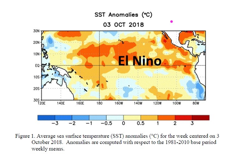
El Nino update

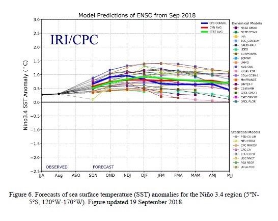
Figure 6 is a quick look at the El Nino status.  It is clear that El Nino is coming on (and is here now). The forecast off into next year keeps us in El Nino conditions for a long time to come (Figure 7).  The winter forecasts I'm seeing have Colorado cooler than normal (by a bit) and wetter than normal (somewhat).  More later as things shape up!

Figure 4: The 500mb forecast upper air analysis for Friday AM. Pink dot is Longmont. Red lines are troughs, blue lines are ridges.

Figure 5: The 500mb forecast upper air analysis for Monday AM. Pink dot is Longmont. Red lines are troughs, blue lines are ridges.

Figure 6: Sea Surface Temperature anomalies (departures from normal) for the equatorial Pacific from NOAA and the IRI.

Figure 7: The forecast El Nino Southern Oscillation (ENSO) index from multiple models by three month averages (for example, NDJ = November, December, January). From the IRI and CPC.

Current Weather

Light rain

Light rain

39°F

UV Index
1 Low
Pressure
29.89 Rising
Visibility
3 miles
Dewpoint
37 °F
Humidity
92%
Wind
N 3.2 mph
Gust
7.5 mph
Wind Chill
37 °F

Hourly Forecast

Today
10 AM
41°F
Rain
Today
11 AM
40°F
Rain
Today
12 PM
39°F
Rain
Today
1 PM
40°F
Rain
Today
2 PM
40°F
Cloudy
Today
3 PM
41°F
Rain
Today
4 PM
41°F
Rain
Today
5 PM
42°F
Cloudy
Today
6 PM
42°F
Rain
Today
7 PM
42°F
Rain
Today
8 PM
41°F
Rain
Today
9 PM
41°F
Cloudy

7 Day Forecast

Rain

Saturday

42 °F

Chilly with rain and a thunderstorm, some heavy early in the day; travel in the foothills and mountains will be slippery due to snow


Rain and snow

Saturday Night

36 °F

Cloudy with rain, mixed with a little snow late; travel in the foothills and mountains will be slippery due to snow


Thunderstorms

Sunday

60 °F

Mostly cloudy and warmer; a thundershower in spots in the afternoon


Partly cloudy w/ t-storms

Sunday Night

37 °F

A thunderstorm in spots in the evening; otherwise, partly cloudy


Partly sunny

Monday

71 °F

Partly sunny, pleasant and warmer


Intermittent clouds

Monday Night

42 °F

Partly cloudy


Mostly sunny

Tuesday

73 °F

Mostly sunny; pleasant in the afternoon


Mostly cloudy

Tuesday Night

40 °F

Mostly cloudy


Intermittent clouds

Wednesday

65 °F

Times of sun and clouds with a passing shower in the afternoon


Rain

Wednesday Night

35 °F

Mainly clear


Sunrise and Sunset

Sunrise
6:04 AM
Sunset
7:52 PM

Based on AccuWeather data