This content was originally published by the Longmont Observer and is licensed under a Creative Commons license.
Forecast Discussion:
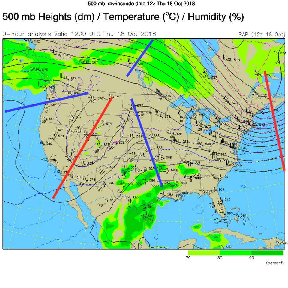
As covered over he last few days, our upper air trough from the southwestern states is moving out. More rain is falling in New Mexico and Texas (and Oklahoma) - but it is missing us (Figure 1). The upper air pattern map (Figure 2) shows that former cut-off low is getting absorbed into the flow. The ridge is ready to become dominate and warm us to the upper 60's F Saturday and lower 70's F Sunday. What a change in a week!
Note: I'll be on a big family vacation at the end of the month. There will be no updates to this column for the period October 26-Nov 4. I'll probably create a page of links to my favorite forecast pages in my absence.

The longer (longer!) range forecast:
As highlighted yesterday, we remain dry and mild until around Wednesday, next week, when a new trough approaches. More on that another day.
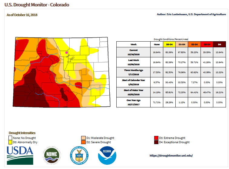
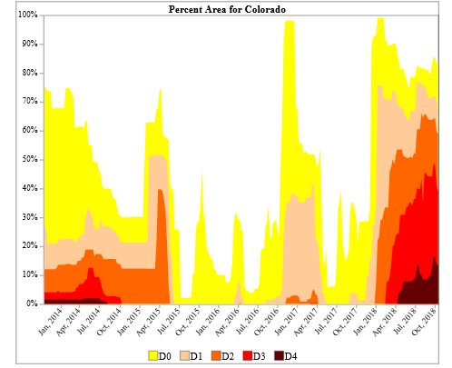
Let's look at the current state of the drought in the state. Figure 3 shows very severe drought still exists in the southwestern parts of the state. The western slopes are very dry as well. We, in Longmont, are now in a slightly-dry category. Also, on this site, was a neat plot of the various levels of the drought index over time. It (Figure 4) shows an interesting progression from a fair amount of drought statewide 3-4 years ago to little drought in the 2015-2016 zone then to more widespread drought over the last year (La Nina related?).
Pulling in some more LONG range winter forecasts (there are plenty on the interwebs) - Figure 5, from onthesnow.com has all of Colorado very close to normal in temperatures and precipitation. They do not have the weatherbell cold trend in the southeast. They do match weatherbell with warm and dry trend in the Pacific Northwest and our 'near normal' status. In Figure 6, they zoom in on the west and give our ski resorts 90-100% normal snowfall. Not too bad.
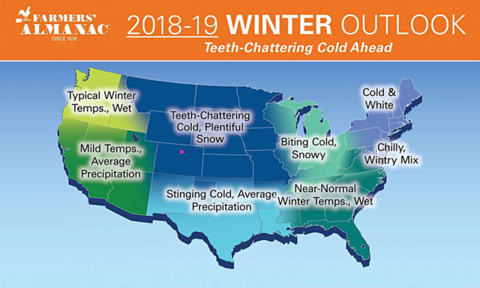
Finally, Figure 7 is from the Farmers Almanac site (not the Old Farmers Almanac). (I don't have much faith in either of these almanacs at all... is it really meteorology?) They give us extra snow and extra cold, for what its worth. The rest of the forecasts we've looked at, taken together, have us very close to normal cold, snow and rain.