This content was originally published by the Longmont Observer and is licensed under a Creative Commons license.
Forecast Discussion:
Enjoy the last three days of late-summer weather. It all ends this week.
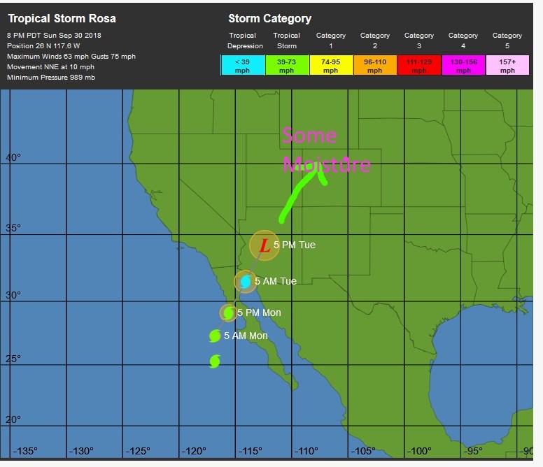
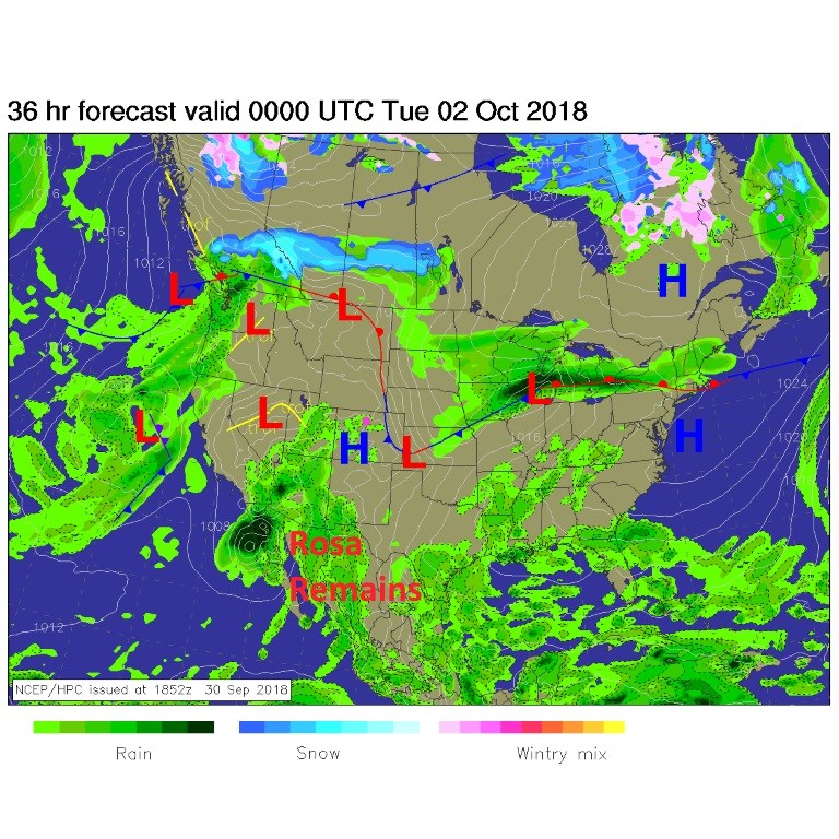
Figure 1 is the forecast surface map for today. Tropical Storm (soon to be downgraded) Rosa is mushing (yes "mushing") ashore in Mexico with rain pouring into Arizona and southern California. We have 'some' moisture already making it into western Colorado. Models are showing the precipitatable water increasing every day this week until we are very moist by Wednesday.
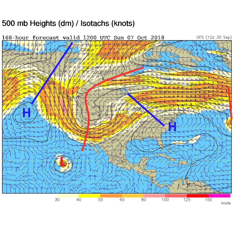
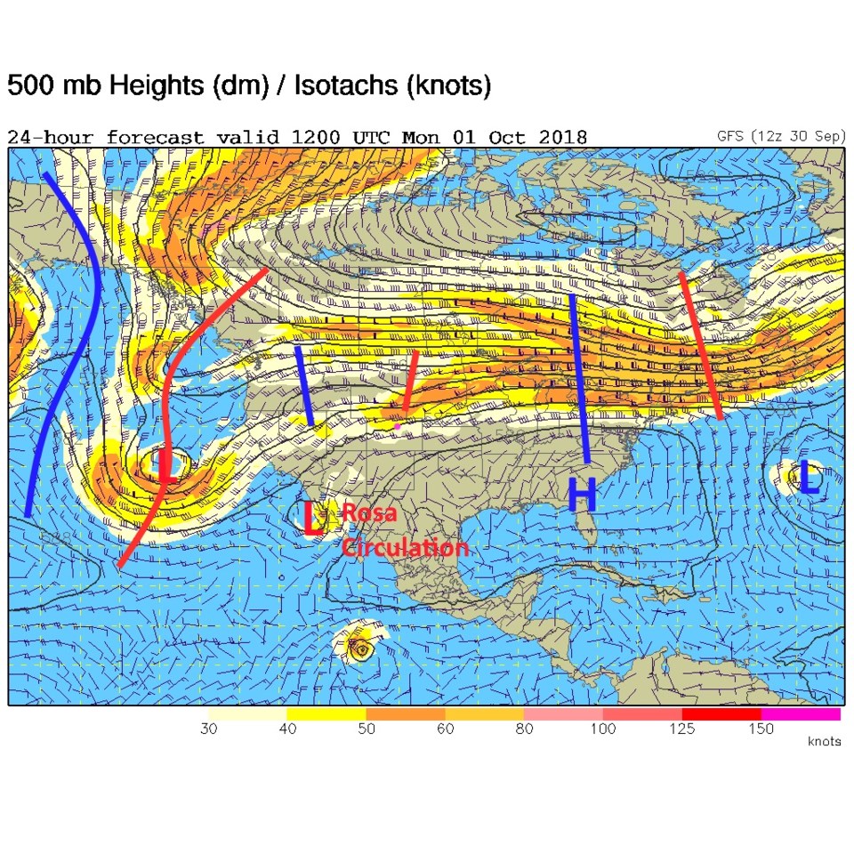
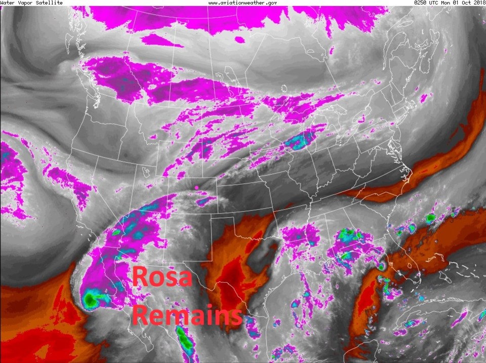
The face of change is the trough on the west coast. The ridge out in the Pacific will grow to become a giant, giving Alaska record heat, and transition us into late Fall/early Winter like weather (Figure 2). Once you see the upper air pattern (Figure 2) - take a look at the water vapor image (Figure 3) and you can see the same pattern in the flow of dry and moist air.
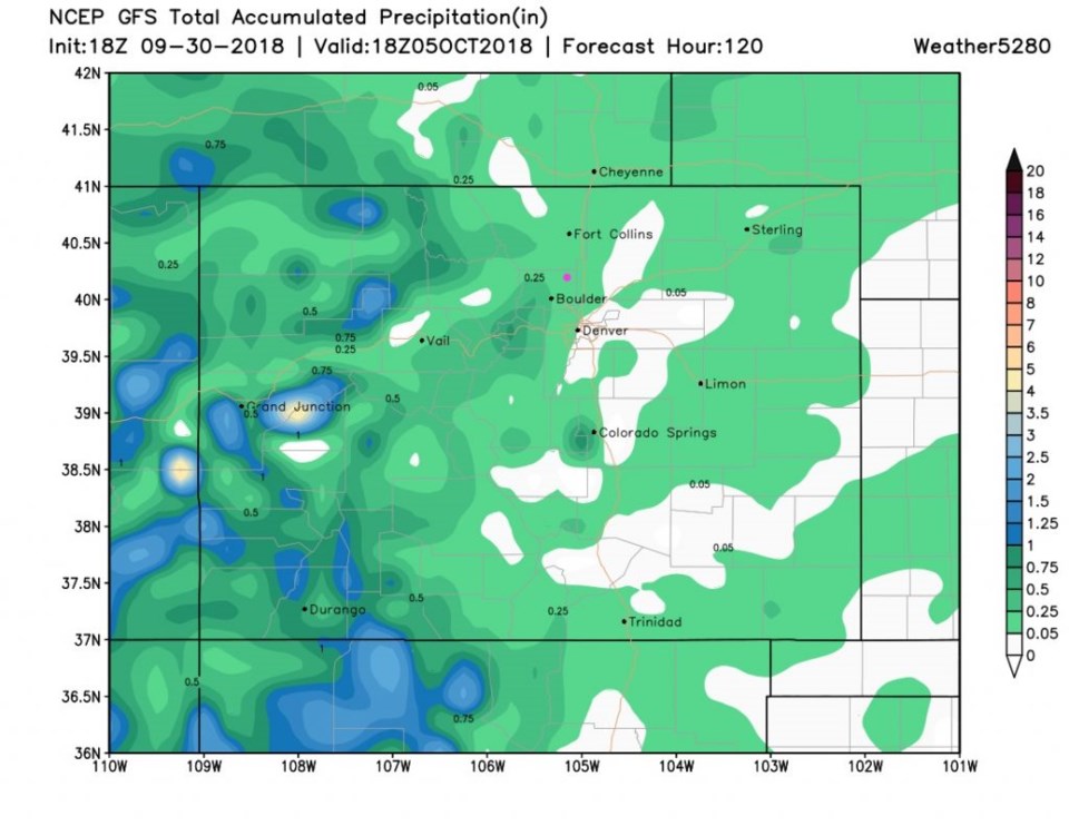
Over the next 5 days, the GFS "STILL" keeps us quite dry (only up to about 1/4 inch of rain) through Friday (Figure 4). (More below in the longer range forecast...)
The longer range forecast:
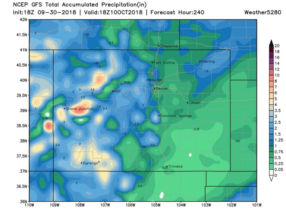
That trough in the west will grow and expand to dominate the western 1/2 of the nation (Figure 5). This means much cooler weather and greater rain chances. Looking at the GFS for the next 10 days (Figure 6) we approach 1 inch of rainfall over the next week plus.
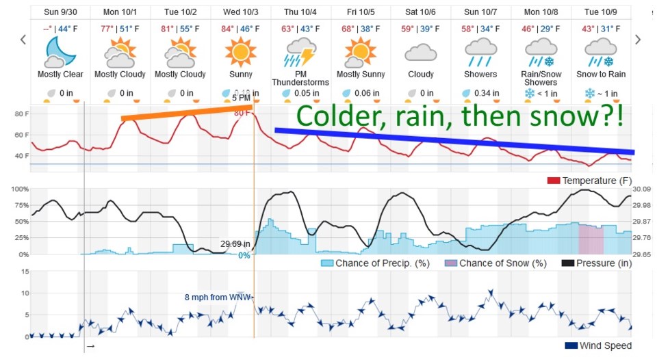
You can see the big picture in Figure 7. We stay in the lower 80'sF through Wednesday when another, strong, front approaches and turns on the cold upslope-flow machine. Rain and thunderstorm chances return. This model (different from the GFS) gives us a similar, roughly 1/10th inch of rain by the weekend. We go off the cliff Wednesday night. Each day gets colder and rain chances slowly increase through next week. And, yes, Virginia, there is snow in the forecast for NEXT Monday/Tuesday. Nighttime temperatures drop below freezing about 9 to 10 days out as well.
Figure 8 is a final look at Rosa. It should still be a tropical depression in central AZ Tuesday night. The moisture that heads to the northeast will join our front later this week. Where did you put your coat, gloves, boots, and hat last year...?
