Skip to content

The Next Storm/Next Snow Forecast Discussion from the Cherrywood Observatory – October 21th, 2018

This content was originally published by the Longmont Observer and is licensed under a Creative Commons license.

Forecast Discussion:

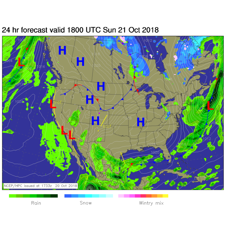
Very nice niceness continues. Figure 1 is the surface map for midday today and high pressure dominates. The dry front to the north will cool temperatures a bit on Monday, but nothing too notable.

Note: I'll be on a big family vacation at the end of the month. There will be no updates to this column for the period October 26-Nov 4. I'll probably create a page of links to my favorite forecast pages in my absence.

Figure 1: The forecast surface map for Sunday noon. From NCEP.

The longer range forecast:

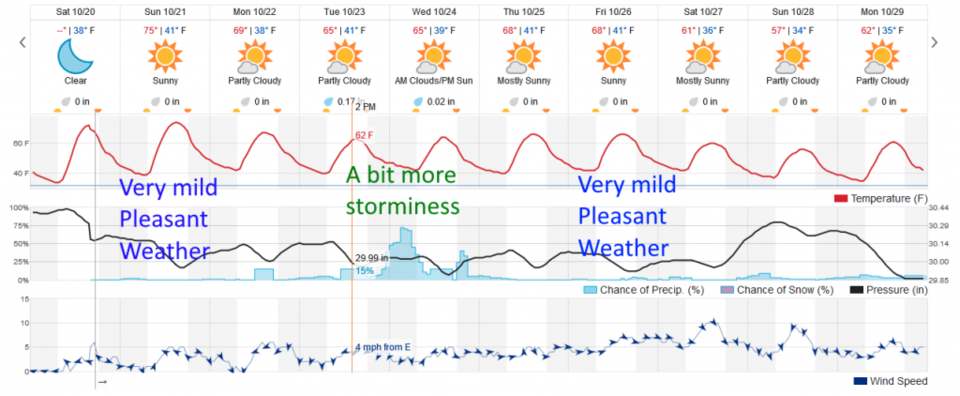
Our approaching trough, though still weak, seems to be grabbing some moisture from the tropics and tropical systems (like Willa) that will increase rain chances. Tuesday into Wednesday looks just a 'bit' more moist now (Figure 2). Don't worry, extreme niceness will return right after that.

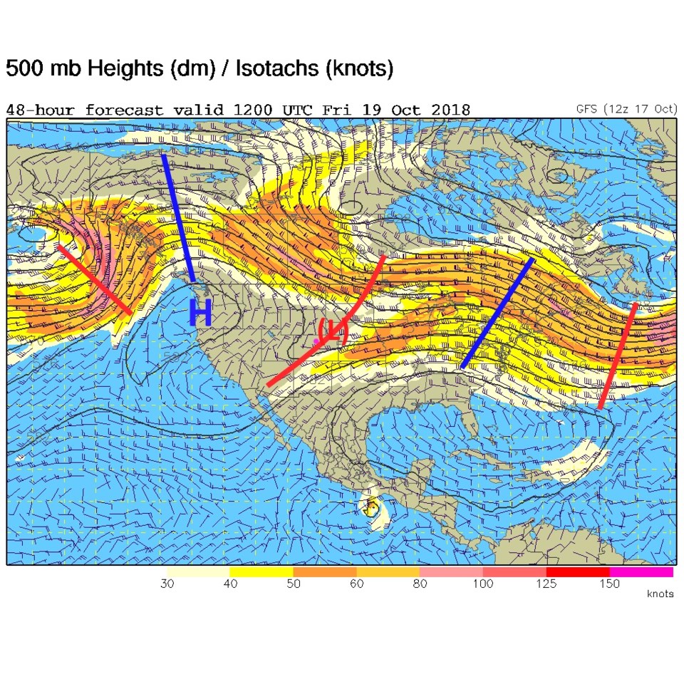
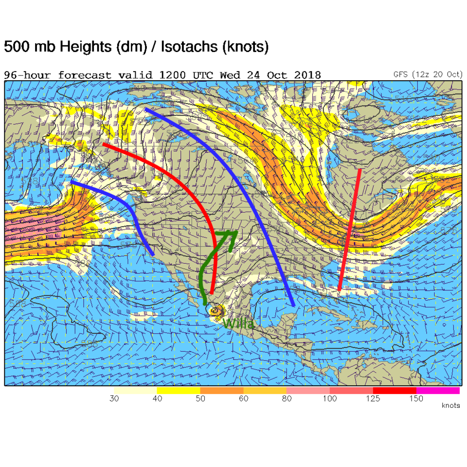
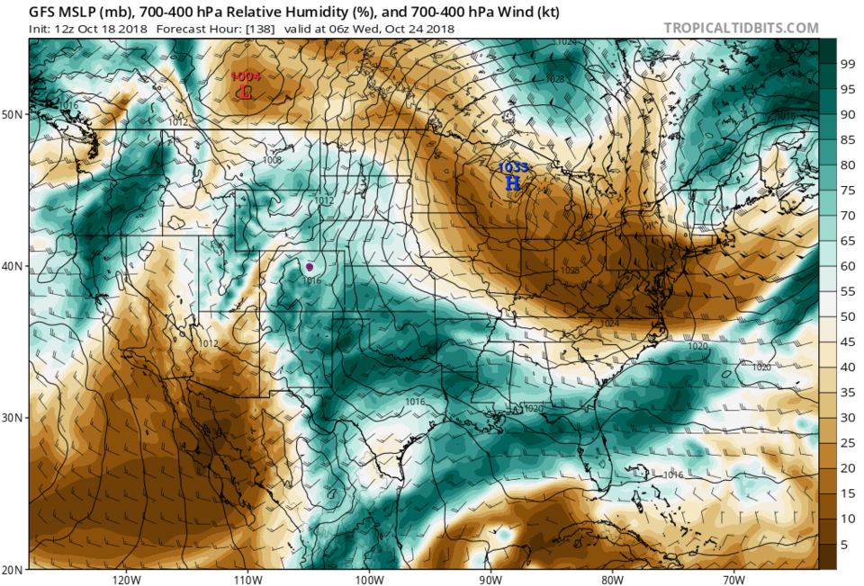
The 500mb map for today (Sunday) shows the warm ridge overhead and Willa beginning to send moisture north (Figure 3). Figure 4 is the upper-air pattern Wednesday a.m. with the trough coming in from the west. Willa is closer and more moisture is being temporarily pulled north. The forecast mid-atmospheric moisture map (Figure 5) shows this plume of water that will make cloudy skies and 'some' precipitation fall (though snow levels should remain around 9000 feet).  Enjoy this nice week!

Figure 2: the next 10 days of the graphical forecast for Longmont, CO from weatherunderground.com

Figure 3: The 500mb forecast upper air analysis for Sunday AM. Pink dot is Longmont. Red lines are troughs, blue lines are ridges.

Figure 4: The 500mb forecast upper air analysis for Wednesday AM. Pink dot is Longmont. Red lines are troughs, blue lines are ridges.

Figure 5: The mid-atmosphere moisture forecast for early Wednesday AM from tropicaltidbits.com

Current Weather

Mostly sunny

Mostly sunny

55°F

UV Index
4 Moderate
Pressure
29.62 Steady
Visibility
8 miles
Dewpoint
23 °F
Humidity
28%
Wind
WSW 9.2 mph
Gust
20.3 mph
Wind Chill
55 °F

Hourly Forecast

Today
10 AM
55°F
Showers
Today
11 AM
57°F
Mostly cloudy
Today
12 PM
58°F
Mostly cloudy
Today
1 PM
59°F
Mostly cloudy
Today
2 PM
60°F
Intermittent clouds
Today
3 PM
62°F
Intermittent clouds
Today
4 PM
60°F
Intermittent clouds
Today
5 PM
58°F
Intermittent clouds
Today
6 PM
56°F
Intermittent clouds
Today
7 PM
54°F
Intermittent clouds
Today
8 PM
51°F
Intermittent clouds
Today
9 PM
48°F
Partly cloudy

7 Day Forecast

Partly sunny w/ showers

Tuesday

62 °F

A brief morning shower or two; otherwise, windy with times of clouds and sun


Partly cloudy

Tuesday Night

34 °F

Partly cloudy and colder; there can be frost in the normally colder spots


Intermittent clouds

Wednesday

59 °F

Cool with times of clouds and sun


Mostly cloudy w/ showers

Wednesday Night

37 °F

Increasing clouds with a shower in spots late


Partly sunny w/ showers

Thursday

56 °F

Times of clouds and sun with a couple of showers; cool


Partly cloudy

Thursday Night

40 °F

Partly cloudy


Mostly cloudy

Friday

63 °F

Mostly cloudy and warmer


Clear

Friday Night

40 °F

Clear


Mostly sunny

Saturday

74 °F

Mostly sunny, pleasant and warmer


Mostly clear

Saturday Night

43 °F

Mainly clear


Sunrise and Sunset

Sunrise
5:52 AM
Sunset
8:02 PM

Based on AccuWeather data