Skip to content

The Next Storm/Next Snow Forecast Discussion from the Cherrywood Observatory – September 14th, 2018

This content was originally published by the Longmont Observer and is licensed under a Creative Commons license.

Forecast Discussion:

Broken record time:  we remain dry, clear, unusually warm (record heat at some stations), but now get a bit of local smoke.

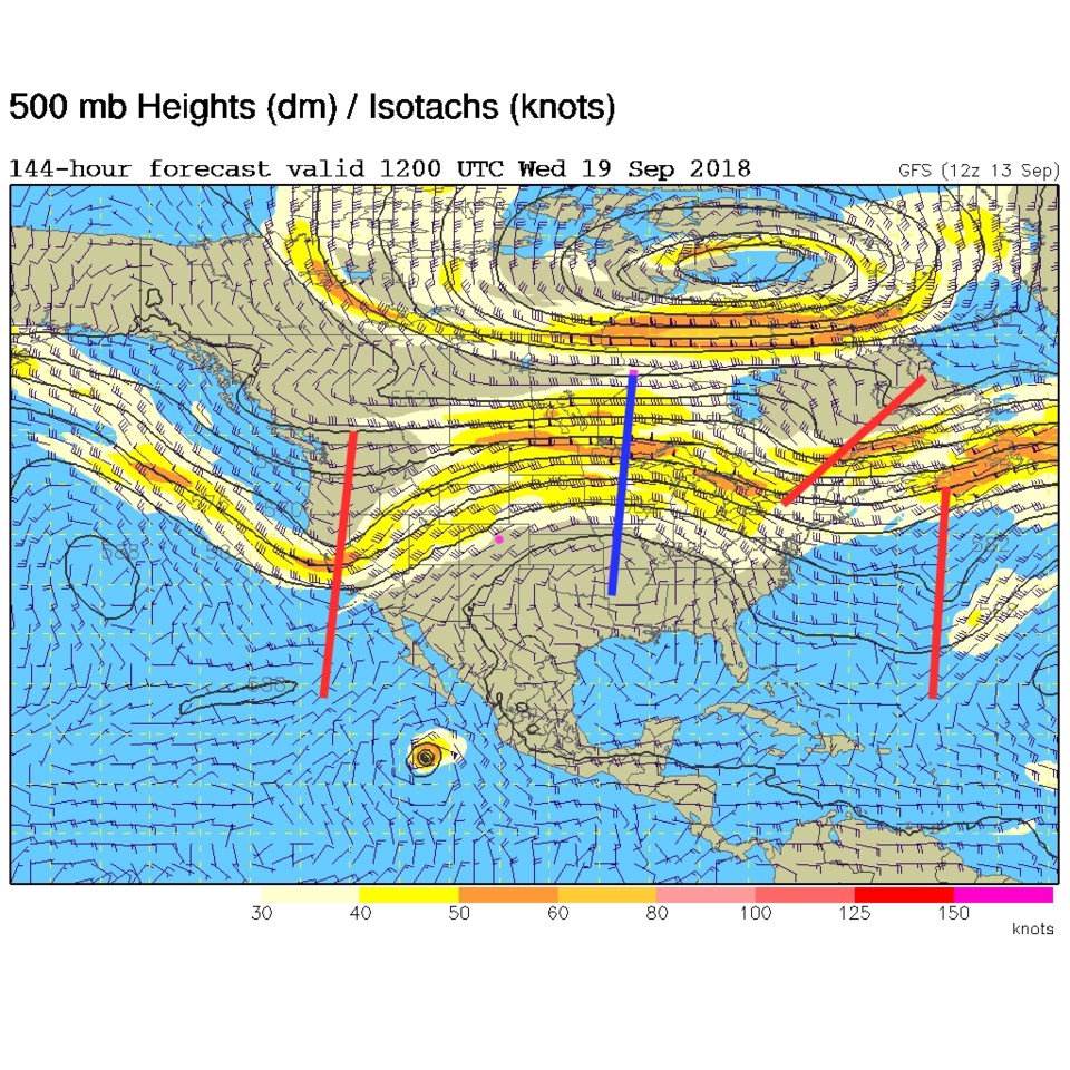
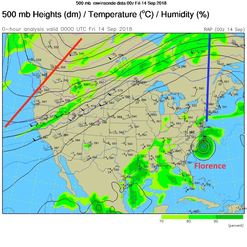
The trough remains far off to the west as we sit under the giant ridge's western edge (Figure 1).  The ridge is squarely centered over Florence and is not helping that storm move in any direction for the next few days. There are almost no winds aloft over the SE U.S. Figure 2 is the surface map for later today with a surface high sitting over the state still. Hot and dry are the words.

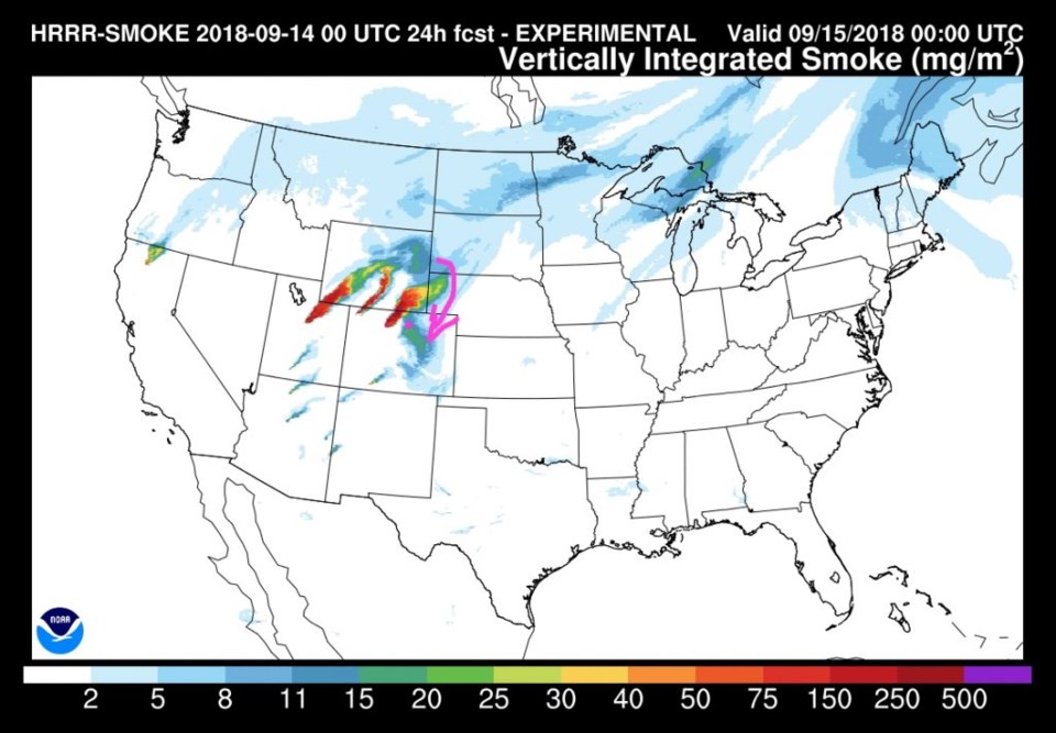
We do have a few local fires that have begun. Smoke from those will begin to mar our beautiful blue skies and mountain views (Figure 3).  It doesn't look choking thick, but you might smell it at times.

Figure 1: The 500mb upper air analysis for Thursday PM. Pink dot is Longmont. Red lines are troughs, blue lines are ridges.

Figure 2: The forecast surface map for Friday PM. From NCEP.

Figure 3: The HRRR (high resolution rapid refresh) model forecast of smoke at all levels for Friday PM.

The longer range discussion:

Very little changes through the weekend with summer heat still baking us.  It isn't until Tuesday/Wednesday that the ridge collapses eastward and the west coast trough begins to approach us for our next big cool down and returning rain chances (Figure 4).  More tomorrow!

Figure 4: The 500mb forecast upper air analysis for next Wednesday AM next week. Pink dot is Longmont. Red lines are troughs, blue lines are ridges.

Current Weather

Mostly cloudy

Mostly cloudy

53°F

UV Index
0 Low
Pressure
29.93 Steady
Visibility
8 miles
Dewpoint
39 °F
Humidity
58%
Wind
NNE 2.2 mph
Gust
4.2 mph
Wind Chill
53 °F

Hourly Forecast

Today
10 PM
54°F
Intermittent clouds
Today
11 PM
51°F
Mostly clear
Tomorrow
12 AM
49°F
Mostly clear
Tomorrow
1 AM
48°F
Mostly clear
Tomorrow
2 AM
46°F
Mostly clear
Tomorrow
3 AM
45°F
Mostly clear
Tomorrow
4 AM
43°F
Mostly clear
Tomorrow
5 AM
42°F
Mostly clear
Tomorrow
6 AM
39°F
Mostly sunny
Tomorrow
7 AM
41°F
Mostly sunny
Tomorrow
8 AM
47°F
Intermittent clouds
Tomorrow
9 AM
53°F
Intermittent clouds

7 Day Forecast

Intermittent clouds

Saturday

64 °F

Cooler with clouds giving way to some sun


Intermittent clouds

Saturday Night

39 °F

A shower in spots this evening; otherwise, turning out clear


Mostly cloudy

Sunday

78 °F

Cloudy most of the time, breezy and warmer


Mostly cloudy

Sunday Night

47 °F

Rather cloudy and windy


Windy

Monday

60 °F

Very windy; cloudy and cooler


Intermittent clouds

Monday Night

41 °F

Partly cloudy


Intermittent clouds

Tuesday

59 °F

Cool with times of clouds and sun; windy in the afternoon


Partly cloudy

Tuesday Night

32 °F

Partly cloudy


Intermittent clouds

Wednesday

60 °F

Times of clouds and sun


Intermittent clouds

Wednesday Night

35 °F

Partly cloudy


Sunrise and Sunset

Sunrise
5:55 AM
Sunset
7:59 PM

Based on AccuWeather data