Skip to content

The Next Storm/Next Snow Forecast Discussion from the Cherrywood Observatory – September 30th, 2018

This content was originally published by the Longmont Observer and is licensed under a Creative Commons license.

Forecast Discussion:

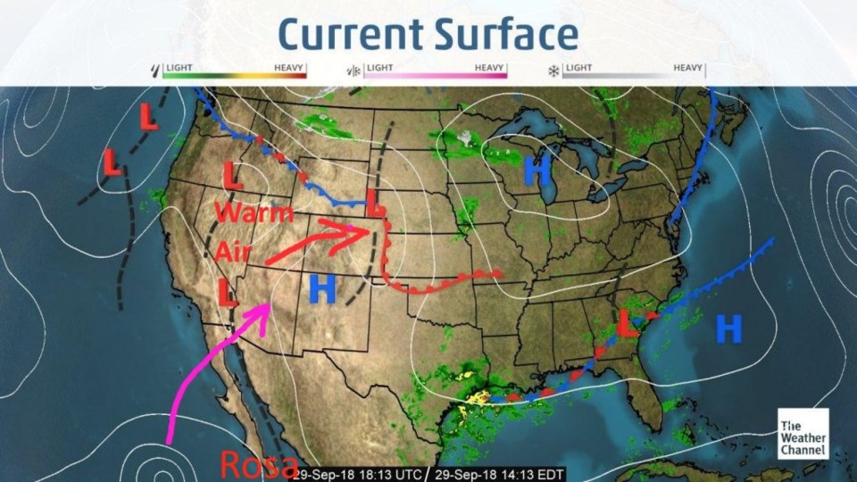
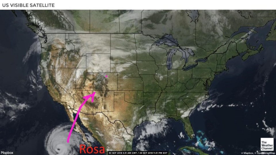
The warm air pushed our chilly Friday away on Saturday. It was up into the mid-80's F by afternoon Saturday (red arrow in Figure 1). Rosa is still headed north then northeast, our way, for later this week. You can see the pretty still intact structure of Rosa yesterday in Figure 2.

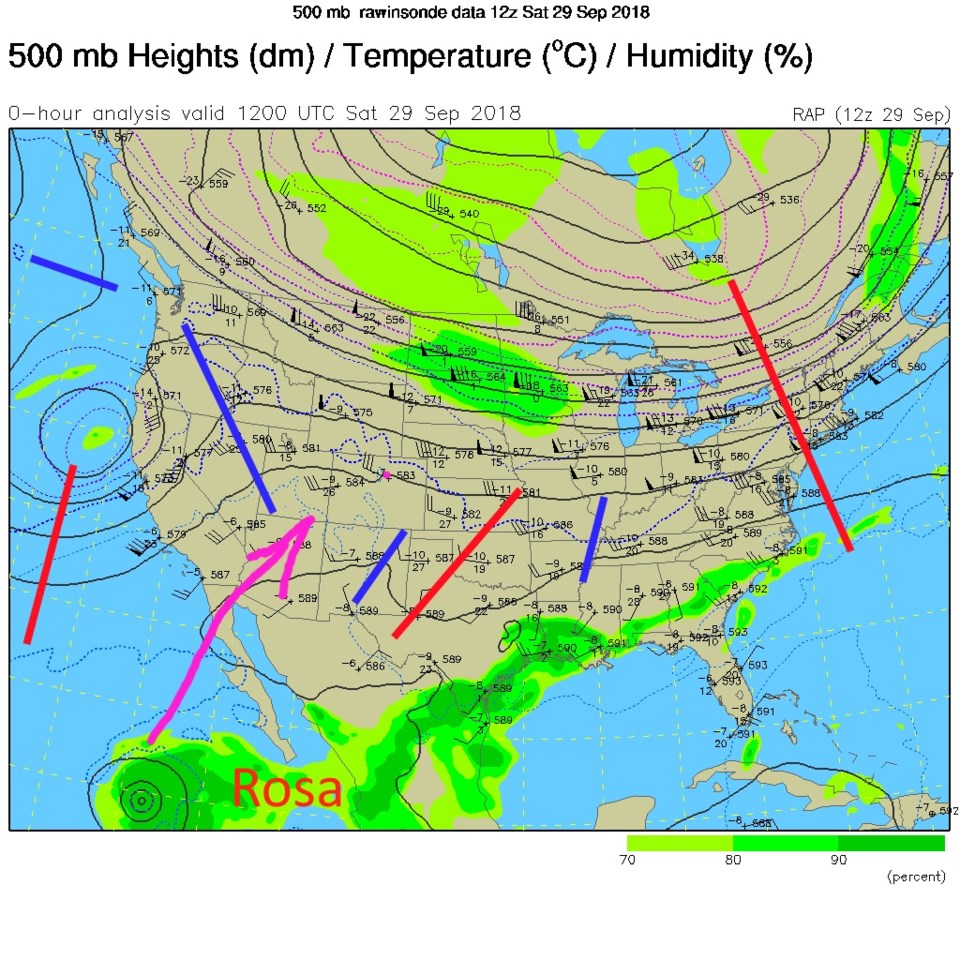
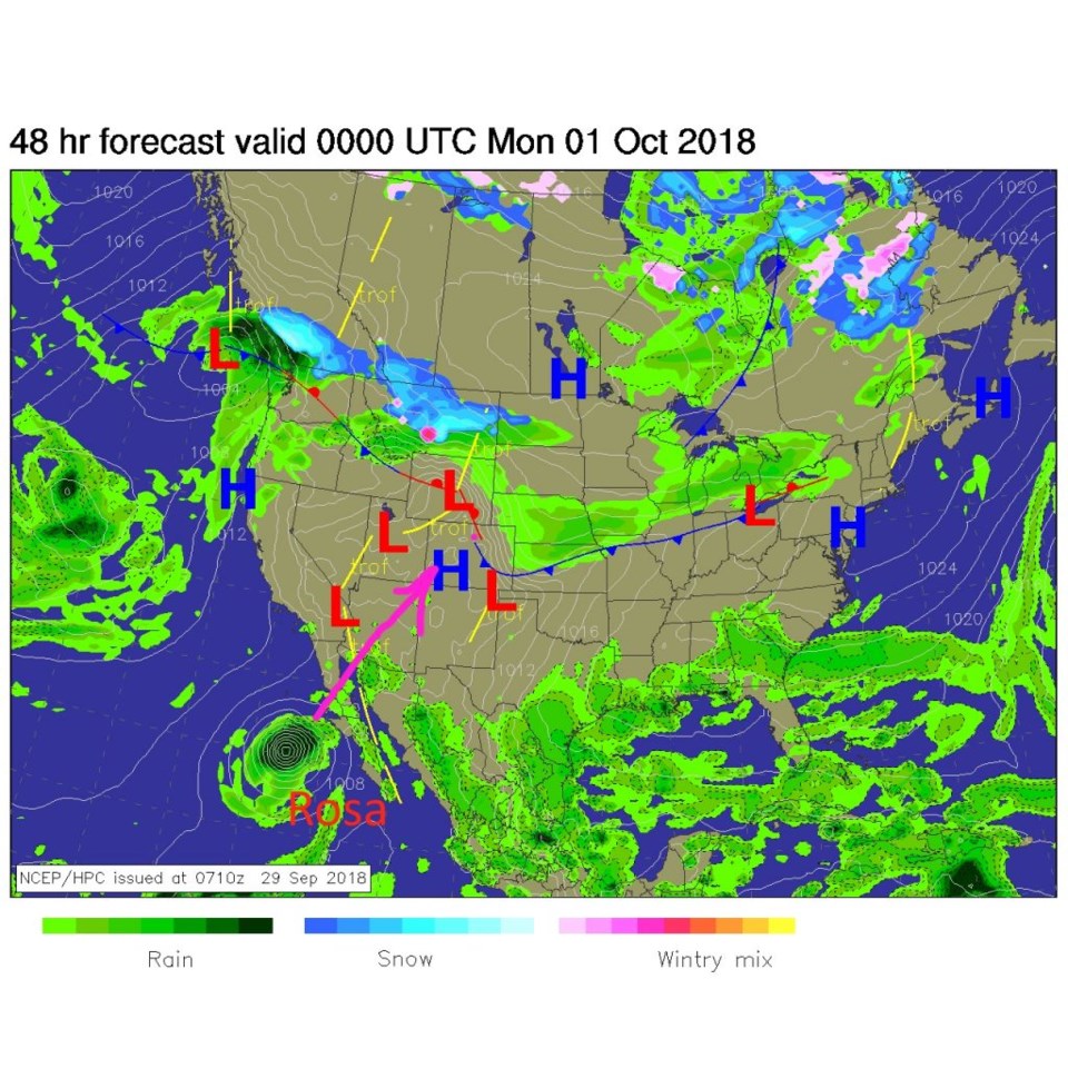
The upper air pattern from Saturday shows the west coast trough that is responsible for the future track of that storm (Figure 3). The surface forecast map for today shows a backdoor cold front has again slipped in from the northeast back to the front range. Today will only get up to the 70's F (Figure 4) because of it.

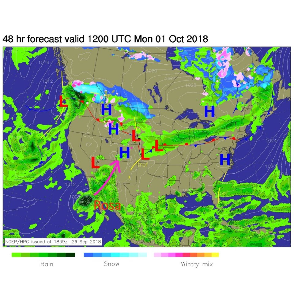
For tomorrow, as the moisture begins to pour into Arizona, the heat pushes east AGAIN - and we yo-yo back to the 80's F for a few (Monday-Wednesday) days (Figure 5).

Figure 1: the current surface map from Saturday afternoon from weather.com

Figure 2: The visible satellite image from Saturday PM from weather.com

Figure 3: The current 500mb map from Saturday morning from the NWS. Red lines are upper air troughs, blue lines are upper air ridges.

Figure 4: The forecast surface map for Sunday PM. From NCEP.

Figure 5: The forecast surface map for Monday AM. From NCEP.

The longer range forecast:

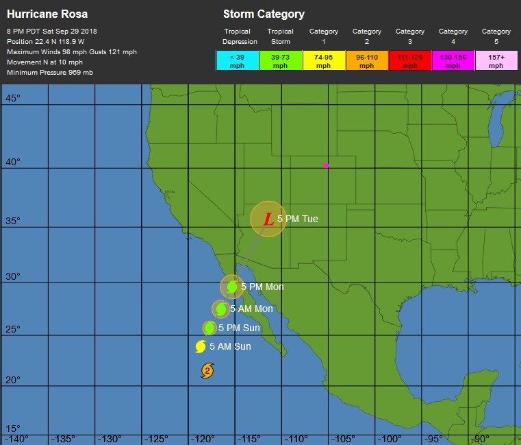
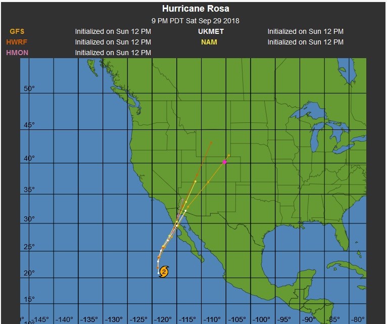
The future path of Rosa has it as a tropical depression up around Winslow, AZ on Day 5 (Figure 6). The comparison of various tropical models (Figure 7) still has one model bring the center of the remains of Rosa right over Longmont later in the week. Wow.

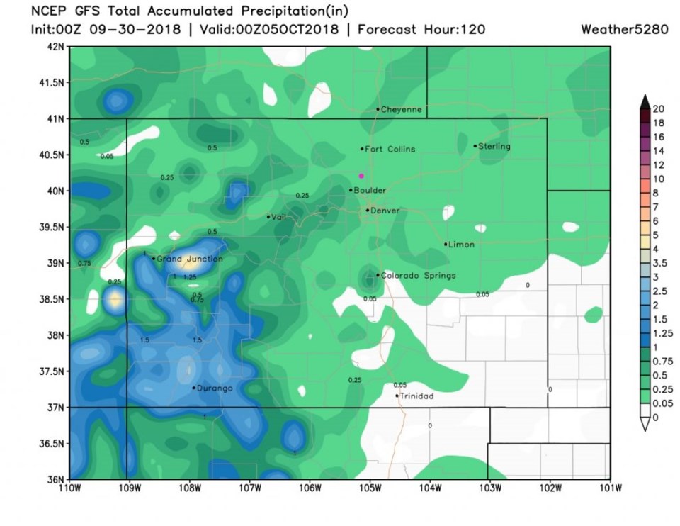
The GFS gives us a five day total of only up to 1/4th inch (Figure 8). The weatherunderground model gives us closer to an inch of rain over about 3 days at the end of the week. That would be wonderful.

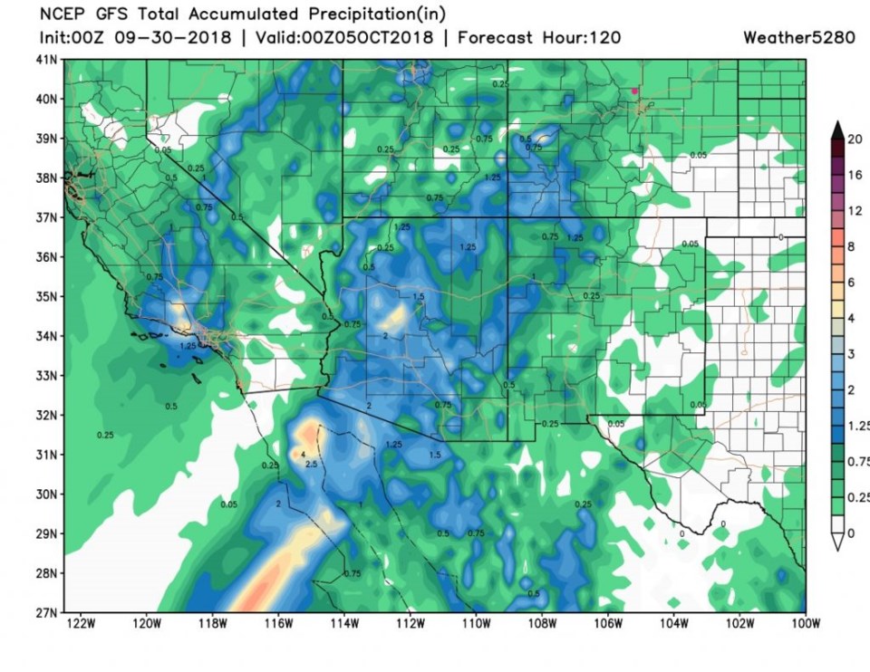
Figure 9 is the same map, but for the entire southwest U.S. Much of Arizona gets 2 inches of rain with a few places up around 4 inches.

Figure 6: The 5 day forecast track and intensity map for Hurricane Rosa from the NHC and weatherunderground.com

Figure 7: The 5 day ensemble model comparison map for Hurricane Rosa from the NHC and weatherunderground.com

Figure 8: The total precipitation between Saturday PM and Thursday PM from the GFS and weather5280.com

Figure 8: The total precipitation between Saturday PM and Thursday PM for the entire southwest U.S. from the GFS and weather5280.com

Current Weather

Cloudy

Cloudy

51°F

UV Index
0 Low
Pressure
29.45 Rising
Visibility
8 miles
Dewpoint
27 °F
Humidity
40%
Wind
WSW 9.4 mph
Gust
25.7 mph
Wind Chill
51 °F

Hourly Forecast

Today
7 AM
47°F
Showers
Today
8 AM
49°F
Cloudy
Today
9 AM
51°F
Cloudy
Today
10 AM
53°F
Cloudy
Today
11 AM
54°F
Cloudy
Today
12 PM
55°F
Cloudy
Today
1 PM
55°F
Cloudy
Today
2 PM
55°F
Cloudy
Today
3 PM
55°F
Cloudy
Today
4 PM
55°F
Cloudy
Today
5 PM
54°F
Cloudy
Today
6 PM
54°F
Cloudy

7 Day Forecast

Windy

Monday

55 °F

Winds gusting past 40 mph; cloudy and cooler


Windy

Monday Night

42 °F

Very windy this evening; partly cloudy


Partly sunny w/ showers

Tuesday

59 °F

A couple of showers in the morning; otherwise, windy and cool with times of clouds and sun


Partly cloudy

Tuesday Night

32 °F

Partly cloudy


Intermittent clouds

Wednesday

60 °F

Times of clouds and sun


Intermittent clouds

Wednesday Night

38 °F

Partly cloudy


Intermittent clouds

Thursday

56 °F

Cool with times of clouds and sun


Cloudy

Thursday Night

39 °F

Cloudy


Intermittent clouds

Friday

62 °F

Times of sun and clouds


Mostly clear

Friday Night

40 °F

Mainly clear


Sunrise and Sunset

Sunrise
5:53 AM
Sunset
8:01 PM

Based on AccuWeather data