Skip to content

The Next Storm/Next Snow Forecast Discussion from the Cherrywood Observatory – September 7th, 2018

This content was originally published by the Longmont Observer and is licensed under a Creative Commons license.

Forecast Discussion:

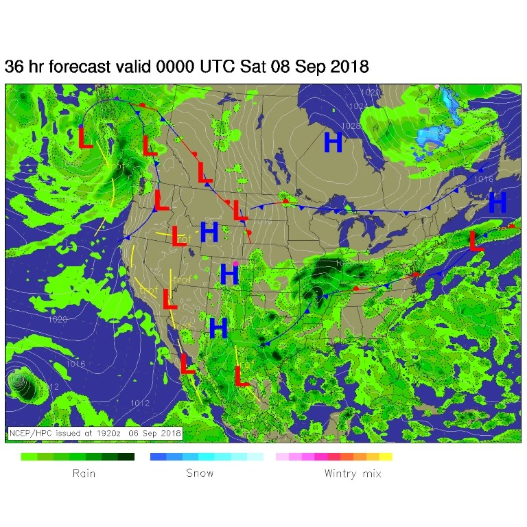
Our last chance of widespread rains (somewhat widespread, at least) pull out in the early morning hours today. The ridge is going to dominate the western U.S. for about a week now. Figure 1 shows the big swoop of a blue line along the ridge line.

We do have two tropical systems clearly visible on the map. Olivia is headed westward to die in colder water, but Florence is something we'll talk about in the longer range forecast below.

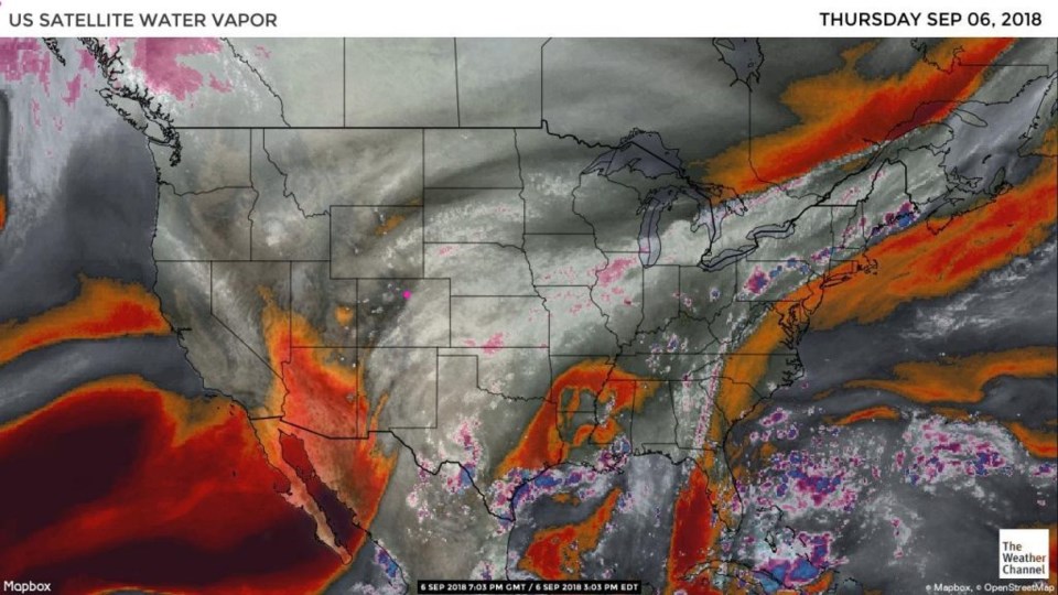
The water vapor satellite image from yesterday (Figure 2) shows the deeper river of moisture getting shoved to the east with the passing trough. The forecast surface map shows better rain chances today off in the southeast 1/3rd of the state this afternoon. We still 'might' see a wandering shower/thunderstorm this afternoon.

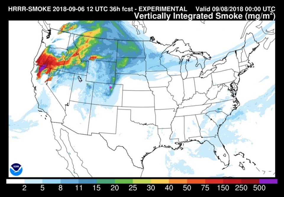
As the ridge builds, it is loading up on west coast (and more locally sourced) smoke. We'll see more haze into Saturday (Figure 4).

Figure 1: The 500mb forecast upper air analysis for Saturday AM. Pink dot is Longmont. Red lines are troughs, blue lines are ridges.

Figure 2: the water vapor satellite image from Thursday afternoon. Reds/Oranges are dry air, greys/whites are moist air regions.

Figure 3: The forecast surface map for Friday PM. From NCEP.

Figure 4: The HRRR (high resolution rapid refresh) model forecast of smoke at all levels for Friday PM.

The longer range forecast:

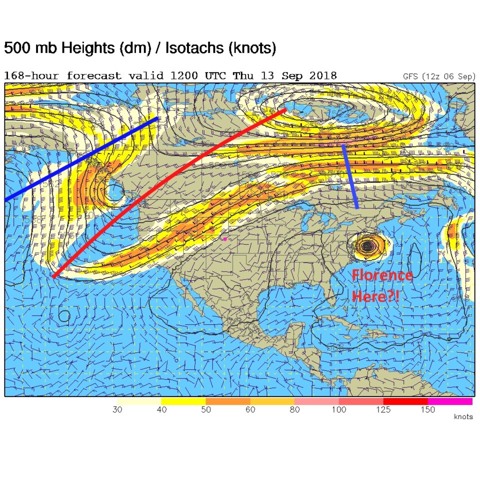
A week from now, the ridge moves over to the east coast which means we might see a big switch back to cooler and wetter weather next weekend (Figure 5). That ridge is bad news for the east coast. Tropical systems do best under a ridge (where there isn't damaging wind shear). If this current run of the GFS is correct, the nation's capital gets a head on hit by a major hurricane. I'll keep my eye on this all week.

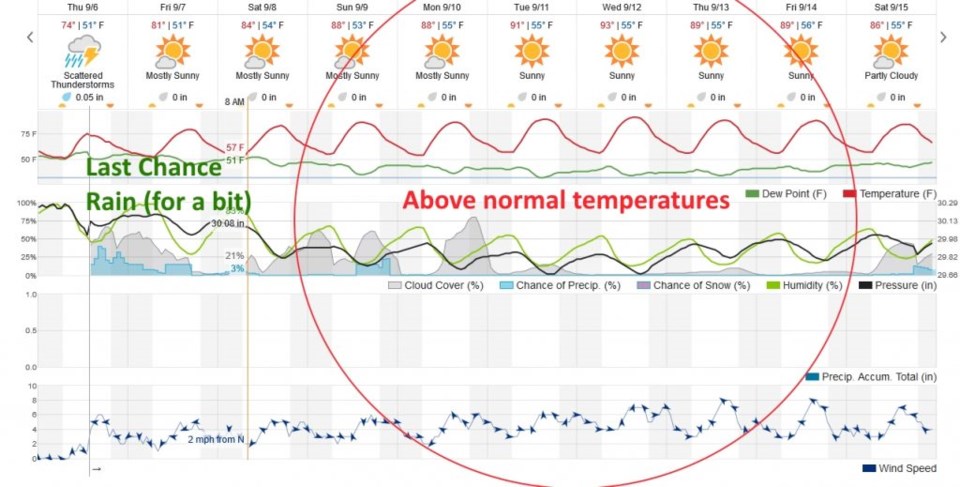
Figure 6 is the next 10 days at a glance. After the moisture and trough pull away today, we get pretty dry and get to about 10° degrees F above normal for the next 5 of the forecast period. This model does not show a big cool down or increase of rain chances out around the 14th or 15th as the upper air map is hinting at (Figure 5) - but that might change.

Figure 5: The 500mb forecast upper air analysis for Thursday AM next week. Pink dot is Longmont. Red lines are troughs, blue lines are ridges.

Figure 6: the next 10 days of the graphical forecast for Longmont, CO from weatherunderground.com

Current Weather

Clear

Clear

42°F

UV Index
0 Low
Pressure
29.93 Steady
Visibility
8 miles
Dewpoint
30 °F
Humidity
63%
Wind
NE 3.2 mph
Gust
6 mph
Wind Chill
41 °F

Hourly Forecast

Today
5 AM
37°F
Mostly cloudy
Today
6 AM
35°F
Mostly cloudy
Today
7 AM
38°F
Mostly cloudy
Today
8 AM
42°F
Mostly sunny
Today
9 AM
47°F
Mostly sunny
Today
10 AM
51°F
Mostly sunny
Today
11 AM
55°F
Mostly sunny
Today
12 PM
58°F
Mostly sunny
Today
1 PM
60°F
Partly sunny
Today
2 PM
62°F
Intermittent clouds
Today
3 PM
63°F
Mostly cloudy
Today
4 PM
64°F
Mostly cloudy

7 Day Forecast

Intermittent clouds

Thursday

64 °F

A blend of sun and clouds; breezy this afternoon


Mostly cloudy

Thursday Night

35 °F

Mostly cloudy


Partly sunny

Friday

68 °F

Increasingly windy with partial sunshine


Partly cloudy

Friday Night

38 °F

Partly cloudy


Partly sunny

Saturday

66 °F

Partial sunshine


Mostly clear

Saturday Night

41 °F

Clear to partly cloudy


Mostly cloudy

Sunday

78 °F

Rather cloudy and warmer; windy in the afternoon


Intermittent clouds

Sunday Night

43 °F

Partly cloudy; windy late


Mostly cloudy

Monday

60 °F

Mostly cloudy, breezy and cooler


Mostly cloudy

Monday Night

43 °F

Mostly cloudy


Sunrise and Sunset

Sunrise
5:58 AM
Sunset
7:57 PM

Based on AccuWeather data