This content was originally published by the Longmont Observer and is licensed under a Creative Commons license.
Forecast Discussion:
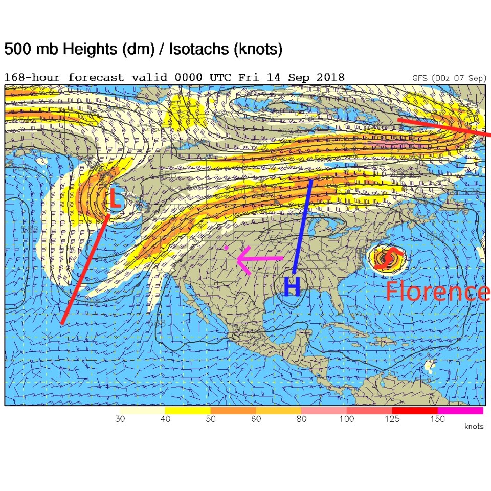
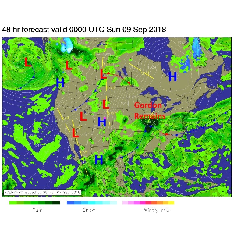
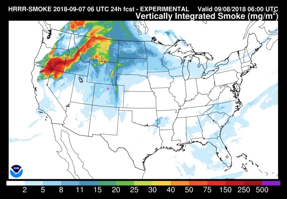
Here comes the ridge, warmth, a bit of smoke, and quiet weather. Figure 1 shows the high pressure center building in Colorado and all the showers to our distant southeast this afternoon. Figure 2 shows smoke traveling up over the ridge in the west with some of the West Coast smoke and Wyoming fires smoke coming down the Front Range. It doesn't look overly thick this weekend, but we won't have our perfect blue skies and sharp mountain views.
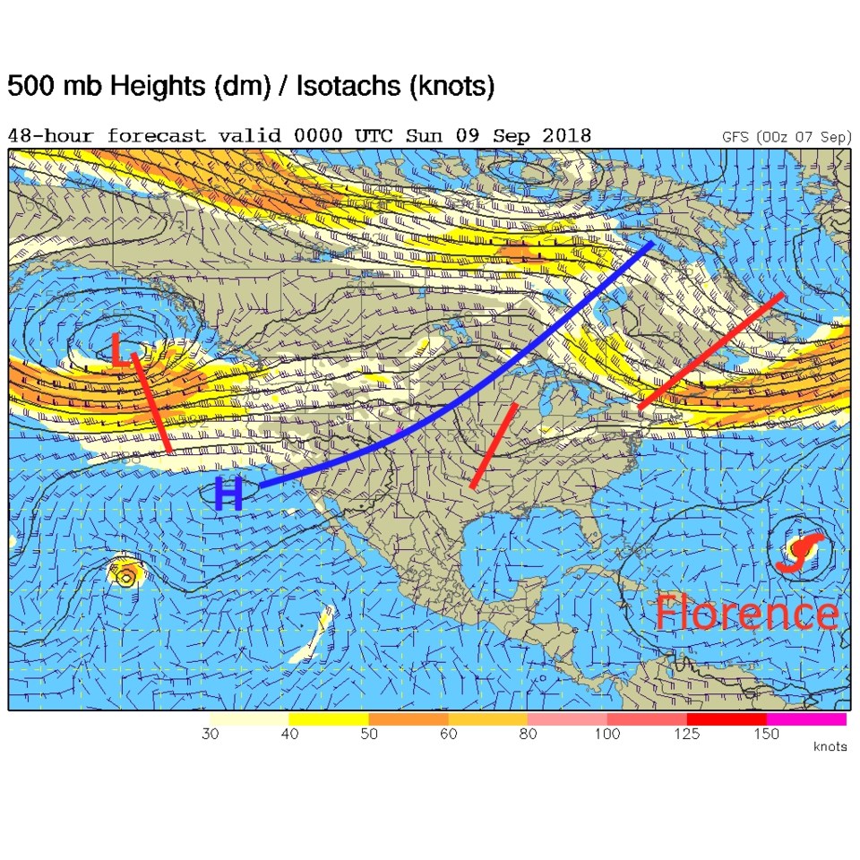
The ridge in discussion is the broad swooping blue line in Figure 3. Our thunderstorm making short wave trough of the last few days is off in the Mississippi Valley interacting with Gordon's remains (Figure 1).
The longer range forecast:
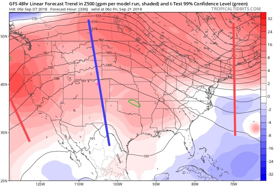
The GFS run on Friday AM has Florence very close to the U.S. East Coast/the Nations Capital. The bad news for us is the trend for the VERY long range is that we'll see this big ridge move back to the west and lift the west coast trough over us to the north. We may NOT see as much cooling and rain chances a week from now, but may in fact go right back to above average heat (purple arrow in Figure 4).
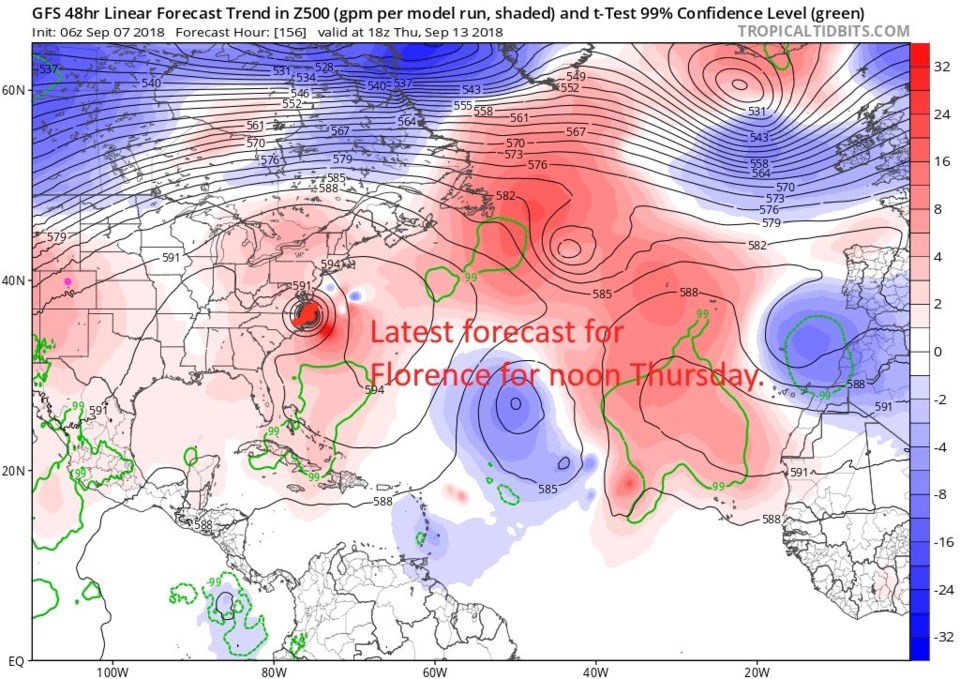
The next set of graphics are forecast trends of the 500mb pattern. These look at earlier forecasts and show how much the height has changed in the forecast from model run to model run. Blues are lower heights (more stormy weather expected in general) and reds are higher heights (less stormy weather is expected in general).
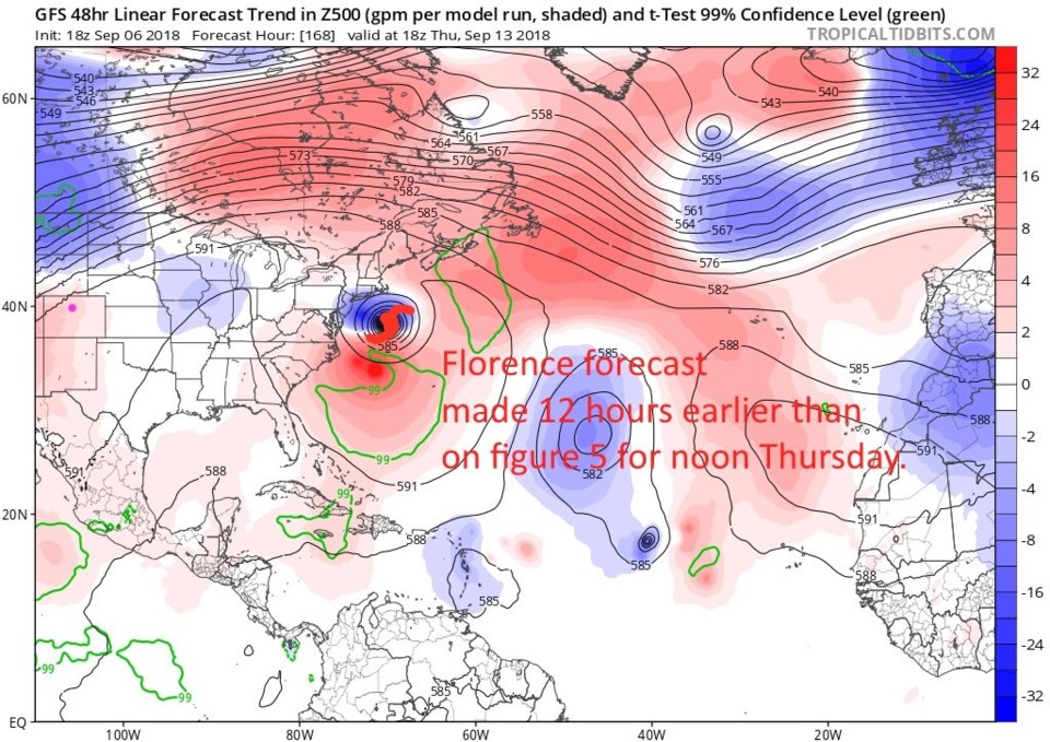
Figure 5 is the latest forecast (made Friday AM) for Thursday noon next week. Florence is hitting around Newport News in this forecast. This is a bit of a jump from the forecast made 12 hours earlier. Figure 6 is that earlier forecast and the hurricane is south of Massachusetts and still out to sea.
Looking at other models briefly, the CMC has a hit on central N. Carolina early Friday AM. The ECMWF model has it hit the N. Carolina /S. Carolina border Thursday night. The NAVGEM has the storm out to sea sort of curving northwestward on Thursday AM to the east of N. Carolina. The WW3 hits it around Newport News, VA again Thursday midday.
Turning back to our REALLY long range forecast trend - 14 days from now (the first day of Fall on the 21st) the ridge is back to being centered over Colorado (Figure 7) with a forecast trend to more ridging than earlier model runs showed. Too bad the pools close on a calendar bases and not based on actual forecasts.