Skip to content

The Next Storm/Next Snow Forecast Discussion from the Cherrywood Observatory – October 10th, 2018

This content was originally published by the Longmont Observer and is licensed under a Creative Commons license.

Forecast Discussion:

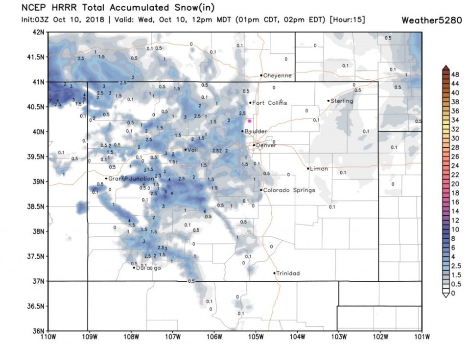
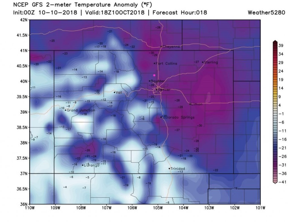
Will you have to shovel snow in the morning, or scrape the windshield? The short answer is - almost to probably. Figure 1 is the HRRR 15 hour snowfall accumulation and there is 2+ inches of snow drawn right up to Airport road, then nothing significant beyond that. Aarug! Figure 2 shows how much super cold air is still in place today with temperatures about 25°F below normal. This is our coldest day yet.

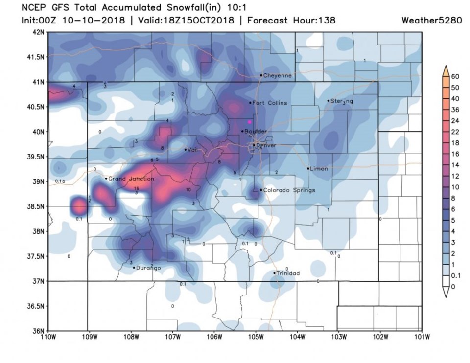
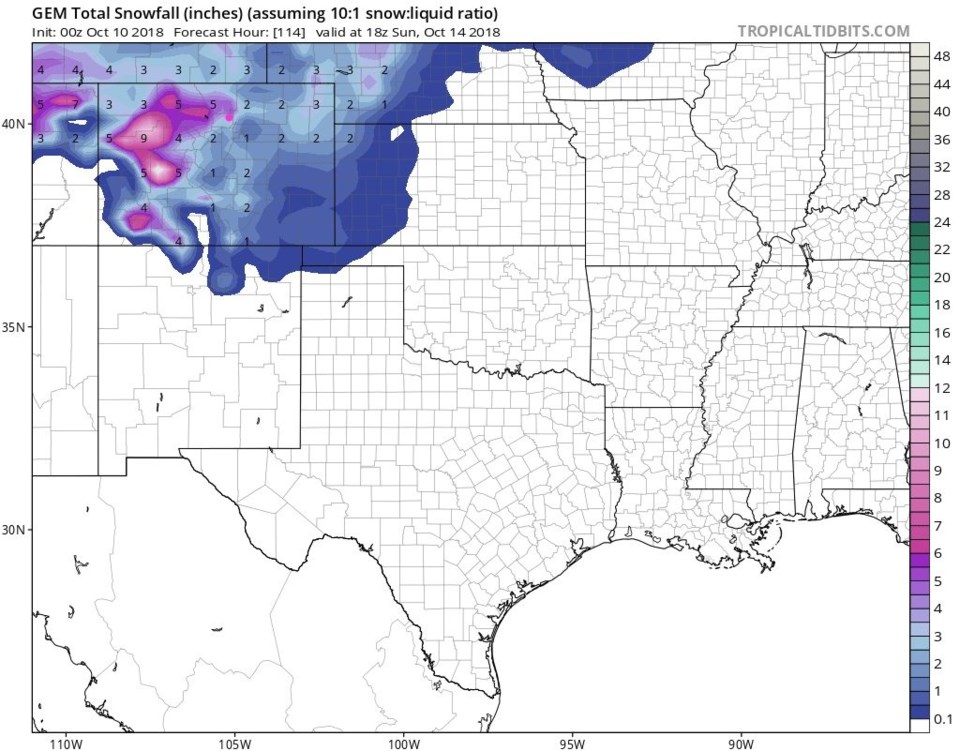
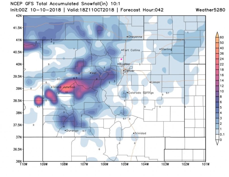
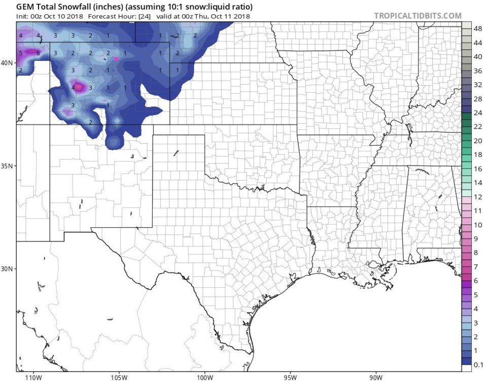
The GFS (Figure 3) still paints a hole on Longmont with no snow, but up to an inch all around. What is up with that!? The GEM model gives us about 1 inch by the end of tomorrow (Figure 4).

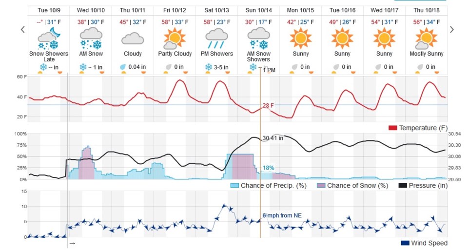
Figure 5 says the highest chances of snow and precipitation for Longmont occur between 5 a.m. and 2 p.m. There are smaller chances of precipitation beyond that. The weatherunderground model (also Figure 5) says approximately an inch. Since there is light sleet falling this evening at 10 p.m., getting some ice in the morning is pretty likely.

Figure 1: The 15 hour snowfall accumulation up to noon today from the HRRR model and weather5280.com

Figure 2: The surface temperature anomaly (departure from normal) for Wednesday noon.

Figure 3: The total snowfall accumulation from Tuesday p.m. up to noon Thursday from the GFS model and weather5280.com

Figure 4: The total snowfall accumulation from Tuesday p.m. up to Wednesday night from the GFS model and weather5280.com

The longer range forecast:

As we get our possible snow, hurricane Michael is hitting the Florida panhandle possibly as a category 4 storm (not shown here). We moderate a bit for Friday and Saturday getting up to only 10°F below normal - then our next storm moves in with 3-5 inches predicted on weatherunderground for Saturday night into Sunday a.m.

The GFS gives us a total of about 4-5 inches (Figure 6) and the NAM gives us about 3-4 inches. This weekend storm is looking significant! More later!

Figure 5: the next 10 days of the graphical forecast for Longmont, CO from weatherunderground.com

Figure 6: The total snowfall accumulation from Tuesday p.m. up to noon Monday from the GFS model and weather5280.com

Figure 7: The total snowfall accumulation from Tuesday p.m. up to Sunday noon from the GFS model and weather5280.com

Current Weather

Partly sunny

Partly sunny

65°F

UV Index
3 Moderate
Pressure
29.82 Rising
Visibility
8 miles
Dewpoint
35 °F
Humidity
32%
Wind
N 8.9 mph
Gust
19.6 mph
Wind Chill
65 °F

Hourly Forecast

Today
5 PM
64°F
Mostly cloudy w/ showers
Today
6 PM
60°F
Partly sunny
Today
7 PM
55°F
Partly sunny
Today
8 PM
53°F
Partly cloudy
Today
9 PM
50°F
Partly cloudy
Today
10 PM
47°F
Partly cloudy
Today
11 PM
45°F
Partly cloudy
Tomorrow
12 AM
43°F
Partly cloudy
Tomorrow
1 AM
41°F
Partly cloudy
Tomorrow
2 AM
41°F
Partly cloudy w/ showers
Tomorrow
3 AM
40°F
Partly cloudy w/ showers
Tomorrow
4 AM
39°F
Partly cloudy

7 Day Forecast

Partly sunny w/ showers

Friday

76 °F

More sunshine than clouds; breezy this afternoon with a shower in spots


Partly cloudy w/ showers

Friday Night

37 °F

Partly cloudy with a couple of showers late


Partly sunny

Saturday

66 °F

Not as warm with sun and some clouds


Mostly clear

Saturday Night

39 °F

Clear to partly cloudy


Mostly cloudy

Sunday

76 °F

Mostly cloudy and warmer; breezy in the afternoon


Mostly cloudy

Sunday Night

51 °F

Rather cloudy; windy late


Windy

Monday

60 °F

Winds gusting past 40 mph; cloudy and cooler


Intermittent clouds

Monday Night

43 °F

Breezy in the evening; otherwise, partly cloudy


Intermittent clouds

Tuesday

62 °F

Times of clouds and sun; windy in the afternoon


Intermittent clouds

Tuesday Night

36 °F

Clearing


Sunrise and Sunset

Sunrise
5:57 AM
Sunset
7:58 PM

Based on AccuWeather data