Saturday Update:
We have a dry wind kicked up by a nearby front. There is a fire that is forcing evacuations near NCAR. Winds will die rapidly tonight with warmer weather Sunday and Monday. There is a storm expected to brin about 1/4th to 1/3rd inch of precipitation. More showers are possible Thursday and Friday. Spring showers!
End Saturday Update.
In Brief
Another storm moves through the state Sunday/Monday with mainly mountain snow, then more Spring-time weather.
Forecast Discussion:
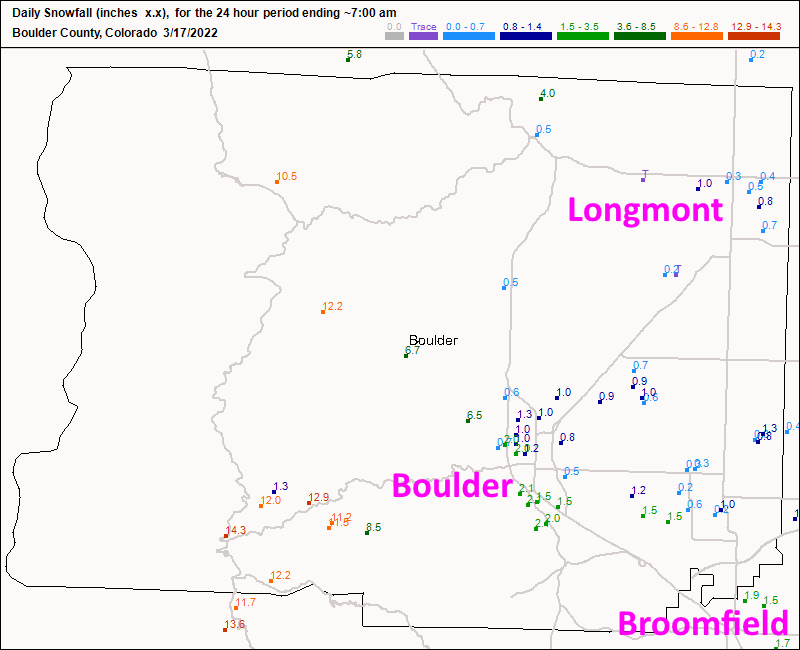
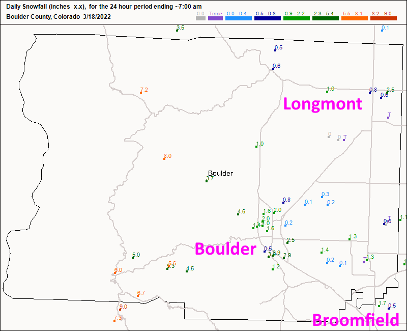
Let's look back on our mid-week storm first. In Boulder county, the two day snow totals from Longmont were about 1 to 1.5 inches. Broomfield did a bit better getting about 2-4 inches. Boulder only received 3-5 inches but the mountains above Boulder saw 14-16 inches. Wow. (Figures 1 and 2.) The great news is areas along I-25 received about 1/2 to 3/4th inch of rain. This is the wonderful combination of water and warmth needed to bring the plant world back to life!
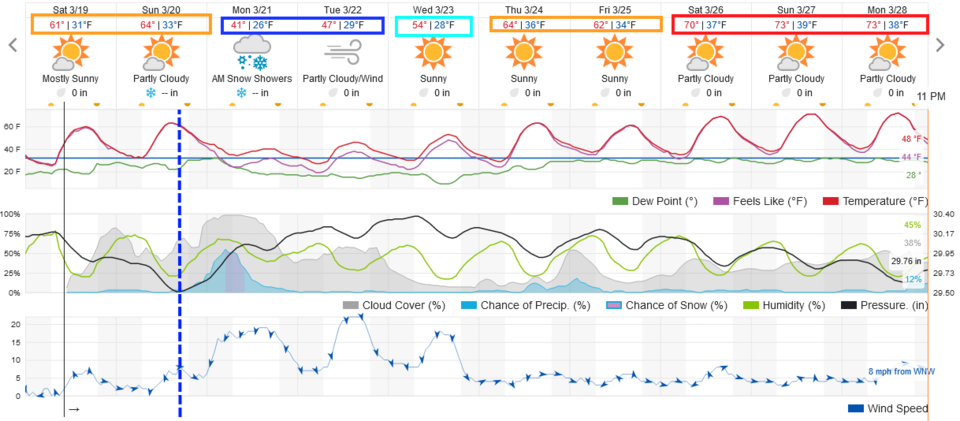
This weekend will see comfortable 60's for highs until a cold front sweeps the state in the early afternoon Sunday. A period of rain then snow will impact most of Colorado Sunday night through Monday evening (Figure 3). Monday will see highs in the upper 30's or lower 40's at the lower elevations. This is not great for accumulating snow along I-25 but it should be a moderate (not big) snow for the mountains again.
The Longer Range Forecast:
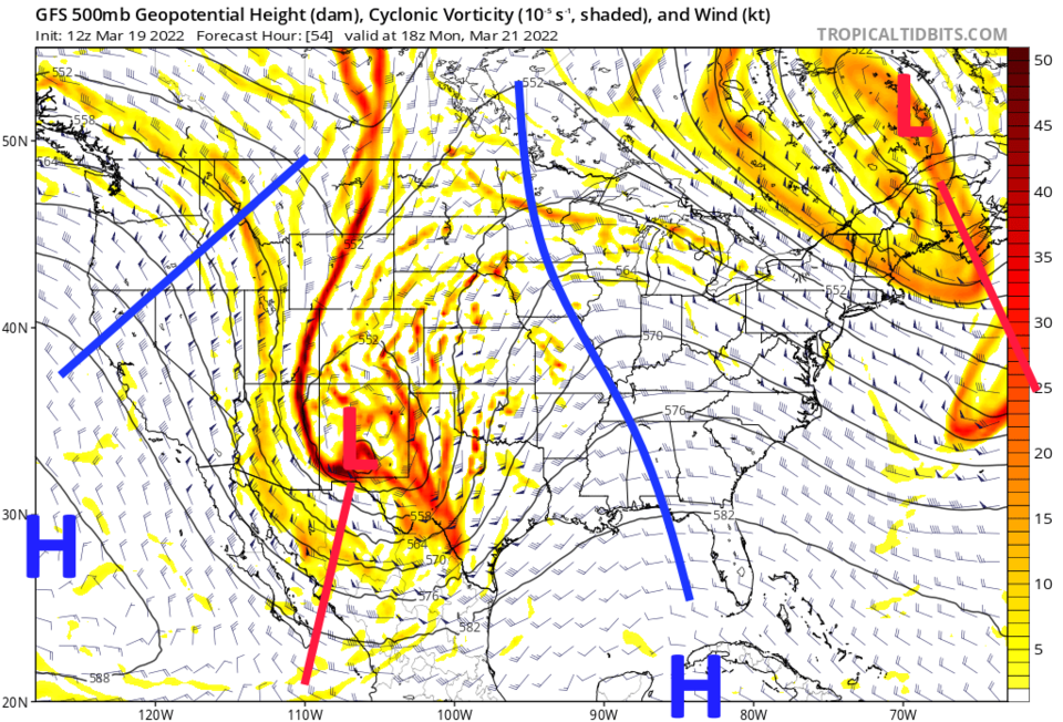
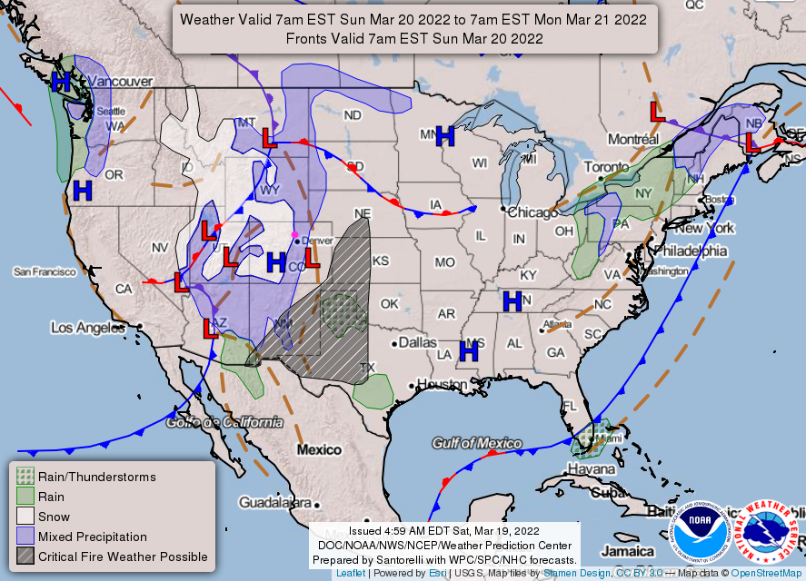
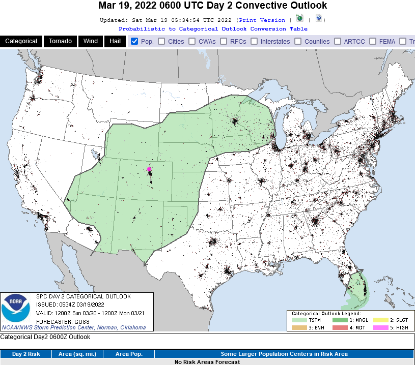
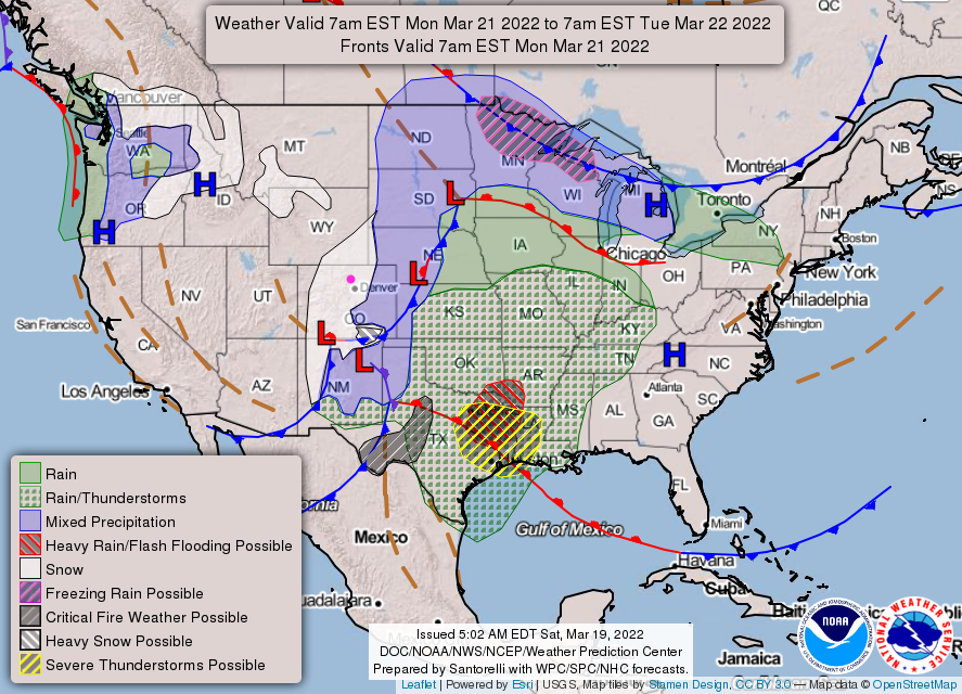
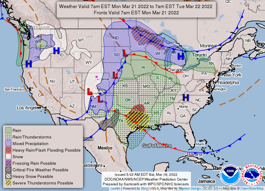
This next system is powered by a healthy trough moving across the state on Monday (Figure 4). On Sunday, the system is binging snow to the western slopes of Colorado and much of Utah (Figure 5). There are even widespread chances of thunder storms (non-severe) Sunday night into Monday (Figure 6). On Monday, there will be a mix of rain and snow on the Colorado eastern plains and snow for the mountains and communities along the Front Range and I-25 (Figure 7).
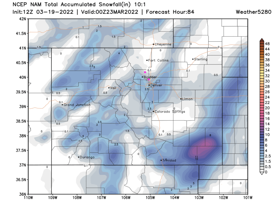
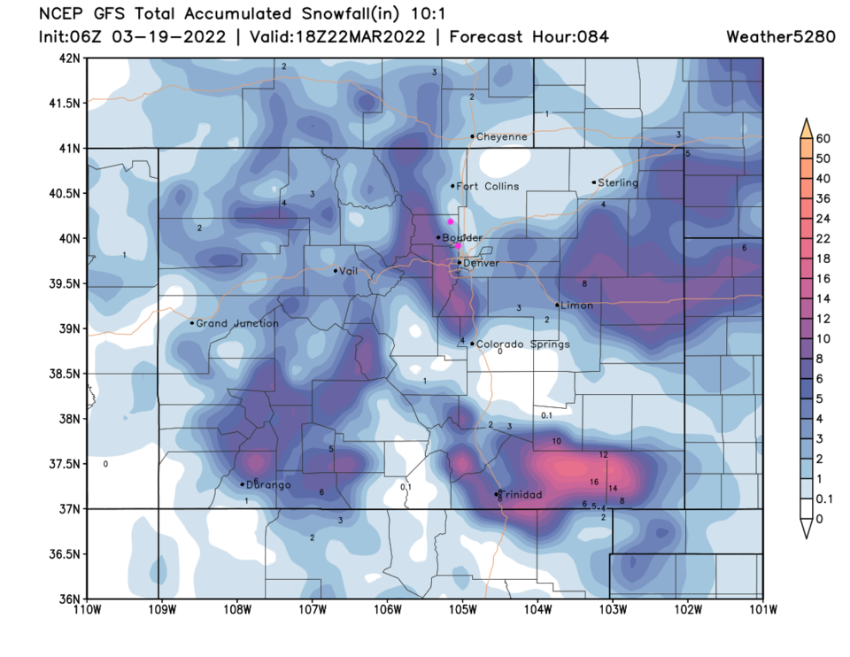
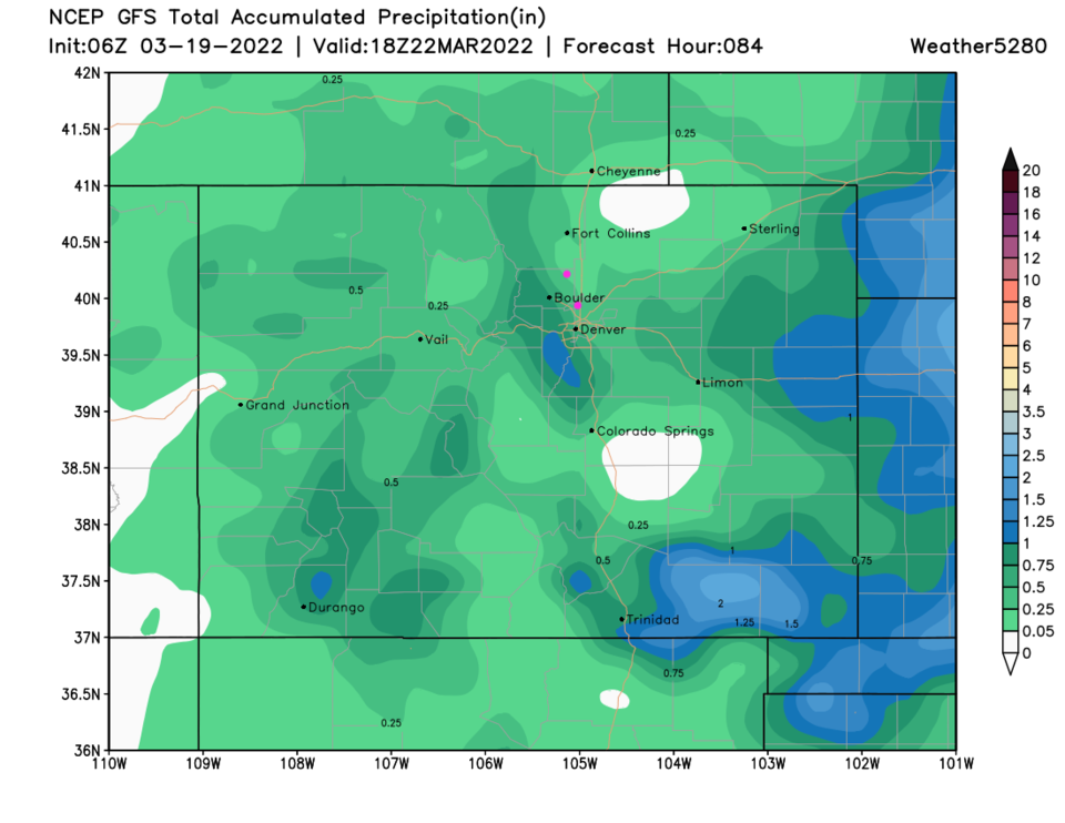
There has been a disagreement between the models for many days with the GFS bringing the low into eastern and southeastern Colorado. That would have given the Front Range and Denver a significant winter storm+moisture. The Euro and NAM have the low doing its "best" while sitting in eastern and northeastern New Mexico. By that, the NAM (Figure 8) has spotty snow totals along I-25 north of Denver (with many locations not receiving any accumulating snow). Denver may get 1-3 inches in places on the western and southern sides of the city. The GFS creates a snow-free spot east of Fort Collins with 2-3 inches along I-25 north of Denver (Figure 9). The GFS also puts 4-8 inches in the foothills west of Boulder, Denver and south of Denver. Recent runs do see the GFS moving the low further south like the other models. The GFS precipitation totals of 1/4th around Fort Collins to 1 inch down to southwest Denver (Figure 10) is still probably overdone.
Overall, expect a cold, windy, couple of days with some rain showers probably turning to snow late Sunday with little accumulation along I-25 and 3-6 inches as a maximum around Nederland. As another example, Estes Park may see 2-4 inches.