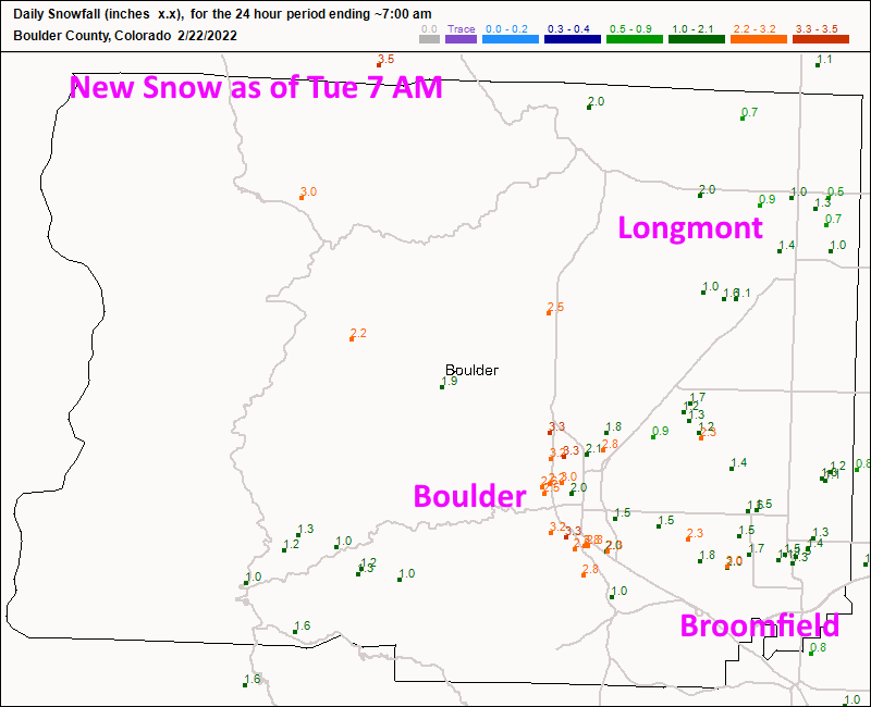
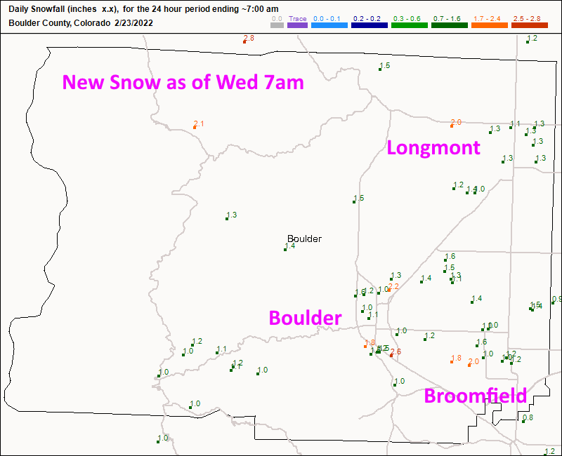
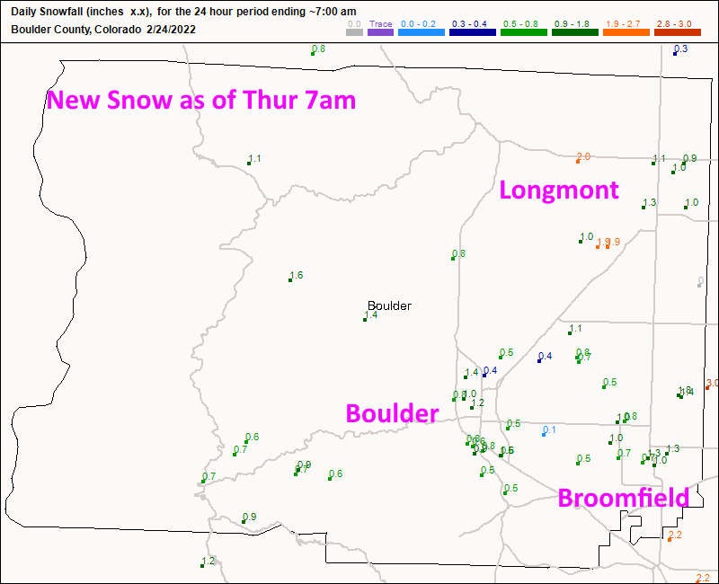
Skip to content
Join our Newsletter

Thursday Update: The Front Range Forecast: clear skies and warming temperatures return

Figure2u_02242022
Figure 2 update: the CoCoRaHS new snow report for Wednesday as of 7am.

Thursday Update:

The storm has departed Colorado and the incredibly cold air is moving off as well. We had a small amount of snow each day due to the incredibly cold air (it holds very little moisture for a system to work with).  Figure 1, 2 and 3 update show the morning snow reports for Tuesday through Thursday.

Longmont received about 3.3 inches of total snow.
Boulder received about 6 total inches of snow.
Broomfield received about 3.8 inches of snow.

We remain mostly dry for the next 10 days (maybe a bit of snow will swish by Friday).  Temperatures warm steadily to highs in the 60s and lows in the 30s next week. Hang on, it will get nice soon!


Figure1u_02242022
Figure 1 update: the CoCoRaHS new snow report for Tuesday as of 7am.
Figure2u_02242022
Figure 2 update: the CoCoRaHS new snow report for Wednesday as of 7am.
Figure3u_02242022
Figure 3 update: the CoCoRaHS new snow report for Thursday as of 7am.


About the Author: John Ensworth

John Ensworth used to work from Longmont as the PI for the NASA through the IGES (The Institute for Global Environmental Strategies). He now teaches technology, algebra, astronomy, meteorology, film school, and Lego robotics to middle/high school.
Read more


Comments


Current conditions are not available.