In Brief:
Beautiful weather changes to a cooler temperature regime with snow Wednesday, Saturday, and possibly early next week.
Thursday Update:
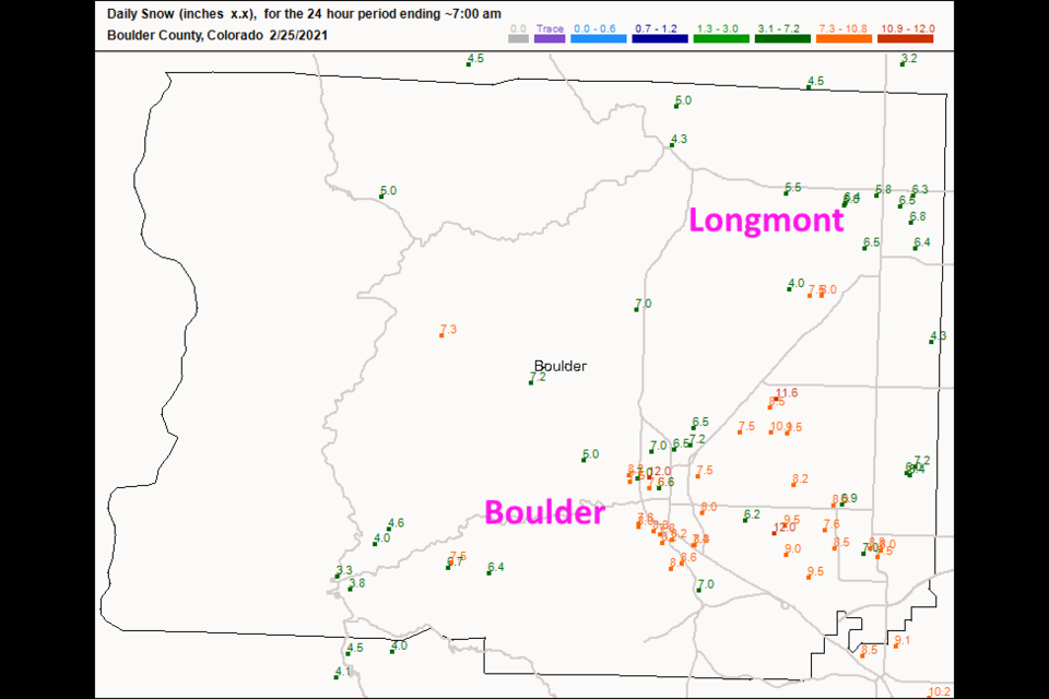
The snow reports are in! Longmont over performed on my forecast (I was happy with a Trace- 3 inches) as did Boulder. Figure 4 update shows Longmont receiving 5.5 to 6.5 inches of snow. Boulder seems to be in the 7-9 inch snow total territory. That was a pretty good storm!
The weekend system seems to be weaker (very small precipitation chances). We warm to the 50's next week. Enjoy the break!
 Figure 4 update: CoCoRaHS snow totals as of 7am Thursday.
End Thursday Update:
Tuesday PM Update:
Cool air is filtering in overnight Tuesday with a front zipping down the Front Range about 2-3pm Wednesday. Snow should begin around 3-4pm and continue through the pre-dawn hours Thursday (Figure 1 update). The weatherunderground.com model gives us 2-3 inches of snow. The GFS (Figure 2 update) gives us about 2-3 inches as well. The forecasters at weather5280.com give us a Trace to 3 inches. I'm happy with those totals. East if I-25 snowfall amounts will drop off quickly.
It looks like we might pick up another inch or two from Saturday morning through Sunday night (new snow in Figure 3 update). More later on that!
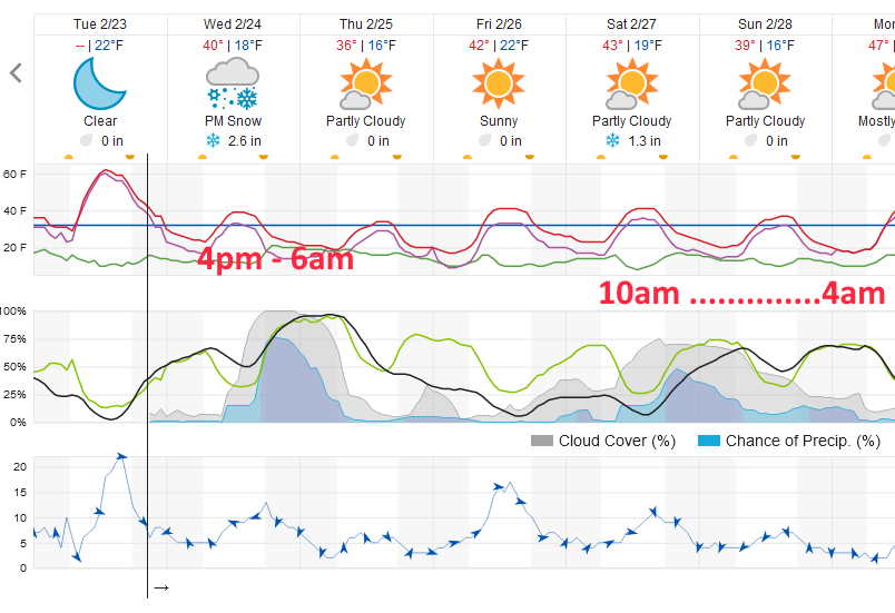 Figure 1 update: snippet of the 10 day graphical forecast from weatherunderground.com for Longmont, CO
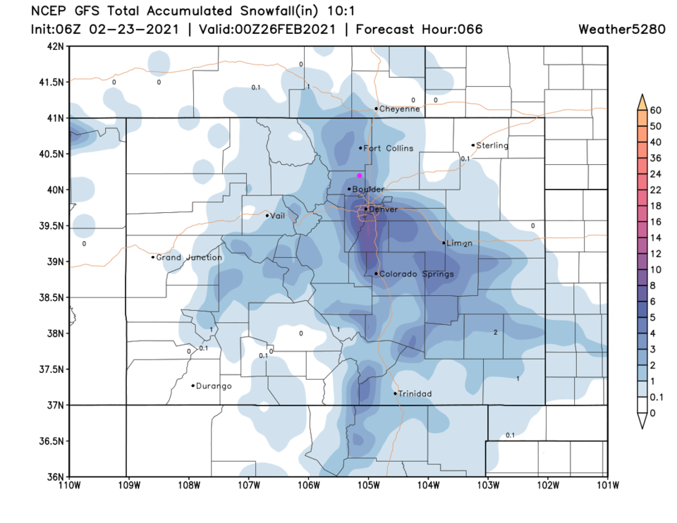 Figure 2 update: the 3 day 10:1 snowfall forecast from the GFS and weather5280.com
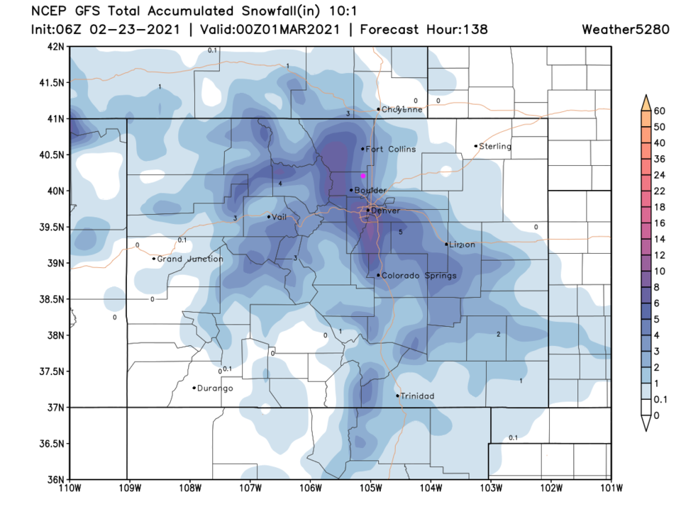 Figure 3 update: the 10 day 10:1 snowfall forecast from the GFS and weather5280.com
End Tuesday PM Update:
Forecast Discussion:
We are enjoying a taste of spring prior to Wednesday. A ridge is drifting overhead with down slope flow off the mountains adding to the warmth (Figure 1 below).
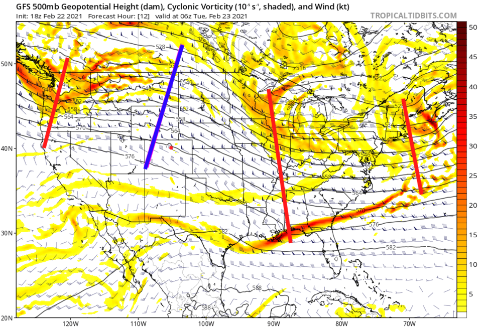 Figure 1: the 500mb upper air forecast map for Tuesday AM from the GFS and tropicaltidbits.com
We'll see temperatures approach 60F on Tuesday before we chill to more normal late Winter temperatures and see snow return Wednesday afternoon (Figure 2).
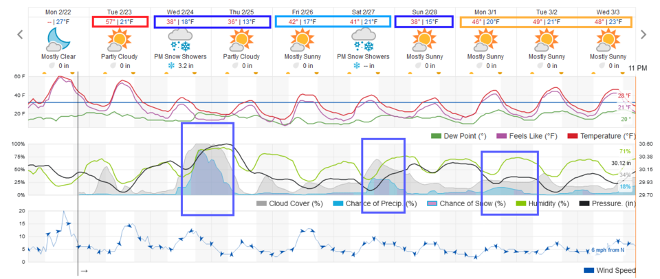 Figure 2: the 10 day graphical forecast from weatherunderground.com for Longmont, CO.
A cold front zips down the eastern Plains but can't cross the Rockies as the cold air is too shallow (Figure 3).
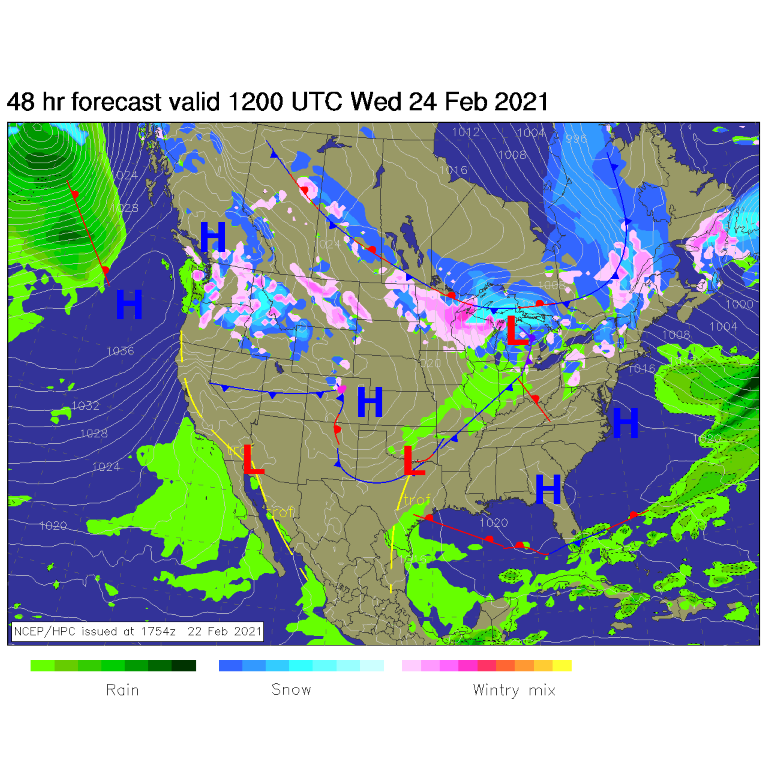 Figure 3: the forecast surface analysis for Wednesday AM from NCEP.
This front and chance of snow is driven by a small but stout short wave moving through the overall northwest flow over Colorado (Figure 4). The maximum extent of snow on Wednesday isn't impressive on the GFS (Figure 5). It paints Longmont with about 1 inch of snow (Figure 6). The weatherunderground model (Figure 2) is more bullish with 3-4 inches of snow. I lean toward the lower end of these two. Snow seems most likely Wednesday around 4pm to Thursday 3am.
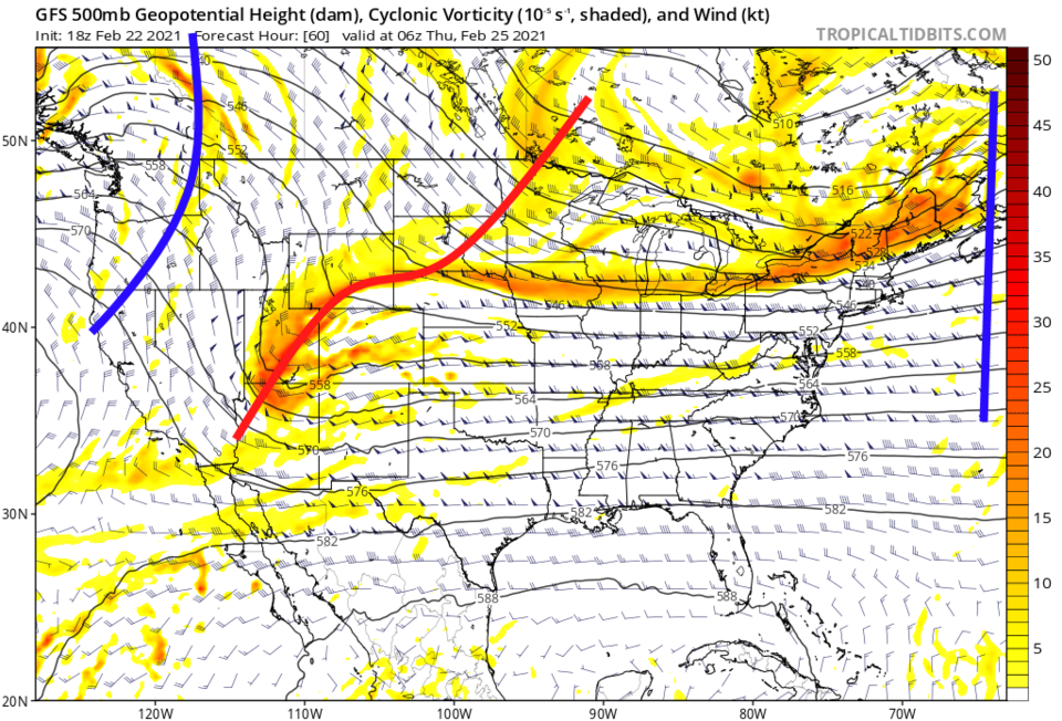 Figure 4: the 500mb upper air forecast map for late Wednesday night from the GFS and tropicaltidbits.com
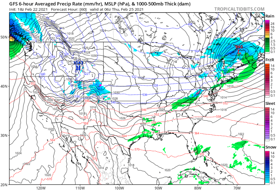 Figure 5: the 6 hour averaged precipitation around Wednesday Sunset from the GFS and tropicaltidbits.com
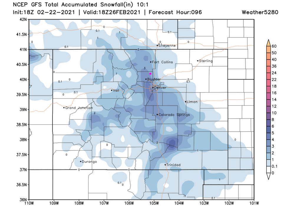 Figure 6: the 4 day (10:1 ratio) total snowfall forecast from the GFS and weather5280.com
The Longer Range Forecast:
The weekend sees another short wave dig into the West and another chance of snow (Figure 7). Figure 8 takes us out beyond that (at present minor system) to 10 days. It has in impressive foot or more almost into Longmont and up into the mountains. We'll see if THAT happens in a future post. Enjoy the warm start-of-week!
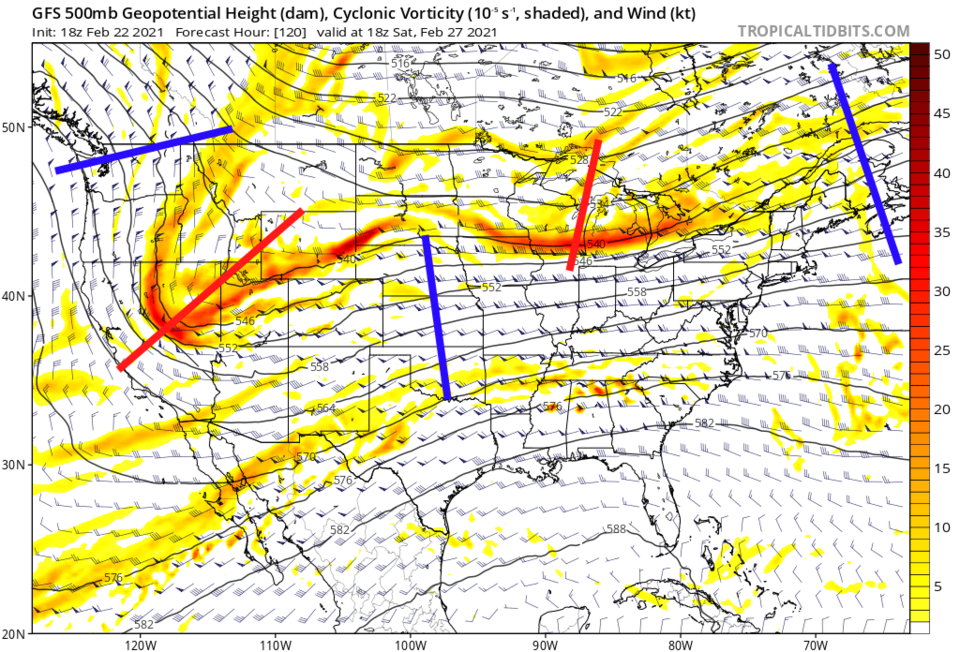 Figure 7: the 500mb upper air forecast map for Saturday noon from the GFS and tropicaltidbits.com
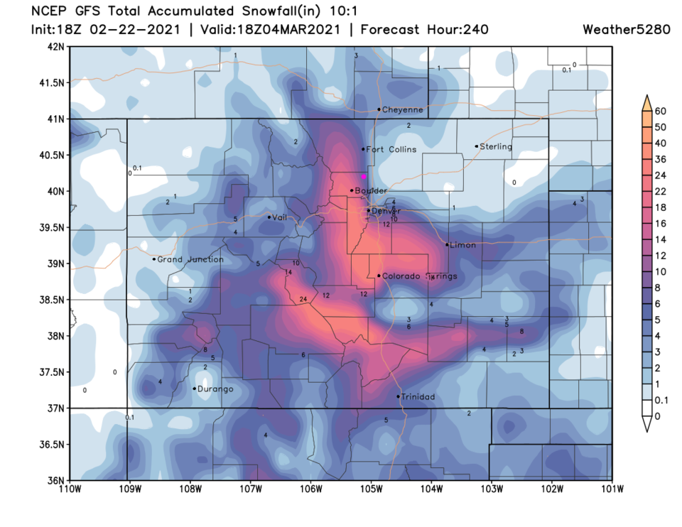 Figure 8: the 10 day (10:1 ratio) total snowfall forecast from the GFS and weather5280.com


