Skip to content

The Next Storm/Next Snow Forecast Discussion from the Cherrywood Observatory – November 19, 2017

This content was originally published by the Longmont Observer and is licensed under a Creative Commons license.

Forecast Discussion:

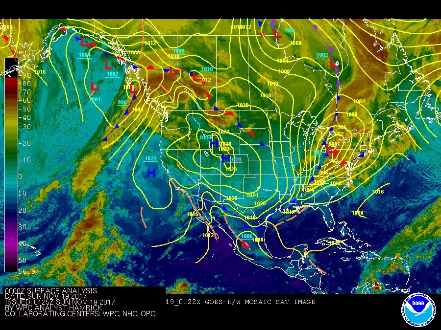
...and the quiet weather begins again.  The current surface map (Figure 1) has a big high pressure system sitting over western Colorado.  The large scale storminess is on the north west coast and east and northeast coast.

Figure 1: Current surface map Saturday PM with Infrared Satellite image background (cold clouds= yellow/orange, warm ground= blues and purples. )

The Longer Range forecast:

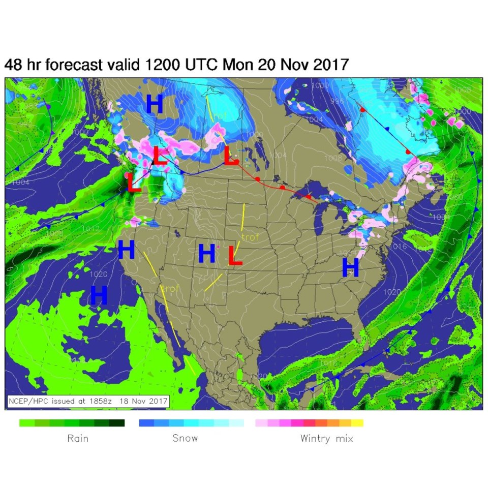
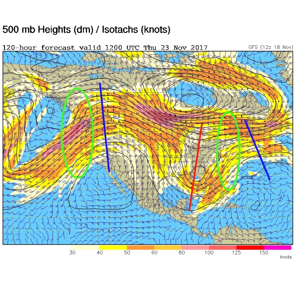
The weather maps changes little by Monday with storms up in the northeast and northwest again (Figure 2). High pressure dominates Colorado. On Thanksgiving day, the troughs have moved little and the unsettled weather (light green ovals Figure 3) is still in the same places - the northeast and northwest coasts.  How long can this pattern hold like this...? We'll see!

Thanksgiving Day forecast created Saturday:  High 68F  Low 43F with partly cloudy skies, light winds out of the west.  Still as ideal as a Thanksgiving day could be here! (And there is no poor weather expected on the travel days on either side of the holiday either.)

Figure 2: NCEP surface map analysis forecast for late Sunday/early Monday (Longmont = pink dot).

Figure 3: Upper air, 500mb forecast map from the GSF for Thanksgiving morning. Trough in red, ridges in blue and unsettled weather in green circles to the right of troughs).

Current Weather

Mostly cloudy

Mostly cloudy

70°F

UV Index
0 Low
Pressure
29.86 Steady
Visibility
8 miles
Dewpoint
39 °F
Humidity
32%
Wind
NW 4.8 mph
Gust
10.4 mph
Wind Chill
70 °F

Hourly Forecast

Today
8 PM
67°F
Showers
Today
9 PM
64°F
Mostly cloudy
Today
10 PM
62°F
Mostly clear
Today
11 PM
60°F
Mostly clear
Tomorrow
12 AM
58°F
Mostly clear
Tomorrow
1 AM
56°F
Mostly clear
Tomorrow
2 AM
55°F
Mostly clear
Tomorrow
3 AM
53°F
Mostly clear
Tomorrow
4 AM
52°F
Mostly clear
Tomorrow
5 AM
50°F
Mostly clear
Tomorrow
6 AM
49°F
Mostly sunny
Tomorrow
7 AM
51°F
Mostly sunny

7 Day Forecast

Mostly cloudy w/ showers

Sunday

79 °F

Some sun, then increasing clouds with a brief shower or two this afternoon


Mostly clear

Sunday Night

49 °F

Breezy this evening with a shower in places; otherwise, mainly clear


Partly sunny w/ t-storms

Monday

71 °F

Not as warm with clouds and sunshine; a thunderstorm in spots in the afternoon


Thunderstorms

Monday Night

47 °F

Cloudy with a couple of thundershowers


Thunderstorms

Tuesday

59 °F

Mostly cloudy and cooler with a couple of showers and a thunderstorm, mainly later


Partly cloudy

Tuesday Night

37 °F

Partly cloudy


Partly sunny

Wednesday

70 °F

Partly sunny, pleasant and warmer


Mostly clear

Wednesday Night

40 °F

Mainly clear


Partly sunny

Thursday

82 °F

Warmer with partial sunshine


Mostly cloudy

Thursday Night

44 °F

Mostly cloudy


Sunrise and Sunset

Sunrise
5:41 AM
Sunset
8:14 PM

Based on AccuWeather data