Skip to content

Next Storm/Next Snow Forecast Discussion from the Cherrywood Observatory – January 26, 2019

This content was originally published by the Longmont Observer and is licensed under a Creative Commons license.

Forecast Discussion:

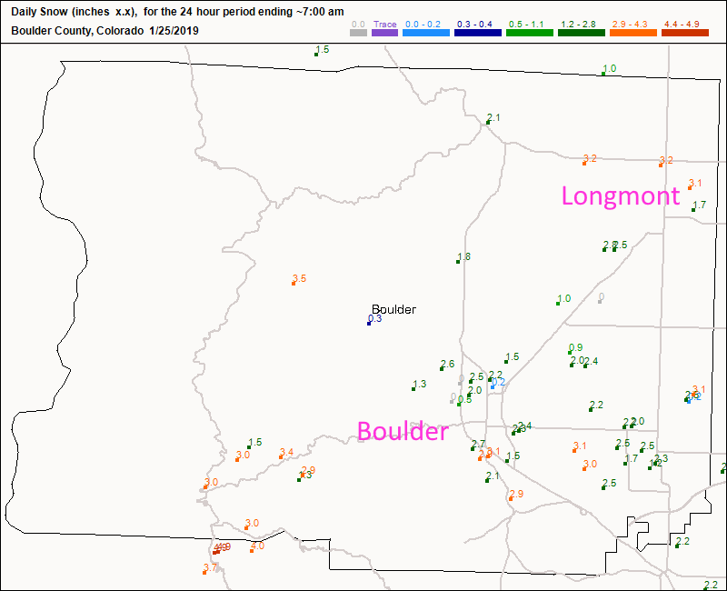
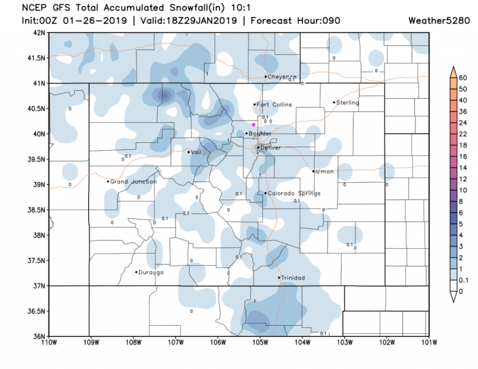
It was easier to put the snow reports in today for the day before yesterday. Longmont received about 3 inches over much of the town, which was an inch more than I had forecasted.  The GFS actually did a good job with this one (Figure 1)! Boulder saw 2-3 inches which was closer to my range.

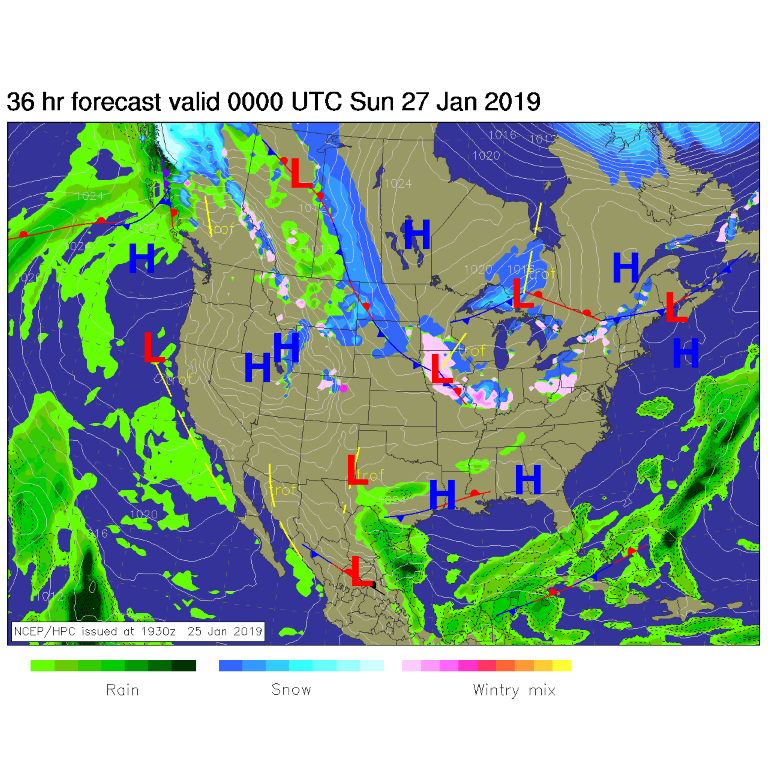
Today, no major storms are sitting near the state, but the mid-level flow and a ripple in the northwest upper air flow will keep a small area of snow flurries going in the mountains today (Figure 2). Otherwise, we'll be warmer, almost reaching 50°F today.

The longer range forecast:

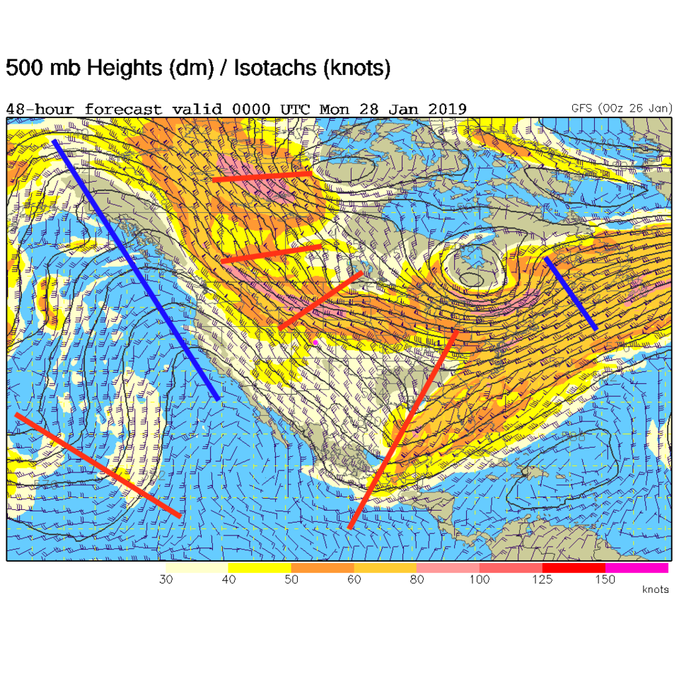
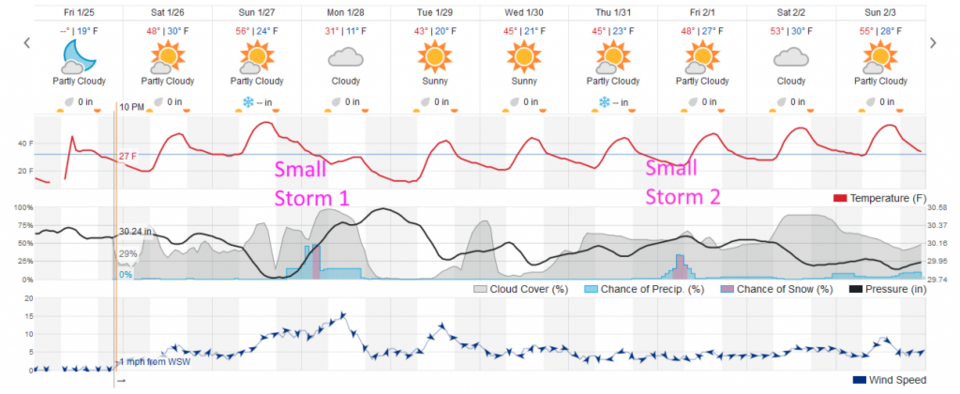
The upper-air pattern by the end of the weekend continues to be dominated by a giant trough in the center of the nation. Ripples in the northwest flow are stacked up to pass over (Figure 3). There isn't much moisture around, though, so the front that will sweep down Sunday PM will chill us to the 30's F (after almost hitting 60°F on Sunday) and some snow is possible (Figure 4). It is looking less significant as that day approaches.

The GFS shows us getting a coating to an inch of snow by Tuesday (Figure 5). Further out, there is another blip on the radar (almost literally) at the end of the week. Enjoy this weekend!

Figure 1: new Snow totals for Friday up to 7am Tuesday for Boulder county from CoCoRaHS.

Figure 2: The forecast surface map for Saturday PM. From NCEP.

Figure 3: The 500mb forecast upper air analysis for Sunday PM. Pink dot is Longmont. Red lines are troughs, blue lines are ridges.

Figure 4: the graphical forecast for the next 10 days for Longmont, CO from weatherunderground.com

Figure 5: the forecast accumulated snow map from the GFS and weather5280.com for Colorado, through Tuesday noon.

Current Weather

Mostly cloudy

Mostly cloudy

69°F

UV Index
0 Low
Pressure
29.96 Steady
Visibility
8 miles
Dewpoint
42 °F
Humidity
37%
Wind
SW 3 mph
Gust
5.9 mph
Wind Chill
69 °F

Hourly Forecast

Today
8 PM
68°F
Showers
Today
9 PM
64°F
Showers
Today
10 PM
61°F
Partly cloudy
Today
11 PM
59°F
Partly cloudy
Tomorrow
12 AM
58°F
Partly cloudy
Tomorrow
1 AM
57°F
Partly cloudy
Tomorrow
2 AM
55°F
Partly cloudy
Tomorrow
3 AM
54°F
Partly cloudy
Tomorrow
4 AM
52°F
Partly cloudy
Tomorrow
5 AM
51°F
Partly cloudy
Tomorrow
6 AM
50°F
Partly sunny
Tomorrow
7 AM
53°F
Partly sunny

7 Day Forecast

Mostly cloudy w/ t-storms

Saturday

77 °F

Not as warm with increasing cloudiness; a thunderstorm in the area late this afternoon


Partly cloudy w/ showers

Saturday Night

50 °F

A couple of showers early this evening; partly cloudy


Mostly sunny

Sunday

81 °F

Sunshine and patchy clouds; breezy in the afternoon


Mostly clear

Sunday Night

49 °F

Mainly clear


Partly sunny w/ t-storms

Monday

70 °F

Not as warm with times of sun and clouds; a thunderstorm in spots in the afternoon


Thunderstorms

Monday Night

46 °F

Cloudy with a couple of thundershowers


Thunderstorms

Tuesday

60 °F

Mostly cloudy and cooler; a couple of afternoon showers and a thunderstorm


Intermittent clouds

Tuesday Night

37 °F

Partly cloudy


Partly sunny

Wednesday

73 °F

Pleasant and warmer with partial sunshine


Mostly clear

Wednesday Night

40 °F

Mainly clear


Sunrise and Sunset

Sunrise
5:41 AM
Sunset
8:13 PM

Based on AccuWeather data