Skip to content

7am Update: Next Storm/Next Snow Forecast Discussion from the Cherrywood Observatory – June 8, 2019

This content was originally published by the Longmont Observer and is licensed under a Creative Commons license.

In Brief:

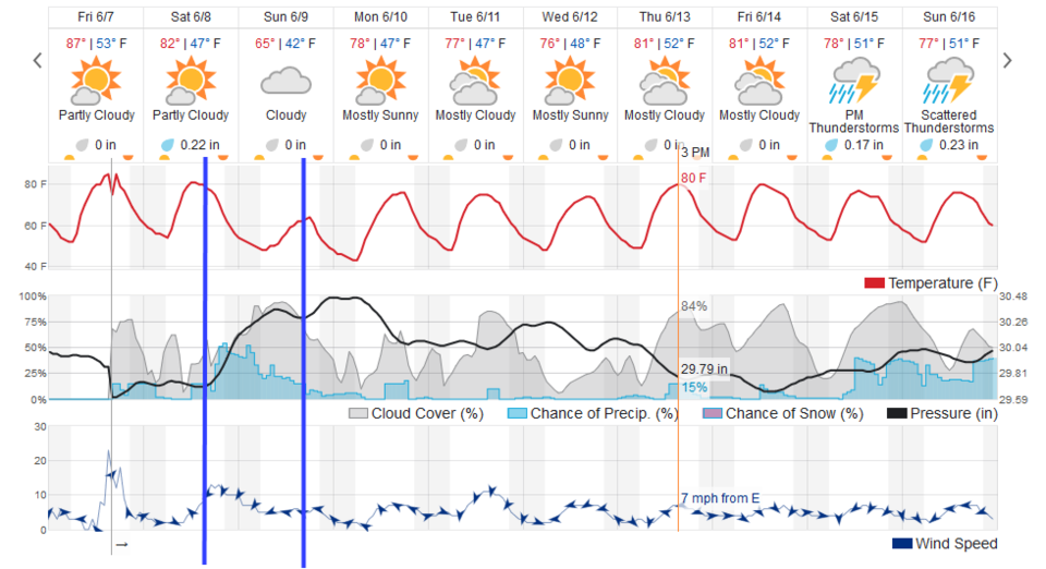
With peak heat peaking Friday afternoon, we cool a bit for Saturday then cool a lot (20F or so from Friday's temperatures) to the 60'sF for a high on Sunday. A strong cold front Saturday afternoon will kick off rain and thundershowers Saturday afternoon and evening tapering off later Sunday. We remain very seasonable next week.

7am Update:

The forecast seems on track today with frontal passage (FROPA) around 3-4pm. Because of this slightly later passage, temperatures should make it to the lower 80'sF today. The high temperature Sunday looks to be 20F lower in the lower 60'sF. This will feel like a real chill.

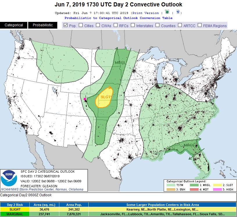
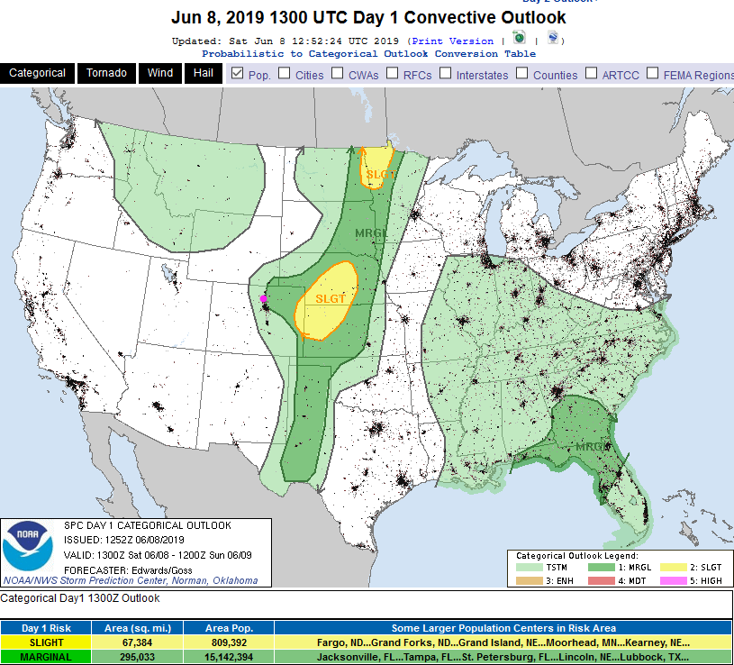
With those high temperatures, the approaching trough and front, and the moisture flowing in- there is a chance of thunderstorms around frontal passage and immediately after it that might put down larger hail. The SPC has painted us with a Marginal Risk (1 on a scale of 1-5) of severe weather. The local forecasters are not mentioning severe weather - concerned that the atmosphere will stabilize too quickly (cool air moving in below warm). They don't think much thunderstorm activity will occur.

Figure 1 update: The severe storm weather forecast for the U.S. from the Storm Predication Center in Norman, OK. Made Saturday for Saturday.

End 7am Update:

Forecast Discussion:

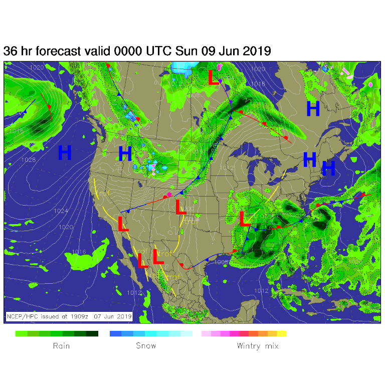
The first wind shift/cool front is coming through as this post goes up Friday afternoon. Some storms are beginning to slide across the I-25 line. It has hit 84F at my site in NE Longmont. The big front coming tomorrow (Saturday) sweeps through around 3pm Saturday (Figure 1 and Figure 2, blue line). There will be a chance of severe weather nearby (east of Denver and Longmont). That 'may' get painted further to the west if the front slows down on Saturday.

The Longer Range Forecast:

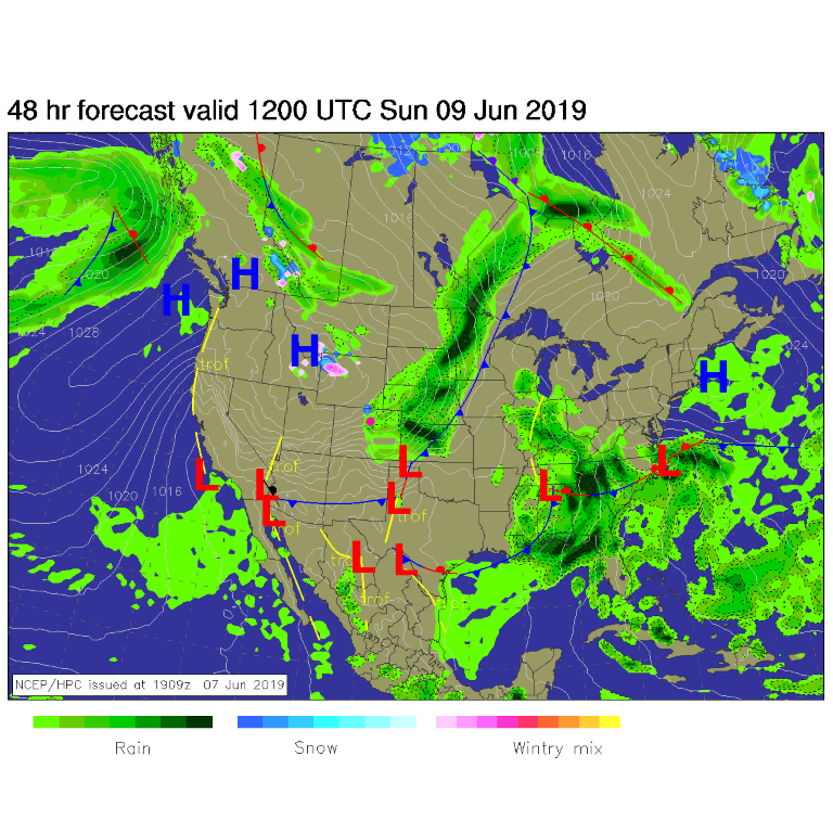
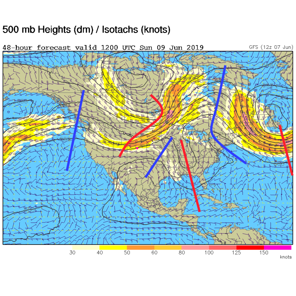
By Sunday morning, rainfall will continue (Figure 4) as the front pushes into Texas and central Kansas. This is being powered by a big trough sitting overhead Sunday AM (Figure 5). The placement of the depressed heights also supports the mid 60'sF temperatures that day.

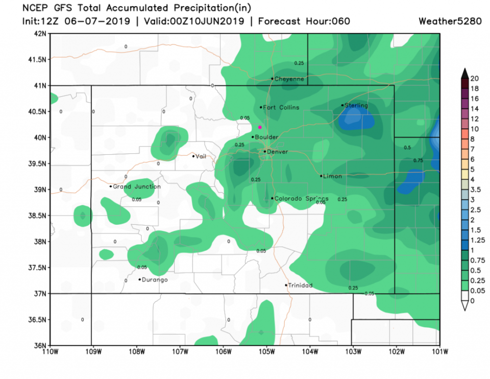
Over the next 3 days, the GFS still gives us minimal rain totals, a tenth to a quarter inch (Figure 5) while the weatherunderground model gives us about a quarter inch as well.

We warm back to the 70'sF Monday - Wednesday then see low 80'sF with a chance of a wandering afternoon thunderstorm every day.

Figure 1: The forecast surface map for Saturday night from NCEP.
Figure 2: The severe storm weather forecast for the U.S. from the Storm Predication Center in Norman, OK. Made Friday for Saturday.
Figure 3: the graphical forecast for the next 10 days for Longmont, CO from weatherunderground.com
Figure 4: The forecast surface map for Sunday morning from NCEP.
Figure 5: The 500mb forecast upper air analysis for Friday AM. Pink dot is Longmont. Red lines are troughs, blue lines are ridges.
Figure 6: the forecast accumulated precipitation map from the GFS and weather5280.com for Colorado,over the next 3 days.

Current Weather

Mostly cloudy

Mostly cloudy

76°F

UV Index
2 Low
Pressure
29.96 Steady
Visibility
8 miles
Dewpoint
46 °F
Humidity
34%
Wind
SE 6.2 mph
Gust
11.2 mph
Wind Chill
76 °F

Hourly Forecast

Today
6 PM
71°F
Thunderstorms
Today
7 PM
68°F
Mostly cloudy
Today
8 PM
66°F
Partly sunny
Today
9 PM
63°F
Partly cloudy
Today
10 PM
61°F
Partly cloudy
Today
11 PM
59°F
Partly cloudy
Tomorrow
12 AM
58°F
Partly cloudy
Tomorrow
1 AM
57°F
Partly cloudy
Tomorrow
2 AM
55°F
Partly cloudy
Tomorrow
3 AM
54°F
Partly cloudy
Tomorrow
4 AM
52°F
Partly cloudy
Tomorrow
5 AM
51°F
Partly cloudy

7 Day Forecast

Partly sunny w/ t-storms

Saturday

77 °F

Partly sunny and not as warm; a thunderstorm in spots late this afternoon


Partly cloudy

Saturday Night

50 °F

Partly cloudy


Mostly sunny

Sunday

81 °F

Sunshine and patchy clouds; breezy in the afternoon


Mostly clear

Sunday Night

49 °F

Mainly clear


Partly sunny w/ t-storms

Monday

70 °F

Not as warm with times of sun and clouds; a thunderstorm in spots in the afternoon


Thunderstorms

Monday Night

46 °F

Cloudy with a couple of thundershowers


Thunderstorms

Tuesday

60 °F

Mostly cloudy and cooler; a couple of afternoon showers and a thunderstorm


Intermittent clouds

Tuesday Night

37 °F

Partly cloudy


Partly sunny

Wednesday

73 °F

Pleasant and warmer with partial sunshine


Mostly clear

Wednesday Night

40 °F

Mainly clear


Sunrise and Sunset

Sunrise
5:41 AM
Sunset
8:13 PM

Based on AccuWeather data