Skip to content

Next Storm/Next Snow Forecast Discussion from the Cherrywood Observatory – March 18, 2019

This content was originally published by the Longmont Observer and is licensed under a Creative Commons license.

Forecast Discussion:

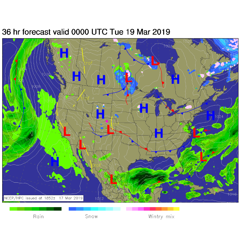
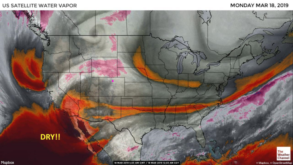
Wonderful quietness keeps being quiet. The snow is vanishing quickly in most locations across the lower elevations. Figure 1 shows our weak front has pushed down across the state, so we'll only be in the upper 40's F today. But it still will feel nice. The atmospheric moisture (water vapor) satellite image- Figure 2 - shows just dry air upstream of our state.

The longer range forecast:

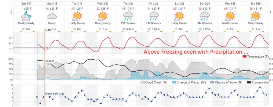
We return to normal temperatures Wednesday and climb to above normal by the weekend. Another (fairly weak) cut off low forms in the southwest U.S. and pumps some moisture up later in the week, but we'll be above freezing day and night - expect some rain chances for a change. Nothing scary. (I call rain self-shoveling-snow.)

Enjoy it! (I'm perched on a narrow data stream in the central AZ mountains this week for Spring Break. I won't say what the weather is like out here.)

Figure 1: The forecast surface map for Monday PM from NCEP.
Figure 2: The water vapor satellite image from Sunday night from NOAA. Longmont is the pink dot.
Figure 3: the graphical forecast for the next 10 days for Longmont, CO from weatherunderground.com

Current Weather

Mostly cloudy

Mostly cloudy

70°F

UV Index
0 Low
Pressure
29.96 Falling
Visibility
8 miles
Dewpoint
41 °F
Humidity
34%
Wind
WSW 4.3 mph
Gust
9.6 mph
Wind Chill
70 °F

Hourly Forecast

Today
8 PM
68°F
Showers
Today
9 PM
64°F
Showers
Today
10 PM
61°F
Partly cloudy
Today
11 PM
59°F
Partly cloudy
Tomorrow
12 AM
58°F
Partly cloudy
Tomorrow
1 AM
57°F
Partly cloudy
Tomorrow
2 AM
55°F
Partly cloudy
Tomorrow
3 AM
54°F
Partly cloudy
Tomorrow
4 AM
52°F
Partly cloudy
Tomorrow
5 AM
51°F
Partly cloudy
Tomorrow
6 AM
50°F
Partly sunny
Tomorrow
7 AM
53°F
Partly sunny

7 Day Forecast

Mostly cloudy w/ t-storms

Saturday

77 °F

Not as warm with increasing cloudiness; a thunderstorm in the area late this afternoon


Partly cloudy w/ showers

Saturday Night

50 °F

A couple of showers early this evening; partly cloudy


Mostly sunny

Sunday

81 °F

Sunshine and patchy clouds; breezy in the afternoon


Mostly clear

Sunday Night

49 °F

Mainly clear


Partly sunny w/ t-storms

Monday

70 °F

Not as warm with times of sun and clouds; a thunderstorm in spots in the afternoon


Thunderstorms

Monday Night

46 °F

Cloudy with a couple of thundershowers


Thunderstorms

Tuesday

60 °F

Mostly cloudy and cooler; a couple of afternoon showers and a thunderstorm


Intermittent clouds

Tuesday Night

37 °F

Partly cloudy


Partly sunny

Wednesday

73 °F

Pleasant and warmer with partial sunshine


Mostly clear

Wednesday Night

40 °F

Mainly clear


Sunrise and Sunset

Sunrise
5:41 AM
Sunset
8:13 PM

Based on AccuWeather data