Skip to content

The Next Storm/Next Snow Forecast Discussion from the Cherrywood Observatory – November 7, 2017

This content was originally published by the Longmont Observer and is licensed under a Creative Commons license.

Forecast Discussion:

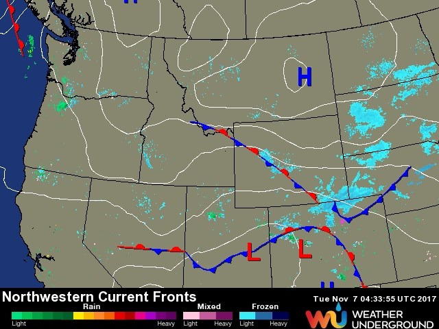
The cold front is a bit slower than I forecasted yesterday, but is about to cross Longmont around 10 pm Monday night. Snow is already forming west of town and to our north (Figure 1).

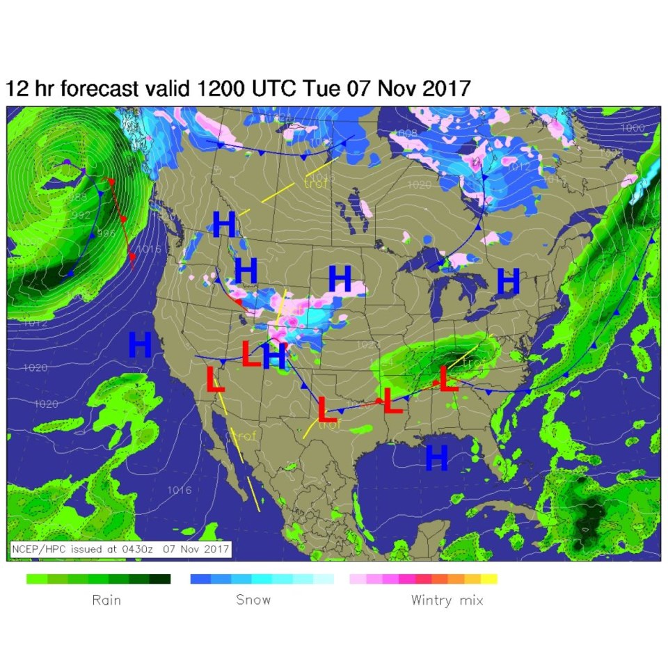
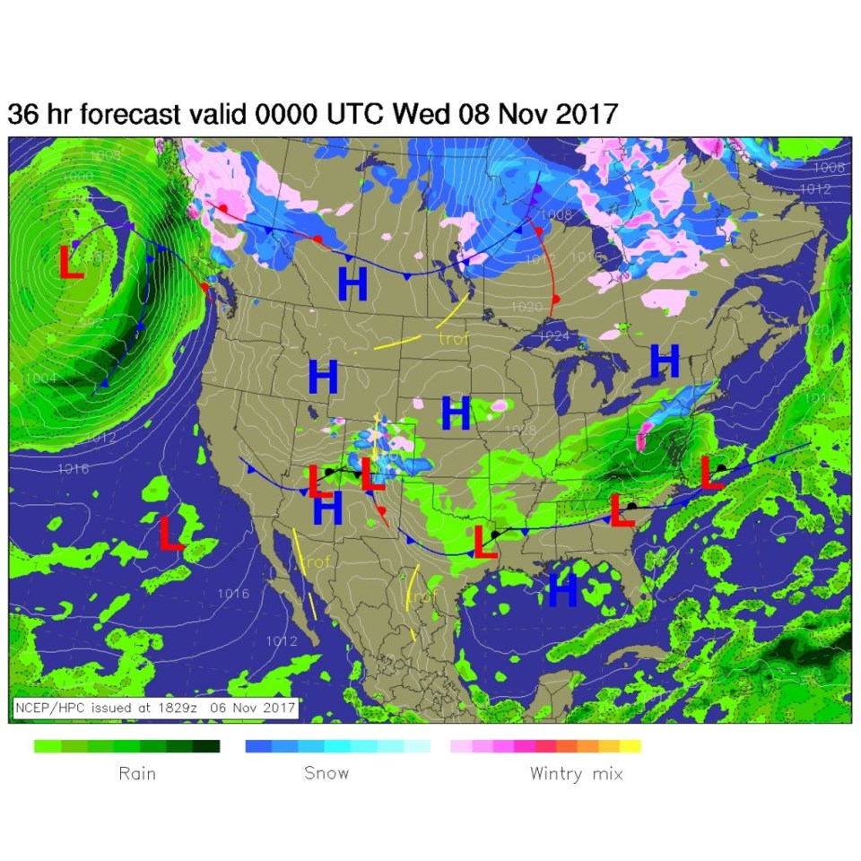
By Tuesday morning, the front is down to New Mexico and light snow and mixed ice/snow dominates northern Colorado (Figure 2).

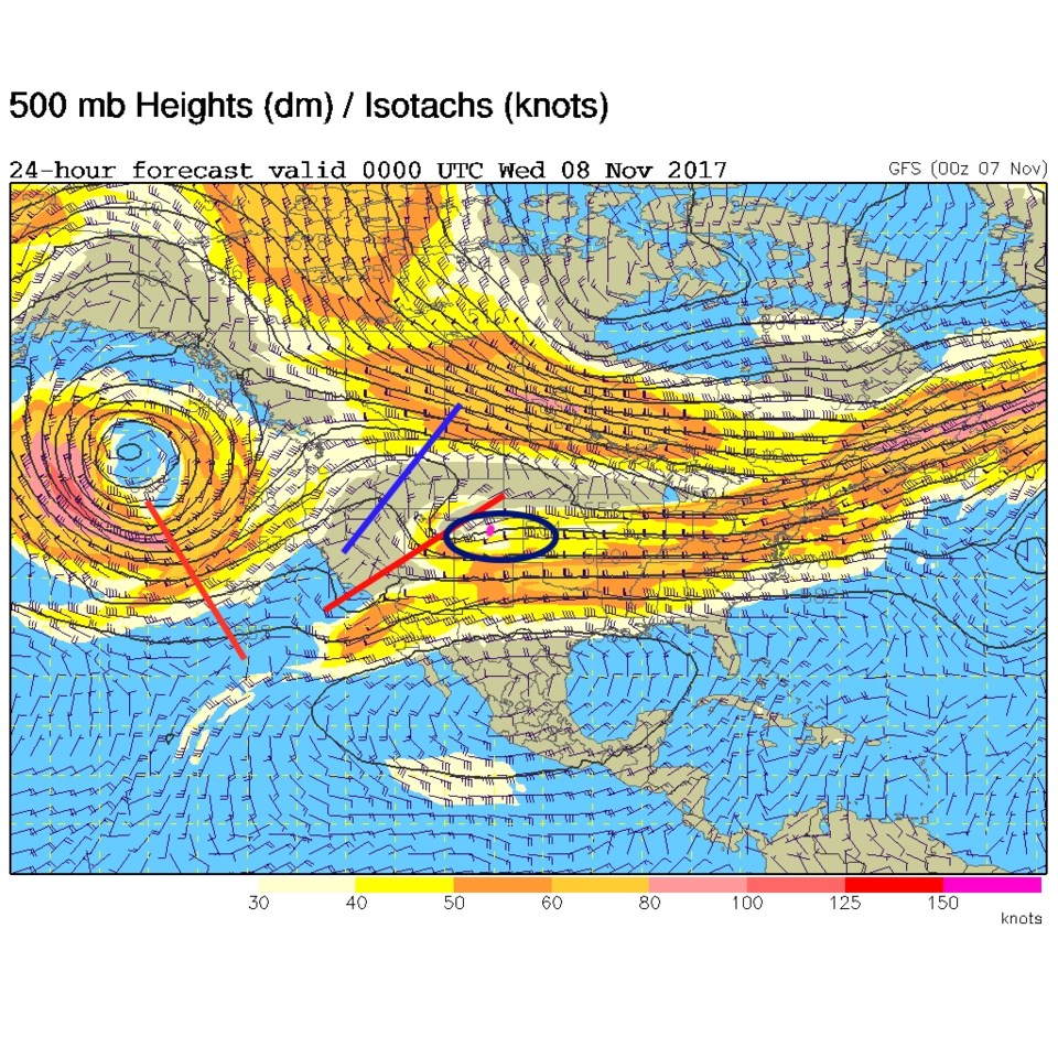
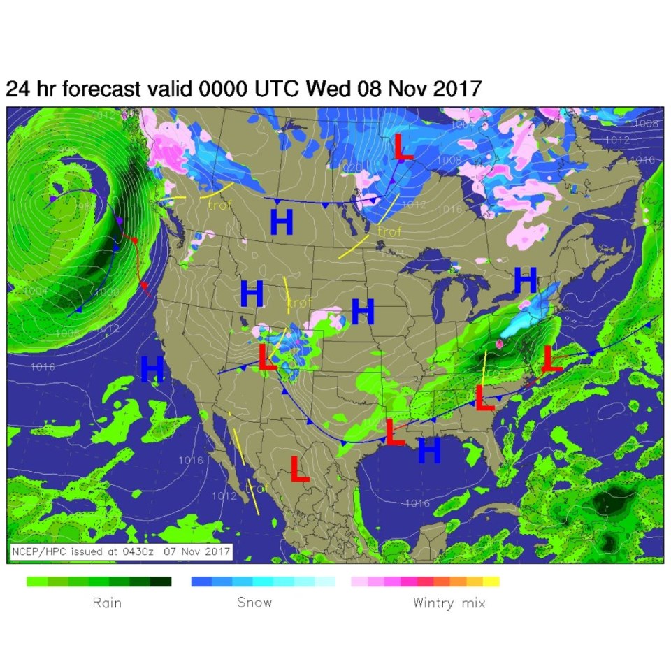
The upper air map by Tuesday PM shows the trough still to our west, so lift continues in the black oval. This seems to be a good 36 hours of precipitation (even if light) over NE Colorado (Figure 3).  At that time, the surface map shows the low forming at the four corners position and bands of snow over the Front Range and I-25 folks (Figure 4).

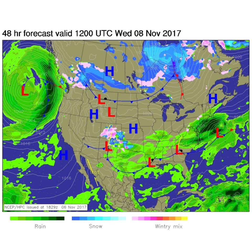
Later Tuesday night, the low is a touch further east, but not much changes up in our neck of the woods (Figure 5).  By Wednesday morning, the low has sunk south of Albuquerque and the precipitation is coming to an end (Figure 6).

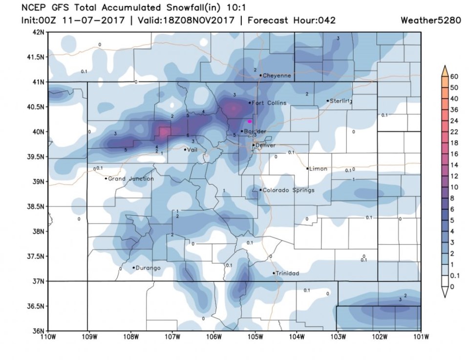
Figure 7 is the GFS snowfall totals from Monday PM to Wednesday midday - we on the boundary of the 4th and 5th blue hue - that puts Longmont in the 4-5" area.  That seems a bit bullish to me and I'm still happier with 1-3" (with some melting).

Tuesday AM Update: At the official reporting time of 7:00am, my home in NE Longmont had received 4.5" of snow.  We picked up another 1/2 inch for a total of 5" before that snow band faded out.  So my forecast was too low. The GFS print out did well. Forecasts look like just an additional dusting or two to another inch or two is possible over the next 24 hours.

Figure 1: Surface analysis Monday PM with radar.

Figure 2: The surface analysis forecast from NCEP/HPC for Tuesday AM.

Figure 3: the 500mb upper air forecast from the GFS. Troughs in red lines, ridges blue line, area of lift black circle. Longmont pink dot.

Figure 4: The surface analysis forecast from NCEP/HPC for Tuesday PM.

Figure 5: The surface analysis forecast from NCEP/HPC for Tuesday PM late.

Figure 6: The surface analysis forecast from NCEP/HPC for Wednesday AM.

Figure 7: The GFS total snowfall forecast from weather5280.com with Longmont as a pink dot.

In the longer range:

Things dry out and moderate through the weekend.  Temperatures hover just above or just below 50F on through Sunday.

Current Weather

Mostly sunny

Mostly sunny

74°F

UV Index
9 Very High
Pressure
29.88 Steady
Visibility
9 miles
Dewpoint
46 °F
Humidity
37%
Wind
NW 6.3 mph
Gust
15.7 mph
Wind Chill
74 °F

Hourly Forecast

Today
12 PM
78°F
Partly sunny
Today
1 PM
81°F
Mostly sunny
Today
2 PM
83°F
Mostly sunny
Today
3 PM
83°F
Mostly sunny
Today
4 PM
81°F
Mostly sunny
Today
5 PM
80°F
Mostly sunny
Today
6 PM
78°F
Mostly sunny
Today
7 PM
75°F
Mostly sunny
Today
8 PM
71°F
Mostly sunny
Today
9 PM
68°F
Mostly clear
Today
10 PM
65°F
Mostly clear
Today
11 PM
62°F
Mostly clear

7 Day Forecast

Mostly sunny

Sunday

83 °F

Mostly sunny; breezy this afternoon


Mostly clear

Sunday Night

50 °F

Breezy this evening; otherwise, mainly clear


Partly sunny w/ t-storms

Monday

73 °F

Not as warm with clouds and sunshine; a thunderstorm in spots in the afternoon


Thunderstorms

Monday Night

47 °F

Cloudy with a couple of thundershowers


Thunderstorms

Tuesday

59 °F

Mostly cloudy and cooler with a couple of showers and a thunderstorm, mainly later


Partly cloudy

Tuesday Night

34 °F

Partly cloudy and colder


Partly sunny

Wednesday

73 °F

Partly sunny, pleasant and warmer


Mostly clear

Wednesday Night

40 °F

Mainly clear


Partly sunny

Thursday

82 °F

Warmer with partial sunshine


Mostly cloudy

Thursday Night

44 °F

Mostly cloudy


Sunrise and Sunset

Sunrise
5:41 AM
Sunset
8:14 PM

Based on AccuWeather data