This content was originally published by the Longmont Observer and is licensed under a Creative Commons license.
In Brief:
We begin a wonderful Spring warm up with a predicted high in the mid 40'sF Friday becoming 50'sF for the weekend. With 12-14 inches of snow to melt, we may see highs stay cooler than the models call for until it has largely melted off. Ripples in the upper air passing over the next week will create small chances of rain showers now and then. Overall, it will be warm and dry.
Update 4/17 5pm:
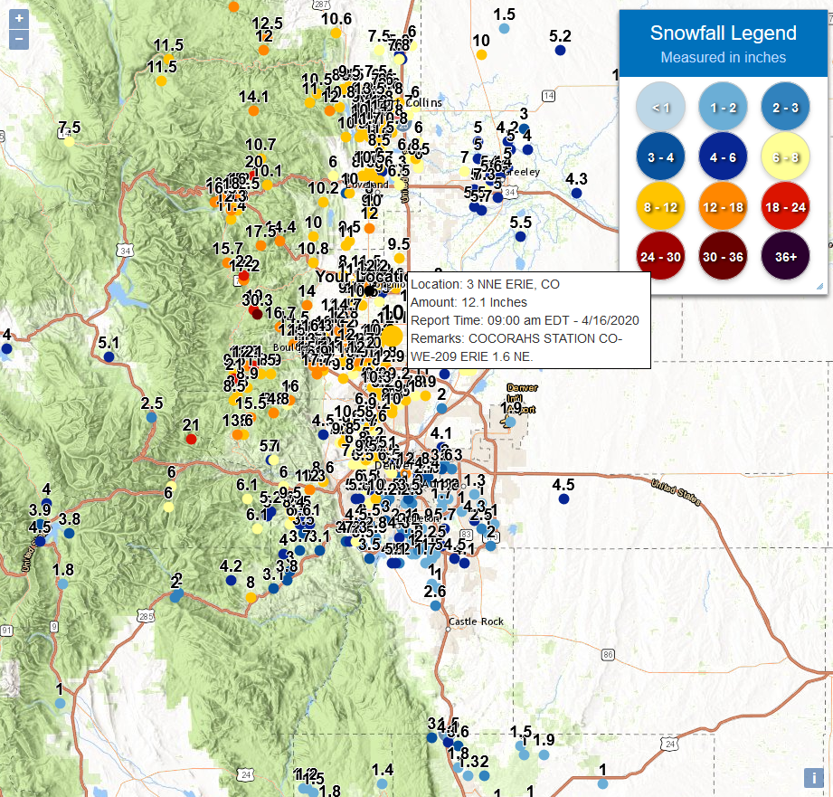
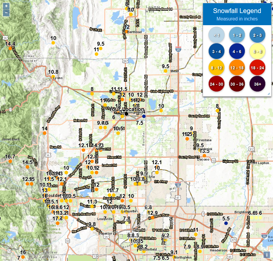
Other than a chance of showers (rain) Saturday afternoon to early evening (roughly 2-10pm) things are warming up nicely and will remain dry. Looking at Figure 1 update, you can see that Boulder and Larimer counties were the big winners in our snowfall this week. The dark yellow and orange dots are around a foot of snow. Very impressive. Figure 2 update is zoomed in on Longmont. Our town saw 8 to 14 inches of snow. At least the roads and sidewalks cleared very quickly (hurray April sun angle!).
End 4/17 5pm update.
The Forecast Discussion:
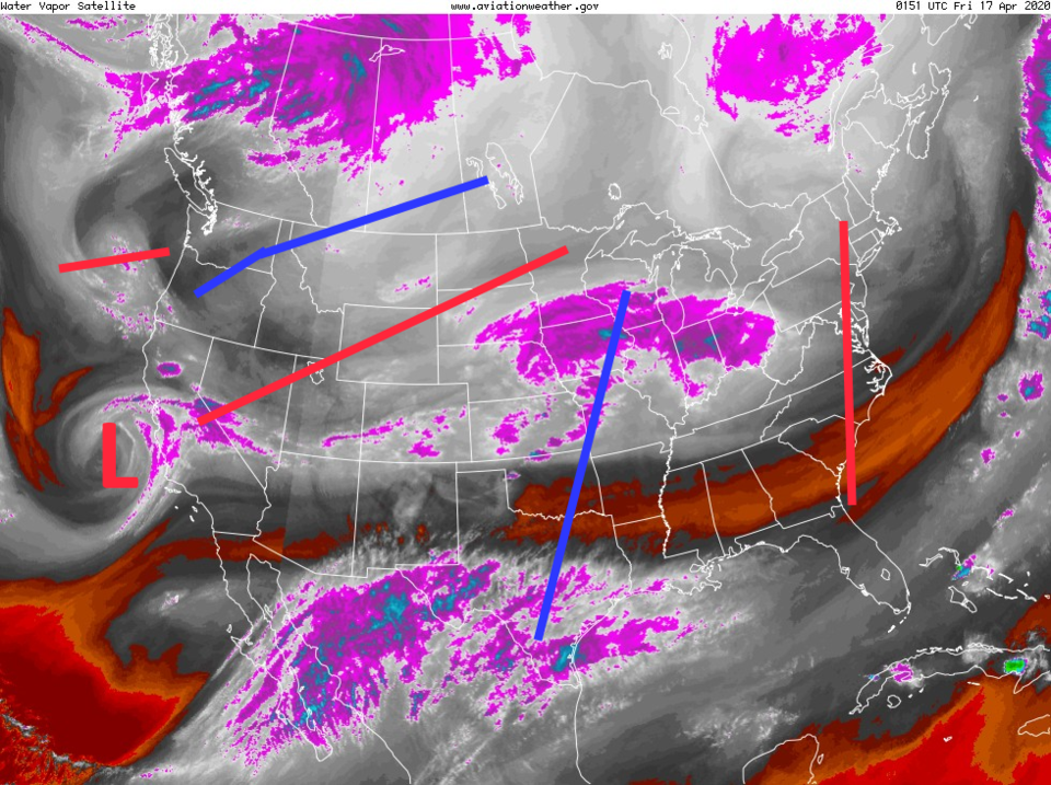
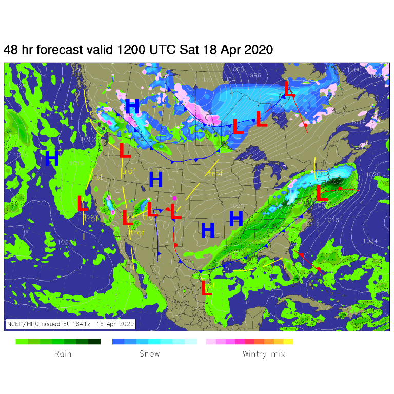
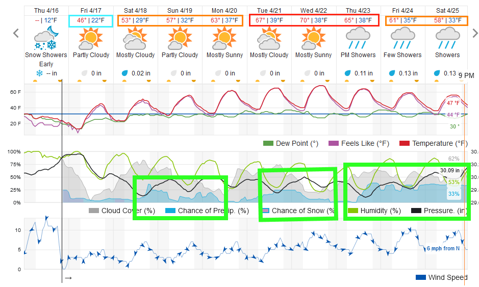
The main storm from Wednesday/Thursday has pulled off to the east (Figure 1). There are a couple of lows in the atmosphere off the West Coast that will pass. These will be kicking off showers now and then, like the first weak system coming in Saturday afternoon (Figure 2). Our best chance of showers first occur Saturday afternoon and Sunday evening (Figure 3).
Check this space for a snowfall total update Friday morning after the NWS and CoCoRaHS observations come in by 7am.
The Longer Range Forecast:
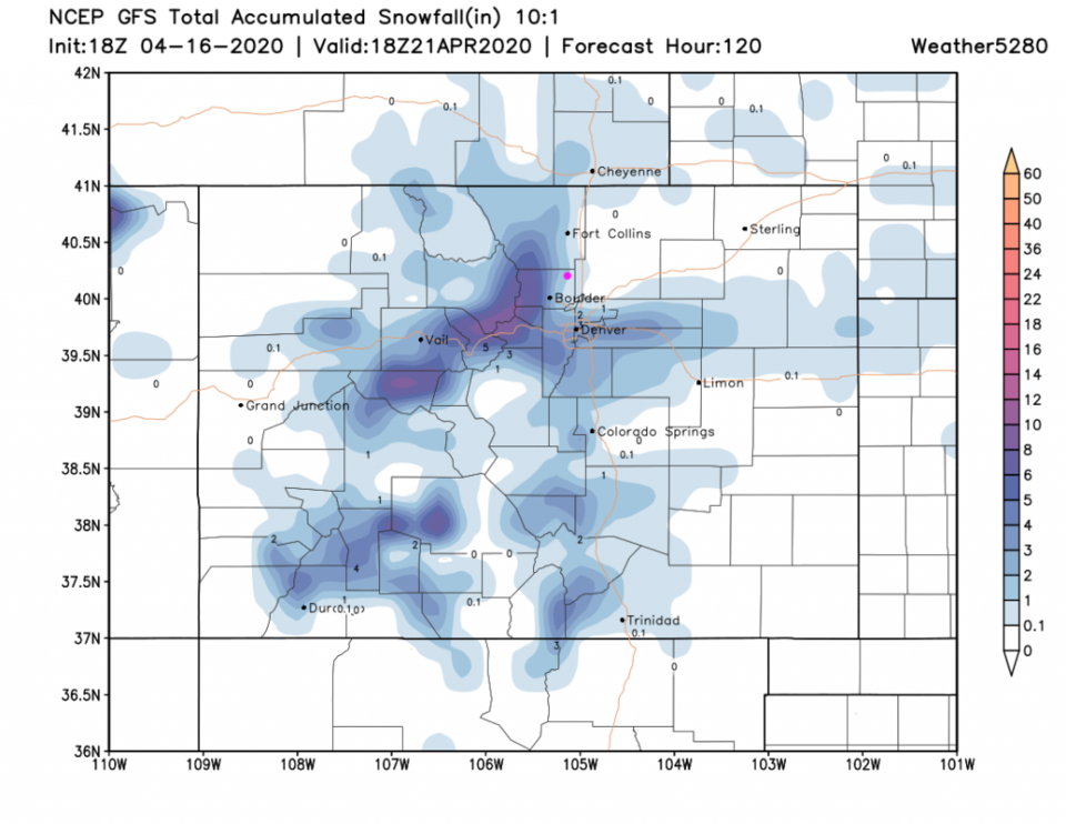
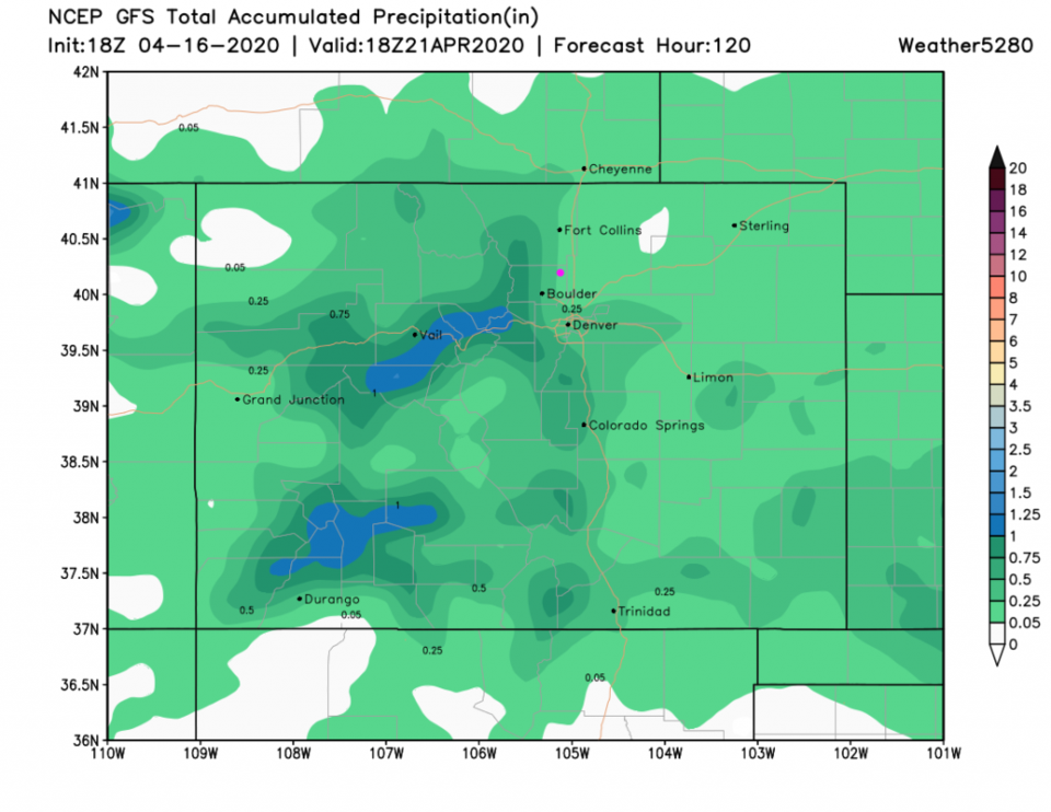
Over the next 5 days, we may see a nocturnal dusting of snow (that might be just before Friday morning) in Longmont (Figure 4). The mountains may still pick up 4-10 inches in the higher elevations. Rainfall will remain light over the next 5 days with only 0.05 to 0.25 inch accumulating over the next 5 days (Figure 5). Enjoy the return to quiet weather as our nearly 1.5 inch of liquid soaks into the ground and flows into rivers and reservoirs.