Skip to content

The Next Storm/Next Snow Forecast Discussion from the Cherrywood Observatory – August 27th, 2018

This content was originally published by the Longmont Observer and is licensed under a Creative Commons license.

Forecast Discussion:

There isn't much happening this week except for the arrival of a stout, but dry, cold front on Monday. When it has passed, we warm back up to near 90°F. That is the week in a nutshell. But for some specifics:

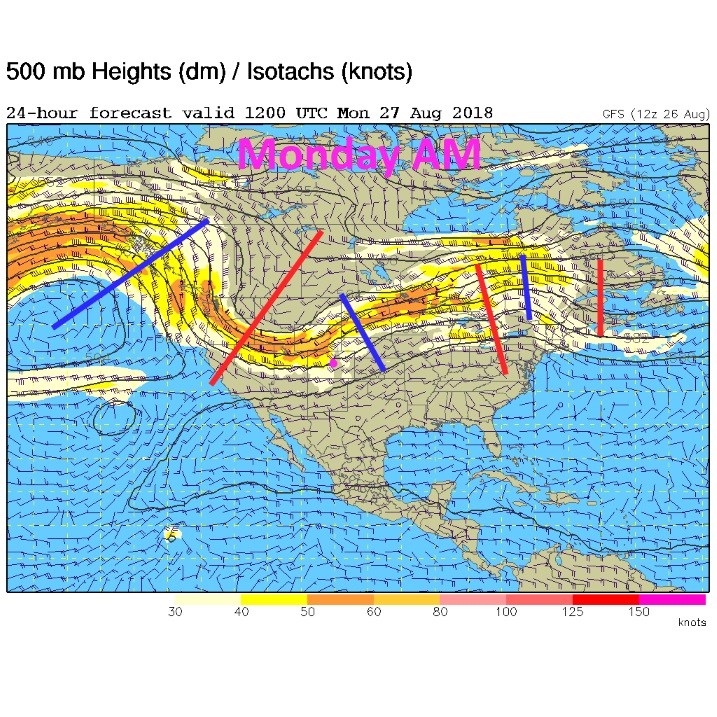
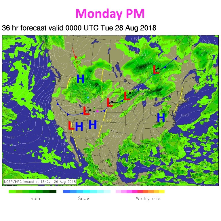
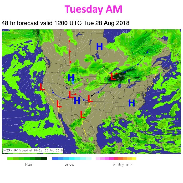
Figure 1 shows the trough to our west that will cool us down to the 70's F on Tuesday. It is also bringing in clean air from the southwest for a day (more later on that). This afternoon, the front is just passing Longmont with some gusty north, then northeast winds - Figure 2. By tomorrow (Tuesday) AM, the front is in the southern counties of the state and we are windy and, relatively, chilly (Figure 3). There is a SMALL chance of showers Tuesday afternoon and evening behind the front, but I'm not excited about them.

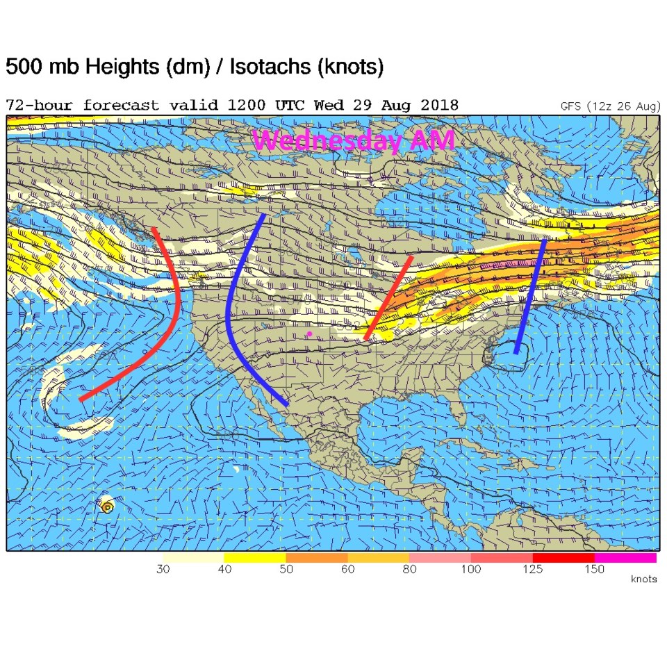
By Wednesday AM, the trough is fading out to the east and the ridge is growing again in the West (Figure 4). We climb to the upper 80'sF on Wednesday and top 90° F on Thursday.

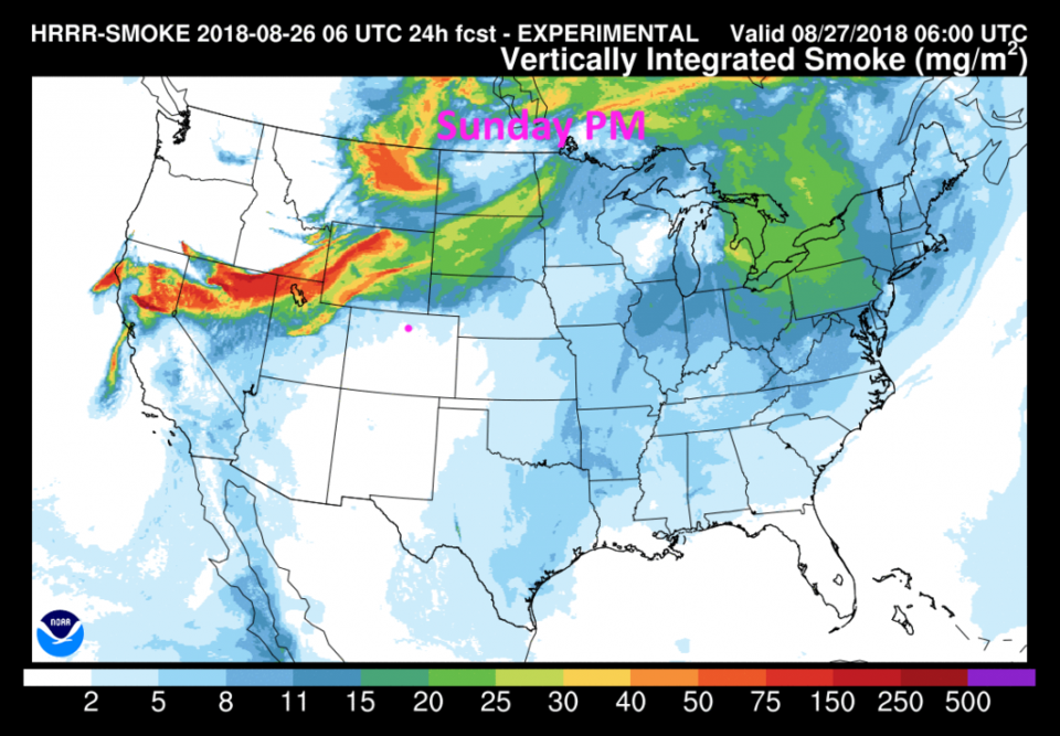
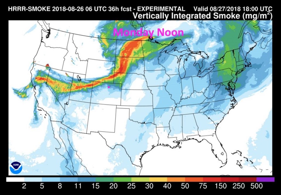
As for smoke, Figure 5 shows the early Monday AM lack of smoke around Longmont, which is replaced by a (relatively thin) ribbon of smoke passing just to our north (Figure 6). It won't be choking thick here, but it will go back to being hazy.

The longer range forecast:

We return to the 90's F into the weekend and stay mostly dry. Eventually we'll have some fun weather to discuss, be patient. We are only a couple of weeks from the earliest recorded measurable snow at DIA and about 2 months away from the average first snow.

Figure 1: The forecast surface map for Monday AM. From NCEP.

Figure 2: The forecast surface map for Monday PM. From NCEP.

Figure 3: The forecast surface map for Tuesday AM. From NCEP.

Figure 4: The forecast surface map for Wednesday AM. From NCEP.

Figure 5: The HRRR (high resolution rapid refresh) model forecast of smoke at all levels for Sunday PM.

Figure 6: The HRRR (high resolution rapid refresh) model forecast of smoke at all levels for Monday noon.

Current Weather

Mostly cloudy

Mostly cloudy

70°F

UV Index
0 Low
Pressure
29.96 Falling
Visibility
8 miles
Dewpoint
41 °F
Humidity
35%
Wind
WSW 3.8 mph
Gust
7.6 mph
Wind Chill
70 °F

Hourly Forecast

Today
8 PM
68°F
Showers
Today
9 PM
64°F
Showers
Today
10 PM
61°F
Partly cloudy
Today
11 PM
59°F
Partly cloudy
Tomorrow
12 AM
58°F
Partly cloudy
Tomorrow
1 AM
57°F
Partly cloudy
Tomorrow
2 AM
55°F
Partly cloudy
Tomorrow
3 AM
54°F
Partly cloudy
Tomorrow
4 AM
52°F
Partly cloudy
Tomorrow
5 AM
51°F
Partly cloudy
Tomorrow
6 AM
50°F
Partly sunny
Tomorrow
7 AM
53°F
Partly sunny

7 Day Forecast

Mostly cloudy w/ t-storms

Saturday

77 °F

Not as warm with increasing cloudiness; a thunderstorm in the area late this afternoon


Partly cloudy w/ showers

Saturday Night

50 °F

A couple of showers early this evening; partly cloudy


Mostly sunny

Sunday

81 °F

Sunshine and patchy clouds; breezy in the afternoon


Mostly clear

Sunday Night

49 °F

Mainly clear


Partly sunny w/ t-storms

Monday

70 °F

Not as warm with times of sun and clouds; a thunderstorm in spots in the afternoon


Thunderstorms

Monday Night

46 °F

Cloudy with a couple of thundershowers


Thunderstorms

Tuesday

60 °F

Mostly cloudy and cooler; a couple of afternoon showers and a thunderstorm


Intermittent clouds

Tuesday Night

37 °F

Partly cloudy


Partly sunny

Wednesday

73 °F

Pleasant and warmer with partial sunshine


Mostly clear

Wednesday Night

40 °F

Mainly clear


Sunrise and Sunset

Sunrise
5:41 AM
Sunset
8:13 PM

Based on AccuWeather data