This content was originally published by the Longmont Observer and is licensed under a Creative Commons license.
Forecast Discussion:
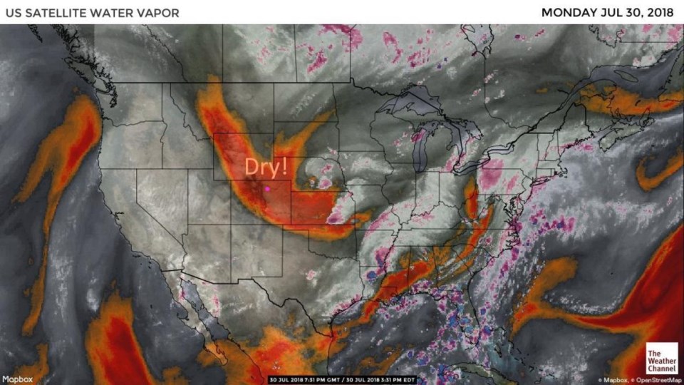
We continue with a quiet and seasonally normal (if not a bit cooler) week. Figure 1 shows the dry air in place over most of Colorado behind the Sunday cold front. Figure 2 for this afternoon shows that cold front down into Mexico and southern Texas today. What a front!
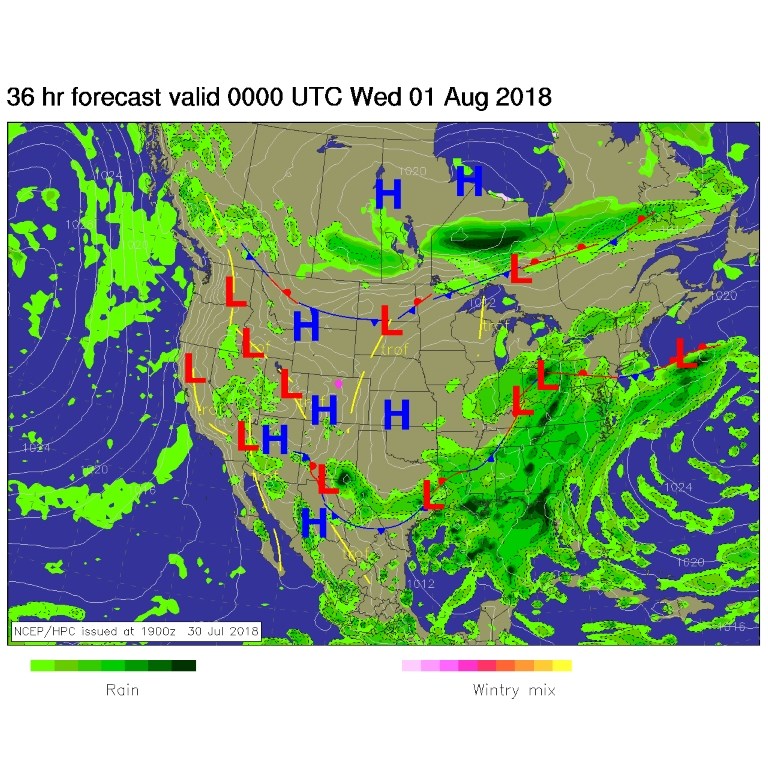
Because of the flow of cool stable air at the surface, we have no chance of convection (thunderstorms) in northern Colorado today (Figure 3).
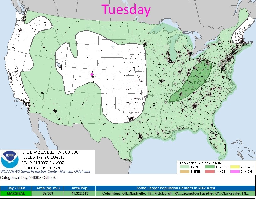
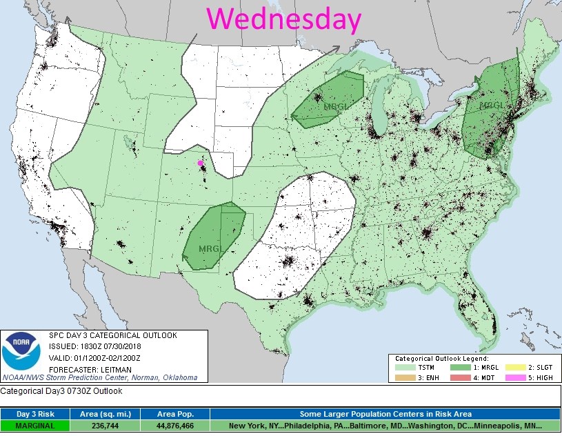
For tomorrow (Figure 4) some heating and moisture returns and we have a small chance of thunderstorms returning for the afternoon.
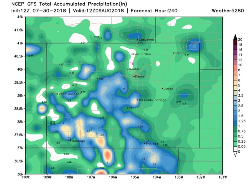
Forecast Discussion:
We slowly warm to the lower 90's F (just a touch above normal) for the weekend. There don't seem to be any big precipitation events in the next 10 days. Random afternoon thunderstorms may give some locations like southern and southwestern Colorado (where it is needed the most) some nice rain. This run of the GFS (Figure 5) doesn't give Longmont anything in the next 10 days, but that is not to be completely believed.