Skip to content

The Next Storm/Next Snow Forecast Discussion from the Cherrywood Observatory – March 11 , 2018

This content was originally published by the Longmont Observer and is licensed under a Creative Commons license.

Forecast Discussion:

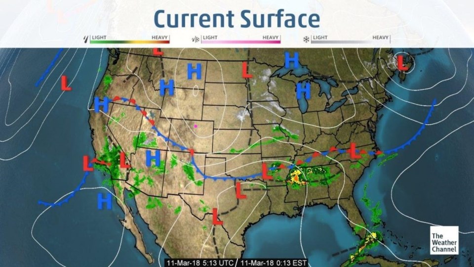
The front came through about three hours later than I called for on Friday. We had clouds, winds, and virga (rainfall that evaporates before hitting the ground). Figure 1 shows the position of the front as of Saturday late night (about the time I was setting clocks forward).

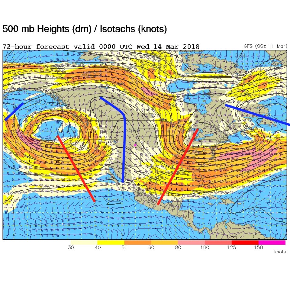
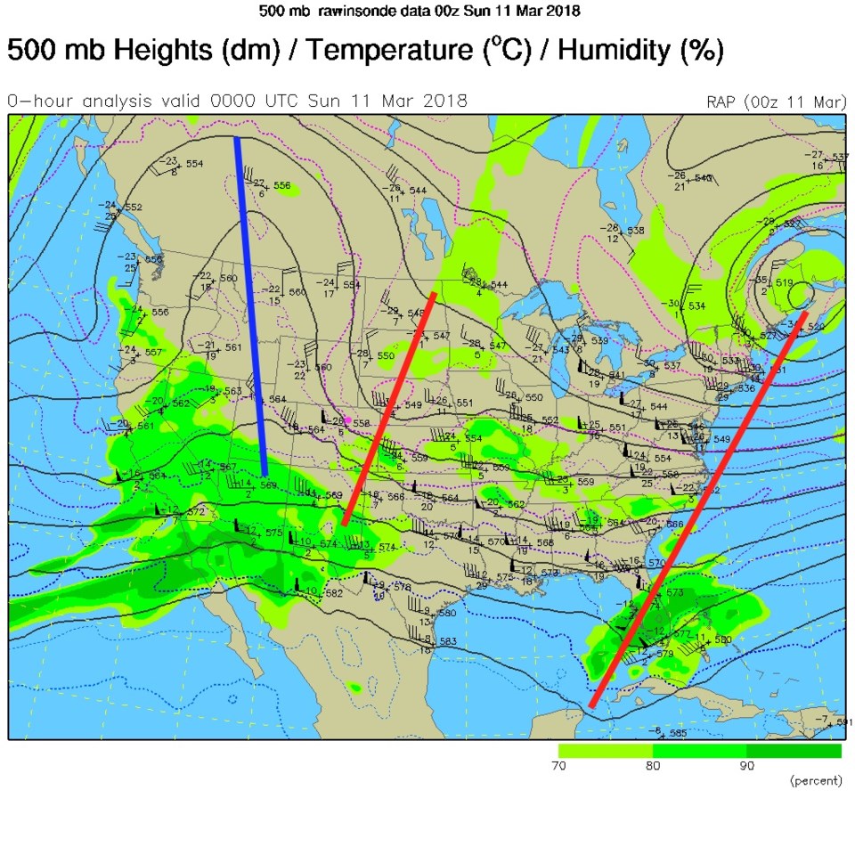
Figure 2 is the upper air map for Saturday PM - the red line to our east (pink dot for Longmont) is the upper air feature that brought the front in.  The ridge to the west (big blue line) is growing!

Figure 1: Current Surface map from Saturday PM from the weather channel.

Figure 2: The current 500mb upper air map from Saturday PM from the RAP model.

The longer range forecast:

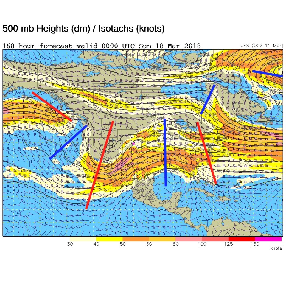
This week will be quite warm and dry. Monday will see mid 50'sF.  Tuesday upper 60'sF.  Wednesday 70'sF. This is the work of the big ridge.  Figure 3 is the upper air map for Tuesday night, the ridge is almost overhead.

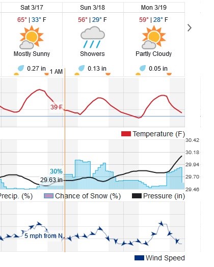
The deep trough over the eastern Pacific ocean in Figure 3 will replace that ridge by the weekend (see Figure 4 - Saturday night). Some models are now bringing in 2/3's of an inch of rain Saturday PM through Monday next week.  Figure 5 is a zoom-in on the weather for next weekend.  This model has about 1/2 of an inch of rain.  Note temperatures remain too warm for much in the way of snow.  That's how it looks for now.  Tune in again tomorrow!

Figure 3: The 500mb upper air map for Tuesday PM from the GFS. Troughs in red, ridges in blue.

Figure 4: The 500mb upper air map for Saturday PM from the GFS. Troughs in red, ridges in blue.

Figure 5: the last 3 days of the 10 day graphical forecast from weatherunderground.com

Current Weather

Mostly cloudy

Mostly cloudy

69°F

UV Index
0 Low
Pressure
29.88 Rising
Visibility
8 miles
Dewpoint
38 °F
Humidity
32%
Wind
NW 4.8 mph
Gust
10.4 mph
Wind Chill
69 °F

Hourly Forecast

Today
9 PM
64°F
Mostly cloudy
Today
10 PM
62°F
Mostly clear
Today
11 PM
60°F
Mostly clear
Tomorrow
12 AM
58°F
Mostly clear
Tomorrow
1 AM
56°F
Mostly clear
Tomorrow
2 AM
55°F
Mostly clear
Tomorrow
3 AM
53°F
Mostly clear
Tomorrow
4 AM
52°F
Mostly clear
Tomorrow
5 AM
50°F
Mostly clear
Tomorrow
6 AM
49°F
Mostly sunny
Tomorrow
7 AM
51°F
Mostly sunny
Tomorrow
8 AM
54°F
Mostly sunny

7 Day Forecast

Mostly cloudy w/ showers

Sunday

79 °F

Some sun, then increasing clouds with a brief shower or two this afternoon


Mostly clear

Sunday Night

49 °F

Breezy this evening with a shower in places; otherwise, mainly clear


Partly sunny w/ t-storms

Monday

71 °F

Not as warm with clouds and sunshine; a thunderstorm in spots in the afternoon


Thunderstorms

Monday Night

47 °F

Cloudy with a couple of thundershowers


Thunderstorms

Tuesday

59 °F

Mostly cloudy and cooler with a couple of showers and a thunderstorm, mainly later


Partly cloudy

Tuesday Night

37 °F

Partly cloudy


Partly sunny

Wednesday

70 °F

Partly sunny, pleasant and warmer


Mostly clear

Wednesday Night

40 °F

Mainly clear


Partly sunny

Thursday

82 °F

Warmer with partial sunshine


Mostly cloudy

Thursday Night

44 °F

Mostly cloudy


Sunrise and Sunset

Sunrise
5:41 AM
Sunset
8:14 PM

Based on AccuWeather data